

 |
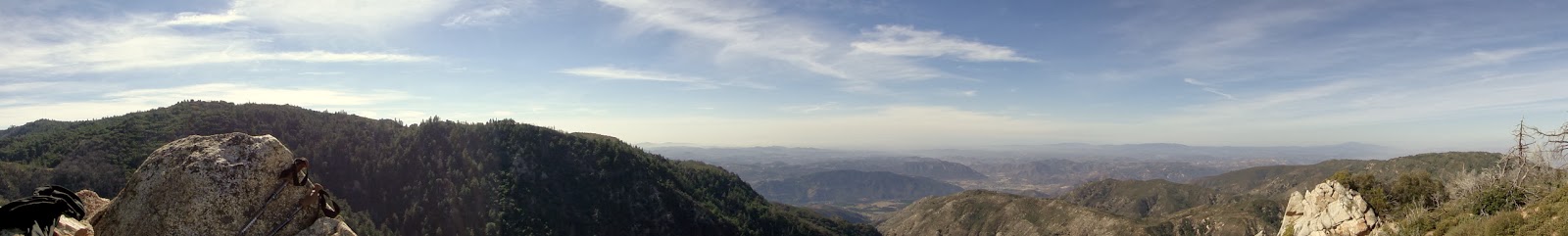
| View from Eagle Crag |
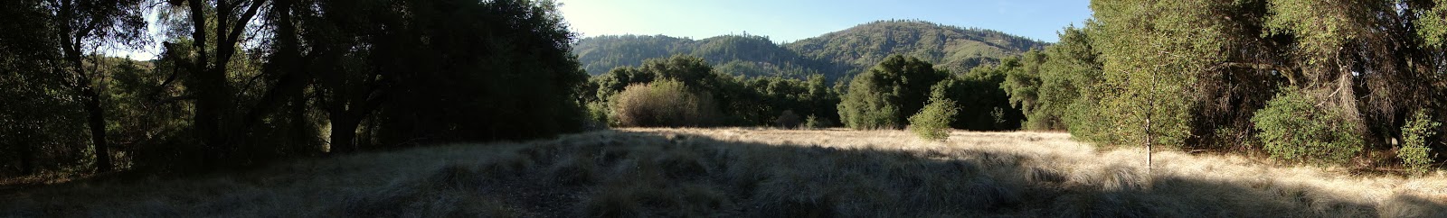 |
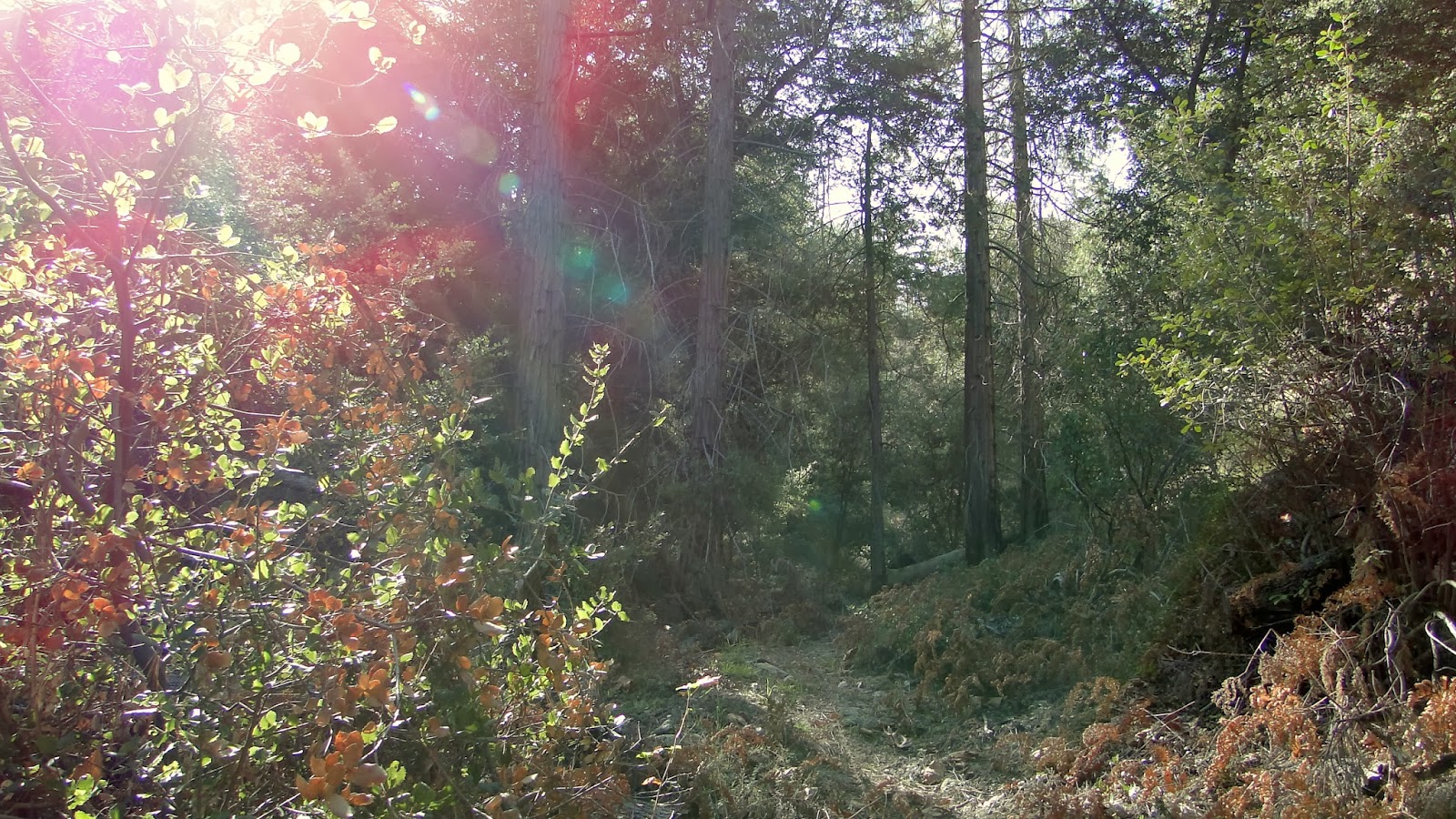
| Cutca Valley |
Eagle Crag is a promontory with a sheer drop of about 1,000 feet in a lonely, wild corner of the Agua Tibia Wilderness. The Cutca Trail connects the Palomar Crest, on which Eagle Crag perches, to the High Point Truck Trail that runs from Aguanga to High Point on Palomar Mountain.
Distance: 18
Elevation Gained: 4200′
Difficulty: Strenuous
Time: 7:30
Critters: Band-tailed pigeons, hawks, mountain quail, rabbits, ladybug dance party
Get there like this.
Note: High Point Truck Trail is frequently rough and not recommended for cars – such as my Honda Civic, which I drove up anyway. I’d recommend an Adventure Pass, but nobody really comes up here anyway.
Details:
I’m walking along this trail thinking, “How on Earth have I never hiked this before?” If this isn’t one of the five best hikes in the San Diego, it is certainly one of the most interesting, varied, and satisfying hikes here – or perhaps anywhere. You get a healthy dose of desert, chaparral, oak woodland, lush meadows, a gurgling stream, a fantastic backcountry campsite, mixed-conifer forests, wildlife, and jaw-dropping views of inland and coastal Southern California. This trail has everything.
And then I remembered that I drove for an hour to dirt road in the middle of nowhere, took that bumpy dirt road in my unreservedly abused Honda, and then hiked 16.2 miles through an exceptionally remote corner of the county. For most people, that are enough no-no’s here to make this hike a non-starter. This is also the reason why I didn’t hike this for so long. I guess I wasn’t entirely comfortable with the isolation of it all. That of course changed when I realized I had cell coverage basically from start to finish. I don’t always love the intrusion of modern life, but I am grateful that I could call for help if I ate shit on the trail.
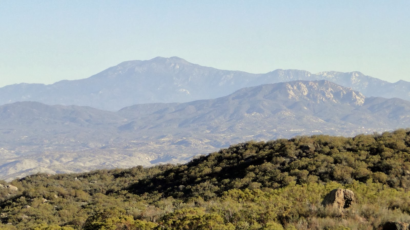 |
| Mt. San Jacinto with Cahuila Mountain in the foreground. |
The trailhead is located about halfway to the High Point lookout tower, which is accessible via hike and not entirely unreasonable if you are able to park at a relatively reasonable distance. In fact, you can drive almost all the way to High Point, which I could not do the last time I was here when they closed the road due to snow. No such problem this year, and I was able to drive to the trailhead. By the time I got there, I felt like I had already had plenty of adventure.
I actually wasn’t expecting much from this hike. I thought I’d see a lot of chaparral, some good views, and walk through burnt forest. Jerry Schad’s write-up on this hike is disappointingly scant, considering the abundance on this trail. His guide in Afoot and Afield now reads like he was trying to keep a secret by not saying much about it. He talks about it being wild, remote, and lonely, and mentions a few trickling brooks. However, he didn’t say what a gorgeous hike this is nearly from start to finish.
In fact, the start and finish of the hike are the only parts that suck. The dirt road is not much fun unless you have 4 wheel drive. The trail drops 500′ in .5 miles, which you obviously have to hike back up again at the end after already hiking 15.7 miles with a lot of climbing. Aside from that, the trail is a dream. It’s long, but only steep for about 2 miles. There’s enough variety to prevent the inevitable boredom that comes with such a long hike. There’s a relatively healthy forest, abundant wildlife, and the views from the top are exceptional.

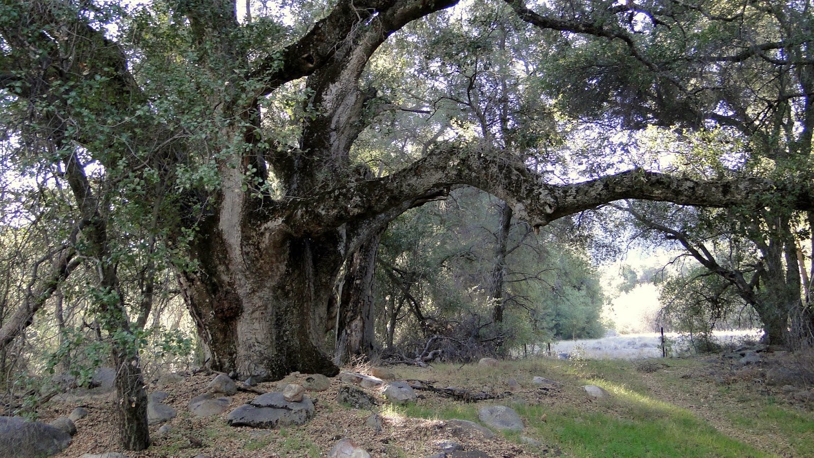
After dropping down, the trail follows a shady ravine up to a series of shallow canyons and rolling valleys. The landscape alternates between mature chaparral with some species of ribbonwood and manzanita growing up to 25′ high and oak woodland. At 5 miles, there’s a gorgeous backcountry campsite that’s sandwiched into a stream that is still flowing vigorously despite the lack of rain and a beautiful meadow. The campsite is rimmed with oaks, pines, and sycamores, and I will absolutely be camping here in the near future.
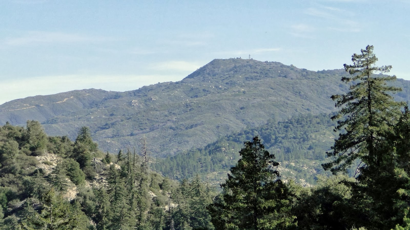 |
| High Point |
After the camp, the trail merges into an old fire road that’s been maintained as a trail. The Cutca Trail branches off to the high ridges the Aguanga block of the Palomar Mountains (sandwiched between the main Palomar block and Agua Tibia Mountain). Before long, the trail enters a cool, deep ravine that would feature a trickling stream if the weather didn’t suck so much. The stream support alders, cedars, black oaks, firs, and pine trees. This is a fine stretch of forest and a highlight of a trip full of highlights.
After climbing out of this ravine, the trail then switchbacks its way up to Palomar-Magee Road, which is an old roadbed no longer maintained that once crossed the crest of the Palomar Mountains. The trail from here can be followed to Crosley Saddle and Agua Tibia Mountain, but that would only be suitable for a long backpacking excursion. About .2 miles west down this road, there’s a steep use trail marked by cairns. This is the short but nasty way up to Eagle Crag.
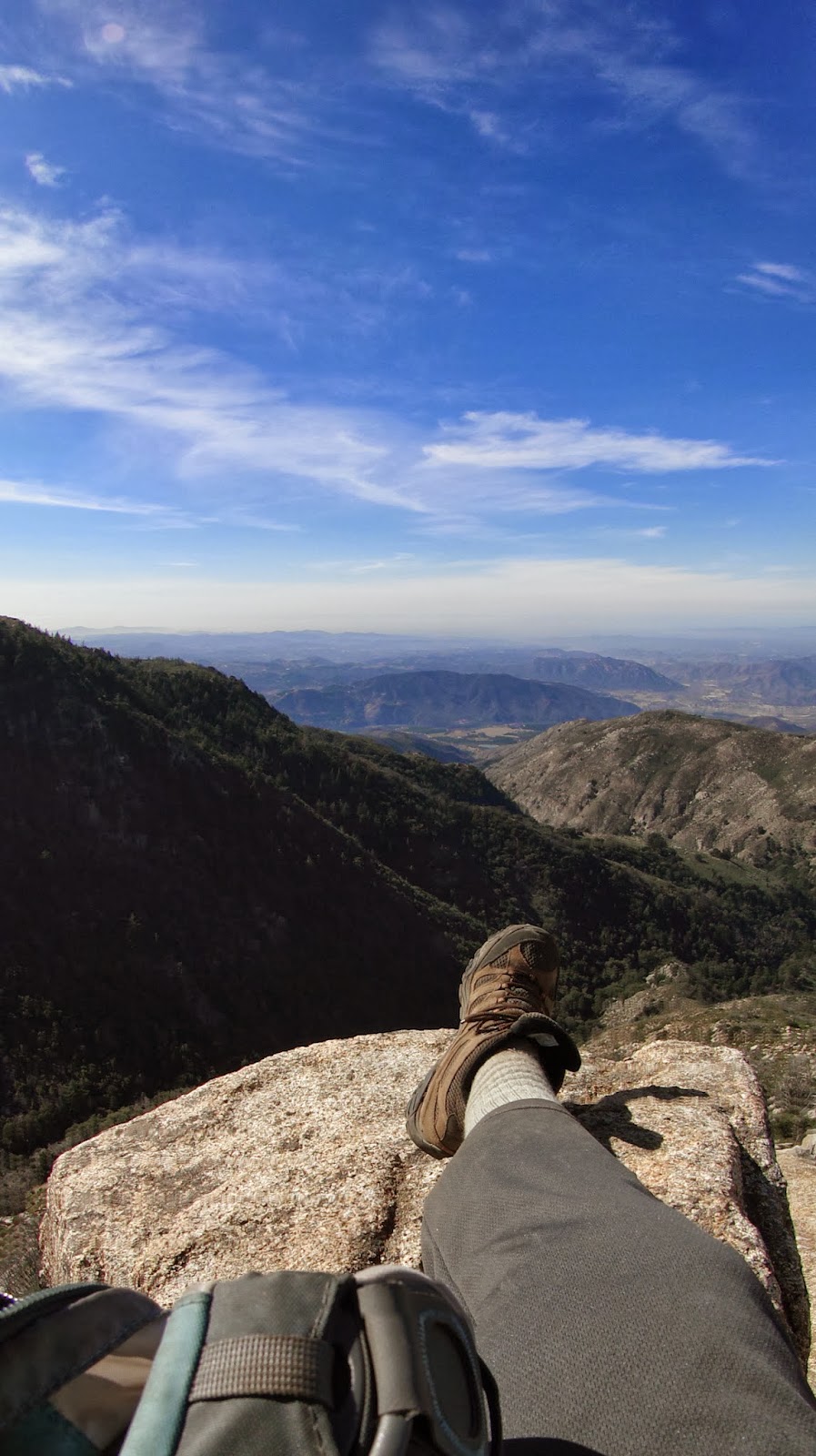
If you take this hike and opt to try for Eagle Crag, do be aware that a fire came through here about 6 years ago. There’s a lot of poodle-dog bush around, which many people find to be more irritating and aggressive than poison oak. Since you have to bushwack your way to the top, you will inevitably come in contact with the bush at close proximity. I was careful not to touch it, although it doesn’t seem to bother me. That doesn’t mean it doesn’t make me nervous, and so I spent a good 30 minutes bushwacking my way over .2 of a mile. It’s worth it once you get to the view and find a seemingly custom-made seat waiting for you at the apex of the crag. Do be aware that there is a terrifyingly steep drop off of the crag. This is not for those afraid of heights.

After that, it’s back the way you came. This hike definitely asks a lot of you, but it gives a lot back in return. It’s a must for any serious California hiker, whether it’s for the adventure, the training, the views, the variety, or all of the above.
January: 90.2
Year-to-date: 90.2

Really enjoyed your post. I was wondering if I could ask you some questions about this hike via email?
Hello Joshua, I haven’t been monitoring this blog, and so I didn’t get your message. Feel free to email me. richardsturner46@gmail.com