


Mt. Gower is a prominent peak dominating its eponymous open space preserve. Located about 15 minutes southeast of Ramona, the peak offers granite-clad views over central east county, including El Cajon Mountain, the San Diego River Valley, and the Mt.Woodson/Iron Mountain range.
Distance: 8.4 Miles
Elevation Gained: 2,600′
Difficulty: Moderately Strenuous
Time: 4:30
Critters: Hawks and ravens
Details:

Yesterday, I learned that the strange cold, damp substance that fell in modest amounts over Southern California was something called rain. I know I may have seen this strange phenomena before, but it has been so long that my memory of it is as confused as a childhood recollection. Not very much of it fell, but it was very interesting to observe the effect that this substance appeared to have on the environment.
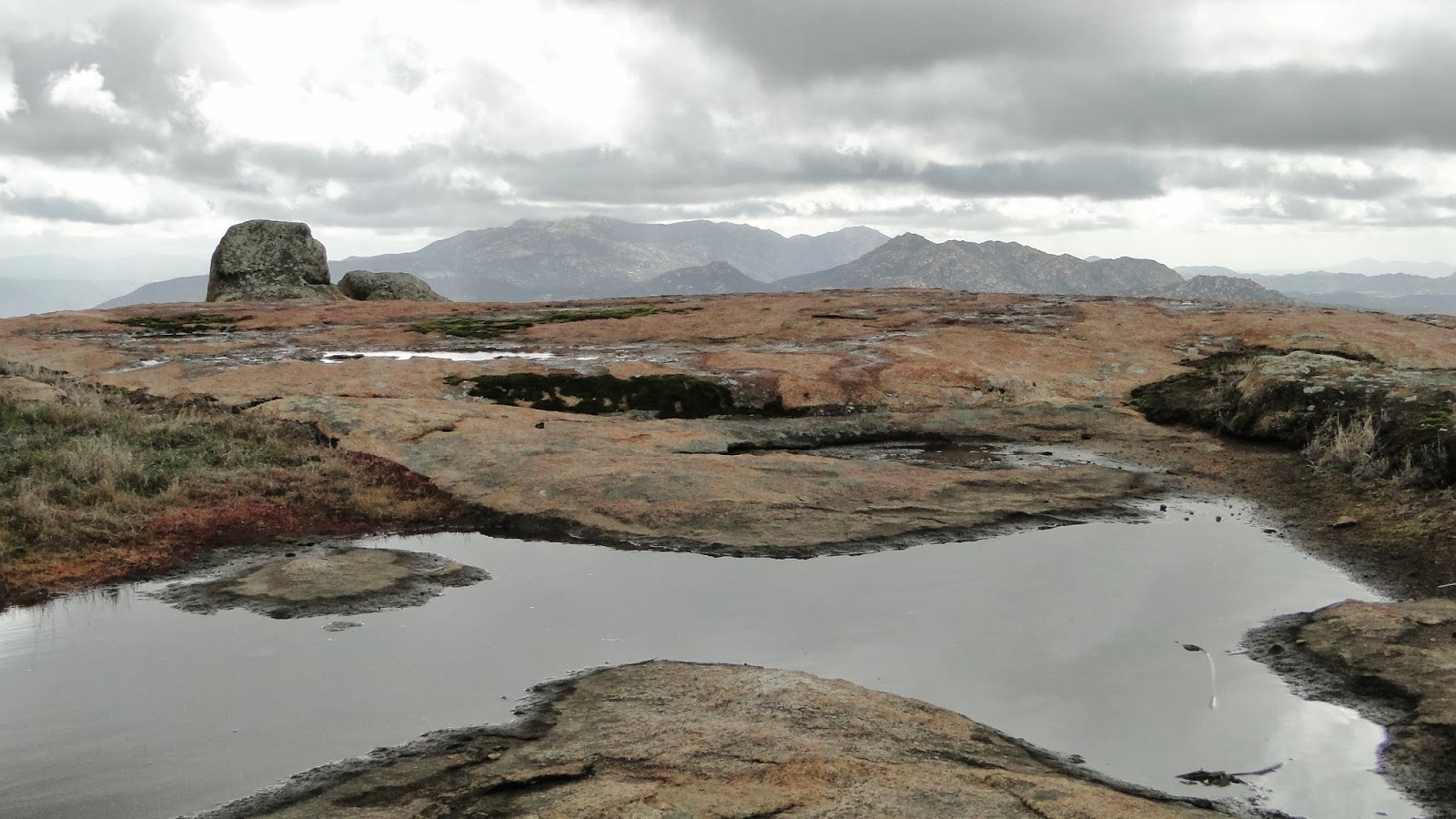
My observations occurred at Mt. Gower Open Space Preserve just south and east of the town of Ramona. The first thing I observed was that the soil was damp. The plants growing out of the soil were flecked with drops of moisture, and the vegetation had a slightly invigorated look. Upon further observations, I observed grasses and mosses that had suddenly turned a brighter shade of green. At one point, I heard a strange trickling sound, and I observed water flowing down the side of a hill. As I climbed further, I noticed something I had not expected, nor had I seen in many long months: puddles. I quite like the effects of this rain. Perhaps we can have more of it?
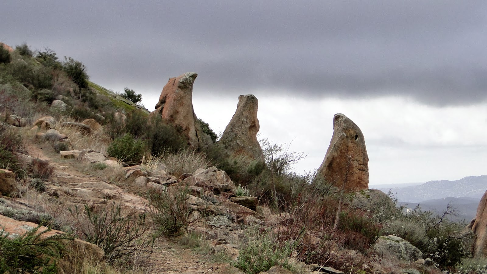
This hike was quite a lot of fun. The first two miles in and out is your usual shrub-and-boulder routine that dominates so much of San Diego County between the 15 and the Peninsular Ranges. Some of these boulders are quite large and comely, and the shrubs emitted spectacular odors due to recent precipitation. A cold day after a rain storm is precisely the right time for this sort of hike, which can be brutally hot and exposed on most other days. This is particularly important here, as the trail undulates over a ridge line before arriving on the shoulder of Mt. Gower itself.

Things get much more interesting and attractive at this point. The topography loses the bulk of the shrubs in favor of massive slabs of granite blanketed in mosses and lichens. The official trail largely bypasses this section as it winds monotonously along the west ridge of Mt. Gower. However, a use trail cuts east toward the 3,100′ summit. To reach the summit, some modest cross-country route finding is in order, although this isn’t as adventurous as it might sound since some cairns make it easy to pick out a route up to the peak.

After clamoring away up the steep boulder-strewn slopes, the use trail spits you out at a rocky summit with nice views west and south. As I sat on this cold, windy spot, the cloud level seemed to top out just above my head, causing the lingering remnants of this recent low pressure system to buzz my dome piece. On a clear day, the views would be appropriately impressive. However, the feeling of cold, damp air in January felt unreasonably good. It has been dry for far too long.

One head’s up for the hiker making an attempt on this peak: the use trail that branches off the main trail vanishes at a large field of granite slabs. The way up is simple and clear. However, it is easy to miss the way back as the trail is much harder to find upon the return. It would probably be useful to leave some kind of marker like a jacket or a hat draped over a branch to indicate where the return trail is. Otherwise, you’ll spend a half and hour looking for the trail as I did.
January: 101.8 Miles
Year-to-date: 101.8 Miles
