

Nate Harrison Grade is a windy fireroad that connects Palomar Mountain State Park to Highway 76. It passes through orange groves, open grassland, and burned forest before entering the park just below Boucher Hill. Palomar State Park is, of course, Palomar State Park, and it’s also my favorite place in San Diego County.
Distance: 6 Miles (Nate Harrison); 7.1 Miles (Palomar)
Elevation Gained: 1,420 (Nate Harrison); 1,500 (Palomar)
Difficulty: Moderate+Moderate = Moderately Strenuous
Time: 2:00 (Nate Harrison); 3:45 (Palomar)
Critters: Mountain Quail, Band-tail pidgeons, hawks, 4 deer, squirrels
Get to Nate Harrison Grade like this.
And get to Palomar Mountain State Park like this.
Note: Nate Harrison Grade is not really a trail. It’s a dirt road leading into Palomar Mountain. There really aren’t very many places to park, and with all of the private property signs around, I wouldn’t recommend parking here for long.
Also note: There is an $8 day fee for Palomar Mountain State Park
Details:
This was supposed to be one long trip up the front side of Palomar Mountain. Initially, I had hoped to climb to the top of Boucher Hill via Nate Harrison Grade, which is a long, winding dirt road that runs up the south wall of Pauma Canyon. All told, this would be 14 miles with about 4,000′ of gain, which is roughly equivalent to Mt. Wilson. I’ve been considering doing something like this for a while now, but the realities of the hike always end up being prohibitive.

Hiking up from Pauma Valley is prohibitive because there is no trailhead and the land around the road is privately owned and Indian Reservation, alternatively. Starting half-way up is prohibitive, as there are all kinds of private property/no parking signs along the way. These are undoubtedly intended to scare off hunters who would park here and wander into Indian land to hunt pigs and turkeys, thereby disrespecting tribal boundaries without permission. However, none of this takes hikers into account, and therefore there’s nowhere really to park.

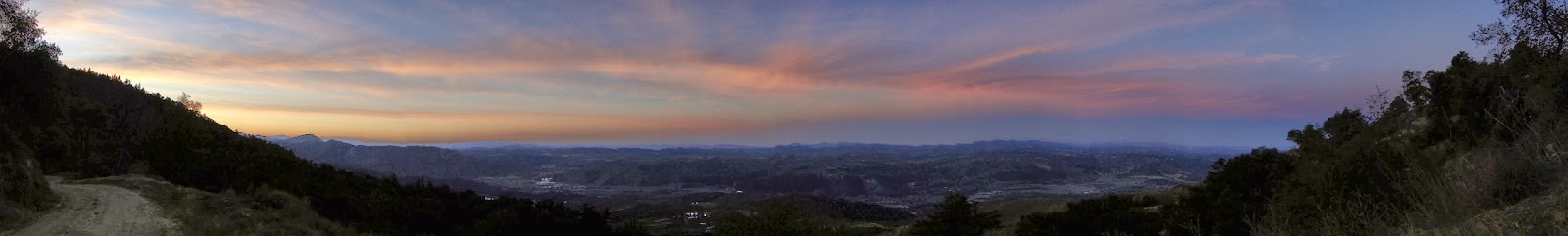
Anyhow, you’d probably have to be a real goober to try something like this, which I most certainly am. It’s a wide fire road over mostly barren landscapes, alternating with fire-scarred forest that doesn’t offer anything other than views that can be had from Boucher Hill without all the hassle. So, I probably wouldn’t recommend this as a hike. As it is, I only hiked 6 miles of the 14 total there-and-back miles of the road, which was probably quite enough. As the pictures suggest, I got a gorgeous sunrise and distant views over the entirety of western San Diego County.

After hiking to the junction with the Adams Trail in Palomar Mountain State Park, I turned back to the car and drove into the park. My original intention was to add a long, leisurely loop to the stretch of Nate Harrison, but I didn’t feel safe leaving my car parked on the road. This loop was a variation on any number of visits to Palomar, and I followed the Boucher Hill, Adams, Baptist, Weir, French Valley, Thunder Spring, Chimney Flat, and Scotts Cabin trails in succession until I got back to my car.
 |
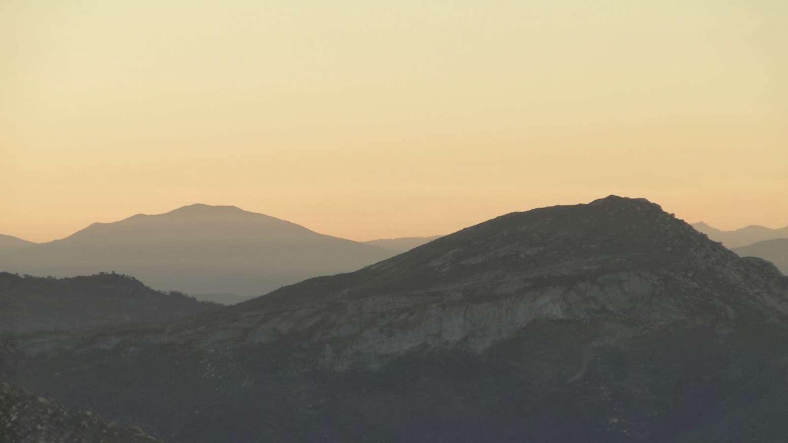
| San Gorgonio and San Jacinto from Boucher Hill |
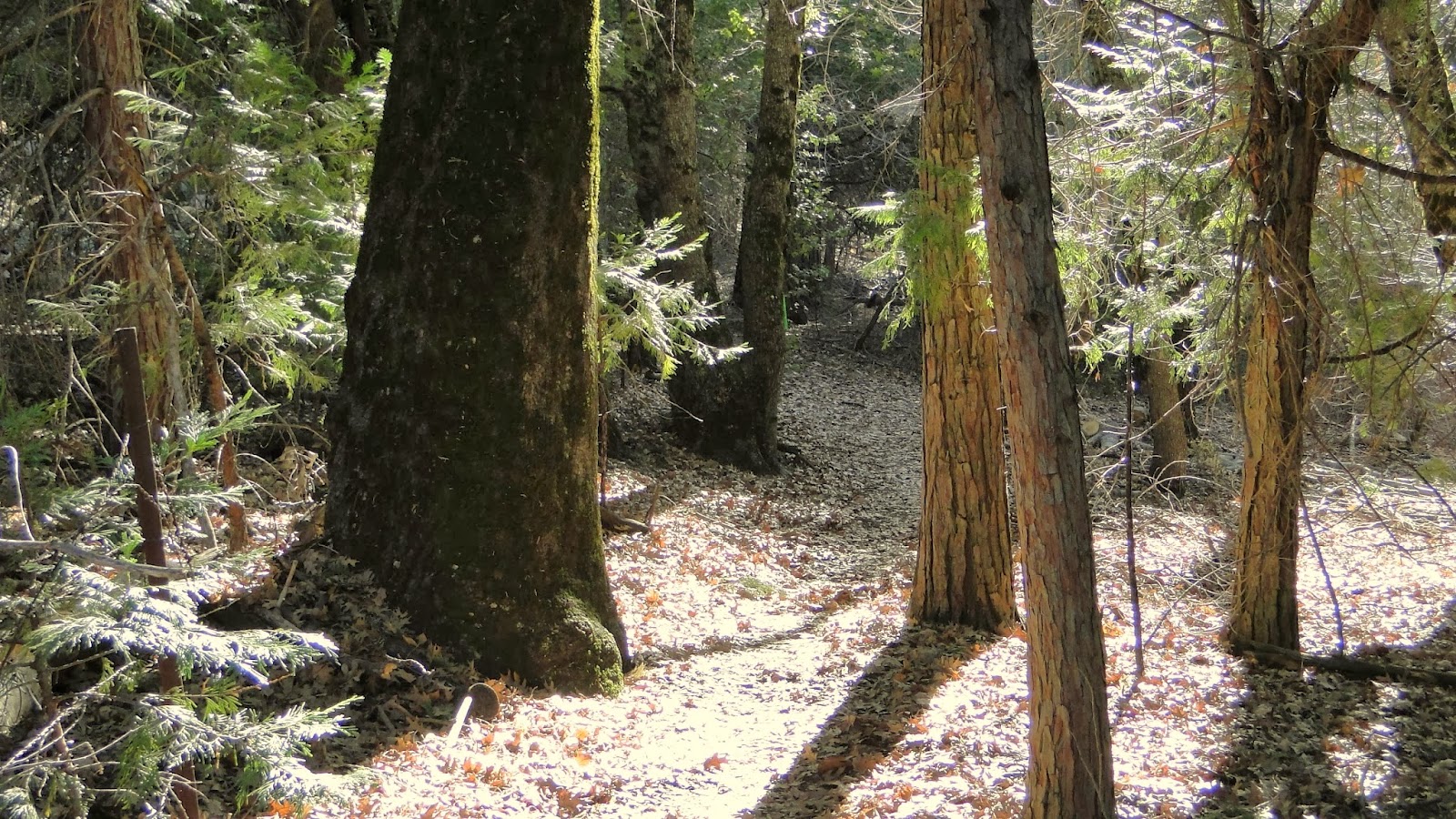
Along the way, I enjoyed a long lunch and an hour of reading at the Weir Historic Site, where Doane Creek collects in a lovely shaded grotto. Following that, I wandered through the forest past icy patches where, miracuously, month-old snow still lingers. I filled up my Camelbak at Thunder Spring (not so thunderous right now), and I strolled through the conifer-dotted meadows along the Scotts Cabin trail.
It was warm and sunny and felt a lot more like April than January, but that’s the freak weather for you. You don’t need me to tell you that we’ve had approximately 0.0″ of precipitation in January, and there is nothing forecast for the remainder of the month. By default, that would make this month the lowest recorded precipitation total for any January in recorded history. This is both alarming and depressing, but I keep trying to find ways to enjoy the world as it is, despite the low humidity, lack of running water, and abnormally high temperatures. Try as I might, it’s still scaring the crap out of me a little bit.

January: 72.2
Year-to-date: 72.2
