Stonewall Peak is a prominent bump rising up out of the rolling valleys and meadows of the Cuyamaca Area. This craggy promontory displays attractive granite outcrops, good views, and fine examples of post-Cedar fire recovery along its steep flanks.
Distance: 8.7 Miles
Elevation Gained: 800′
Difficulty: Moderately Strenuous
Time: 4:00
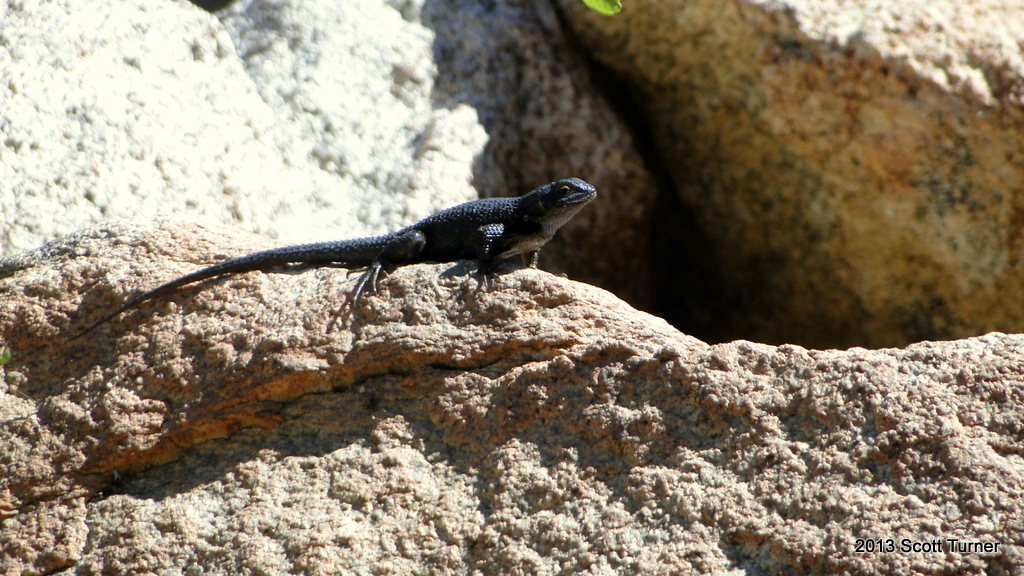
Critters: Deer
Note: There is an $8 day fee to park at Paso Picacho Campground and Day Use

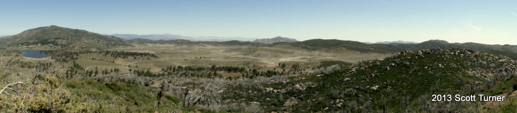
Stonewall Peak is one of the more popular hikes in the Cuyamaca Area. It stands at 5,700′ or so feet, yet it is easily accessible via a well-maintained trail. While it doesn’t feature the dramatic views toward the coast that you would get from Cuyamaca Peak, its views encompass the entirety of the Laguna Mountains to the south, the desert ranges to the east, and the Santa Rosas, San Jacintos, San Bernadinos, and Palomar Mountains to the north.
 |
| Looking south toward the Laguna Mountains |
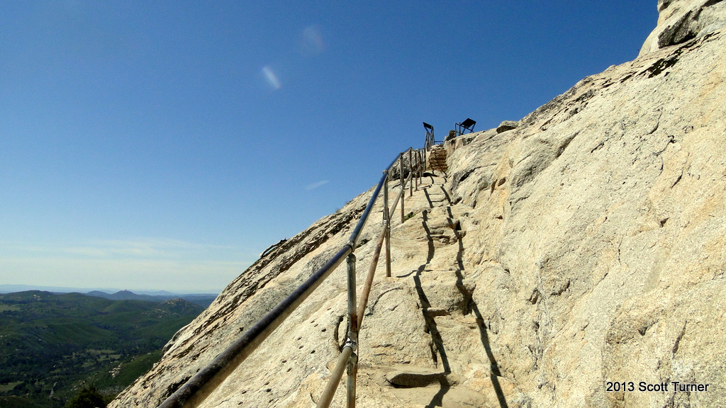
This rocky peak rises up out of the center of the park like a pyramid with the point sanded down. At the top of the peak, you will find numerous granite outcrops similar to what you might find on Woodson Mountain or El Capitan in El Cajon. These granite outcrops provide a nice place to sit and eat lunch or simply a nice place to rest after a moderately tough climb.
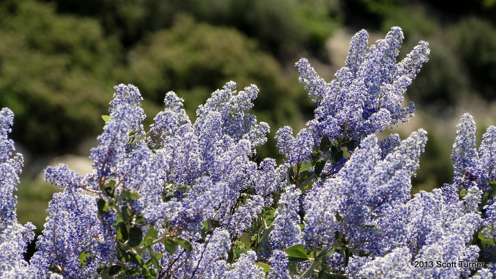
The trail from the campground is well-maintained. It switchbacks steadily up through dense stands of ceanothus and manzanita. There are a number of skeletal-looking dead oak trees that are sending up new shoots from their still-living roots. Eventually, these new shoots will grow into new trees around the dead trunks, which will eventually topple and decay back into the soil. In this way, the oaks of Cuyamaca at least are making a strong comeback. Meanwhile, the ceanothus persists in putting out brilliantly blue flower clusters that smell strongly of honey.
The trip up to Stonewall alone is about 4 miles there and back from Paso Picacho Campground. However, if you want more out of your peakbagging experience, there are a number of different ways to tack on more miles and experience a more comprehensive adventure. On this day, I tacked on 4.7 miles by including the Vaquero Trail, which lead to the Marty Minshall Trail that loops around a forested peninsula protruding into the waters of Lake Cuyamaca.
 |
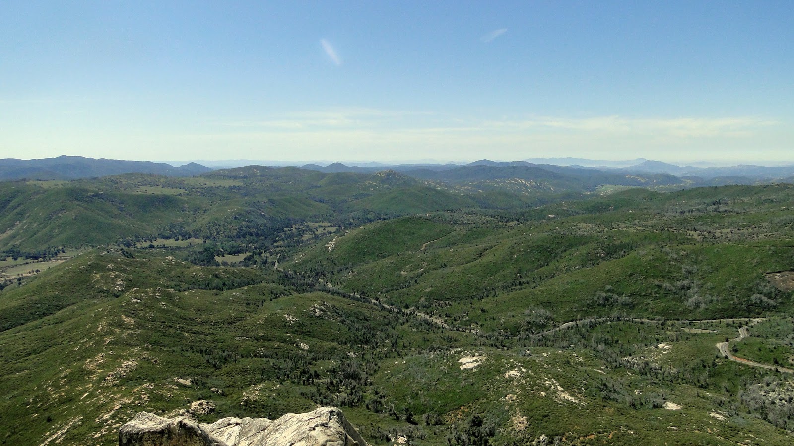
| Looking north at Middle Peak, with Palomar beyond to the left and the Mt. San Jacinto, Hot Springs Mountain, and theSanta Rosas to the right |
Other ways to go include a trek down the north side of the peak and back along the Cold Stream Trail back to the campground. This route probably sits in the 5 mile range, and it takes in some of the views of the vast flatlands on the north end of the park.
One of the great strengths and pleasures of Cuyamaca is that it offers countless choices. Every time I come here, I take a new hike, which usually begins with a quick hike up a peak, such as Stonewall, followed by a more leisurely stroll through rolling meadows lined with pine trees. In spite of all the fire damage, this place remains beautiful.