
The Santa Rosa Plateau stands above the city of Murrieta in the southern foothills of the Santa Ana Mountains. This gently rolling landscape features the last great Engelmann oak woodland, endless fields of green, trickling streams, and California history. With seemingly endless trail options, Santa Rosa presents something for everybody, from lazy strolls to all day walkabouts.
Distance: 13.2
Elevation Gained: 1,000′
Difficulty: Moderately Strenuous
Time: 4:50
Critters: Rabbits, squirrels, hawks, ravens, and quail
Note: There is a $3 day use fee at Santa Rosa Plateau
Also Note: You don’t have to take a 13 mile hike here to enjoy it. There are a number of possibilities from short, 1 mile strolls up to 16-20 mile loops that cover everything. Jerry Schad’s Afoot and Afield in Orange County is an excellent resource if you’re looking for specific guides.
Santa Rosa Plateau
http://www.everytrail.com/swf/widget.swf
EveryTrail – Find the best Hiking in Californiahttp://www.everytrail.com/trip/widgetimpression?trip_id=2031078
For my second visit to Santa Rosa Plateau, I took a nearly daylong walkabout that covered nearly all of the park’s attractions. I had been here before in December with Kelly, so you can read a little bit about the place here. This blog won’t explain what the place is or get into the Engelmann oaks again, except to say that both are great and should not be missed.

On this visit, I started out at the Vernal Pools Trail, which lies on the far west end of the park near some unusual landmarks called, wait for it. . . vernal pools. A vernal pool is an ephemeral body of water that forms as a result of precipitation gathering in a depression, the soil of which prevents absorption. Once sufficient rain falls, water will collect in these pools. Water cannot flow in or out, and the water will only disappear through evaporation. These pools support unique forms of life, including shrimp that lay dormant through the dry season and come to life when the pools begin to fill.
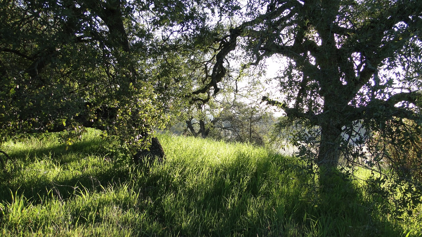
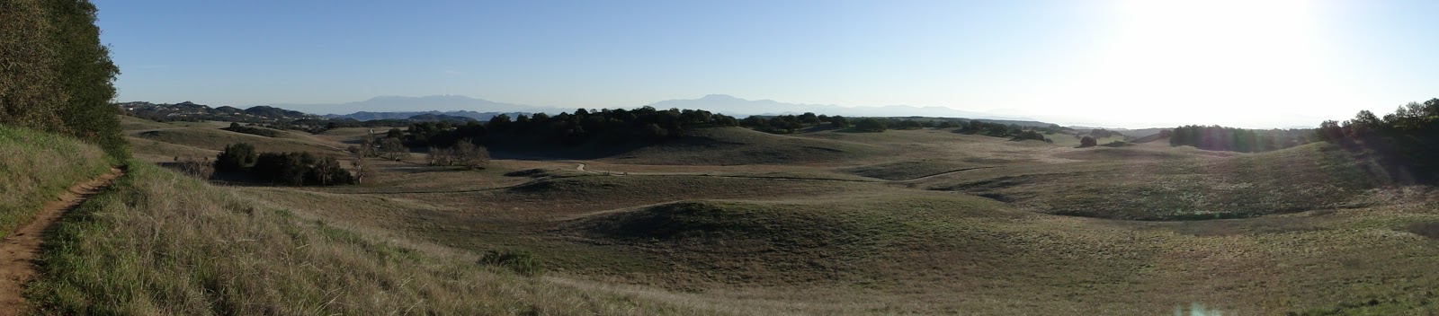
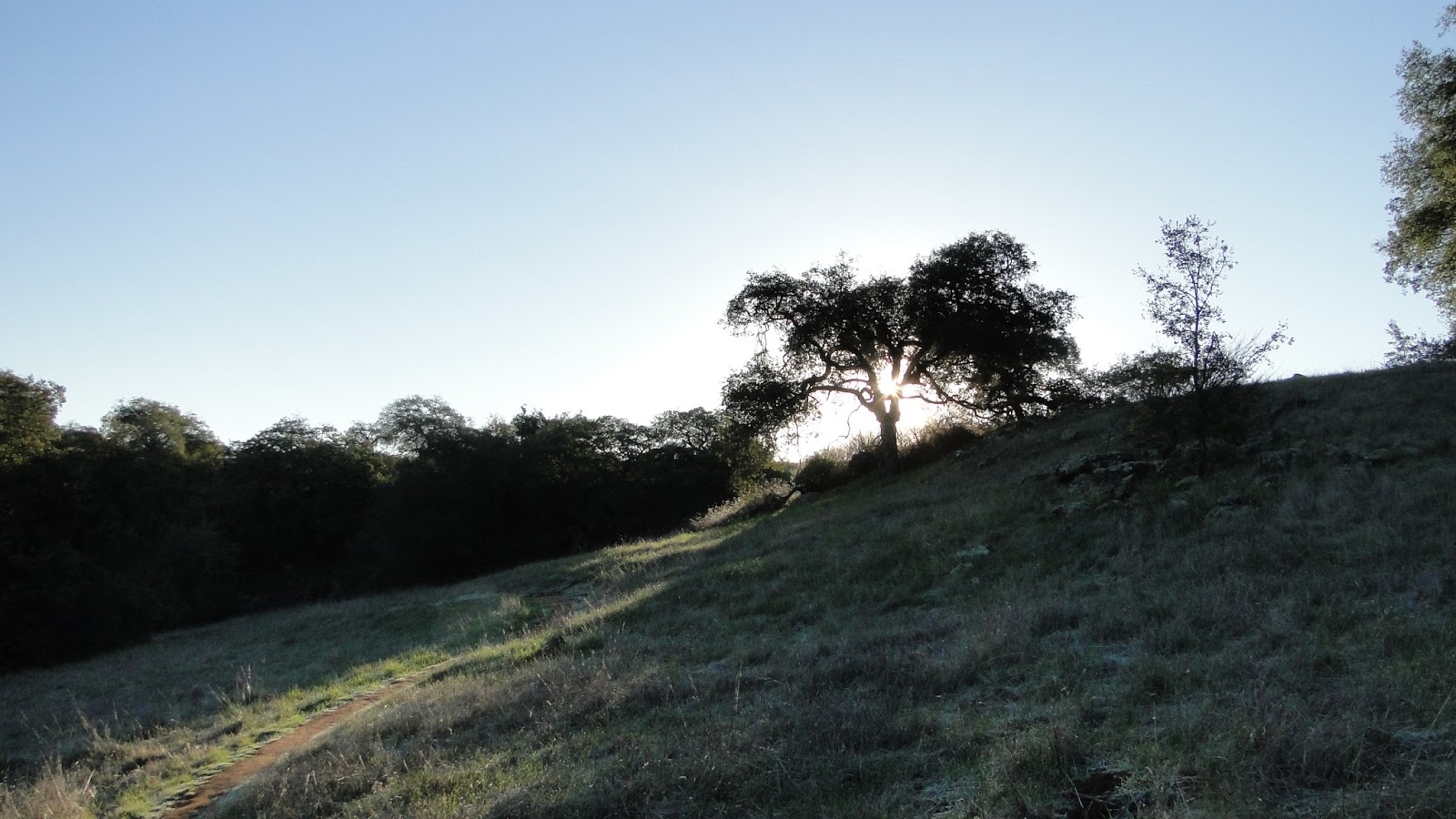
Unfortunately, we’ve had a pretty dry winter, and so there was no water in the vernal pools on this trip. Sad as that is, this was still a great hike, featuring a lot of variety. I headed east almost immediately on the Los Santos Trail, which meanders down hill through a dense oak woodland that primarily features Engelmann oaks. Through here, the grass was a lush green, and the oaks cast pools of shade that made the first few miles perhaps the most enjoyable of the hike.

I meandered through the middle section of the plateau, mostly on whim, until I came to the Hidden Valley Trailhead. From here, I crossed over to the north side of the reserve, which features Sylvan Meadows. I hiked Sylvan Meadows the last time, and I repeated a 2 mile stretch of it going counter-clockwise this time. Along the way, I was rewarded with a patch of wild peonies that were just beginning to bloom. Peonies are rare in California, and they are not nearly as impressive as their cultivated cousins. However, they are always a treat when stumbled upon.

I made my way back to the visitor’s center, where I took a brief break to snack on a peanut butter sandwich. This was about the halfway point of the hike, and I was still looking forward to the Adobe, Punta Mesa, and Vista Grande Trail. The Vista Grande Trail was definitely a highlight, as it meandered through more oak woodland that were studded with granite boulders. Everywhere a pile of boulders lay, a stately oak tree also grew, often bending and twisting around the rocks on the ground. This was an idyllic place to sit, especially with some lovely flat boulders for chairs. I spent a good 45 minutes writing and resting.

From here, the trail lead me through some arid and remote stretches. There were restricted trails leading up to the edge of the plateau, which would have allowed me views of Temecula, Murrieta, Lake Elsinore, Mt. San Jacinto, Mt. San Gorgonio, and Palomar Mountain. Sadly, these trails are closed for “research,” which just means that I can’t have it. Pout, pout, sniff, sniff. That’s not to say that I was in any way deprived for views. Mt. San Gorgonio, Mt. San Jacinto, and Palomar Mountain were present in the distance for long stretches of the hike.
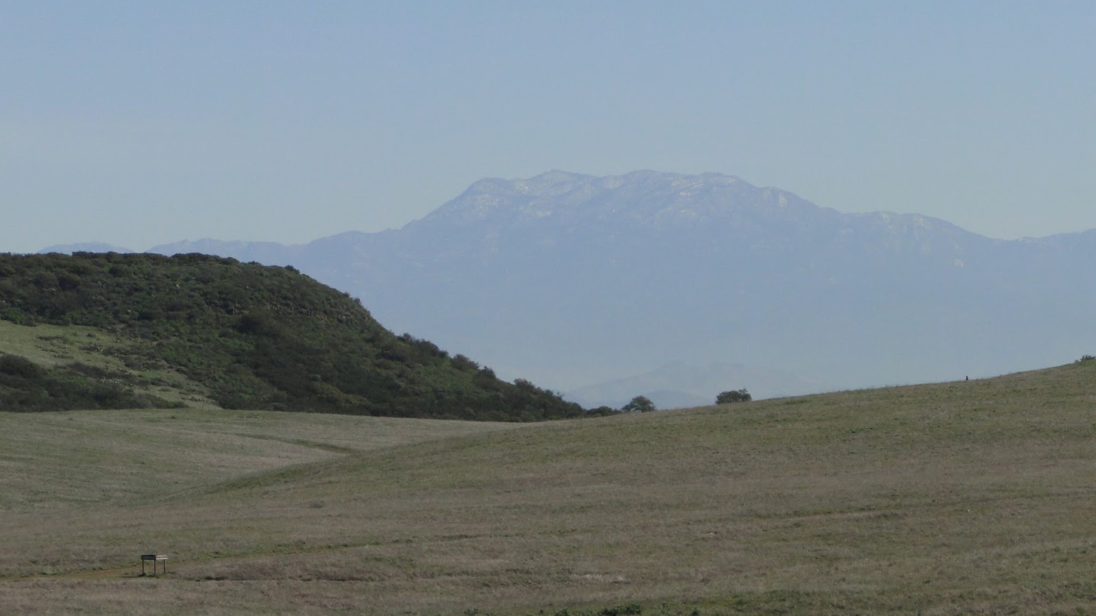 |
| Mt. San Jacinto |
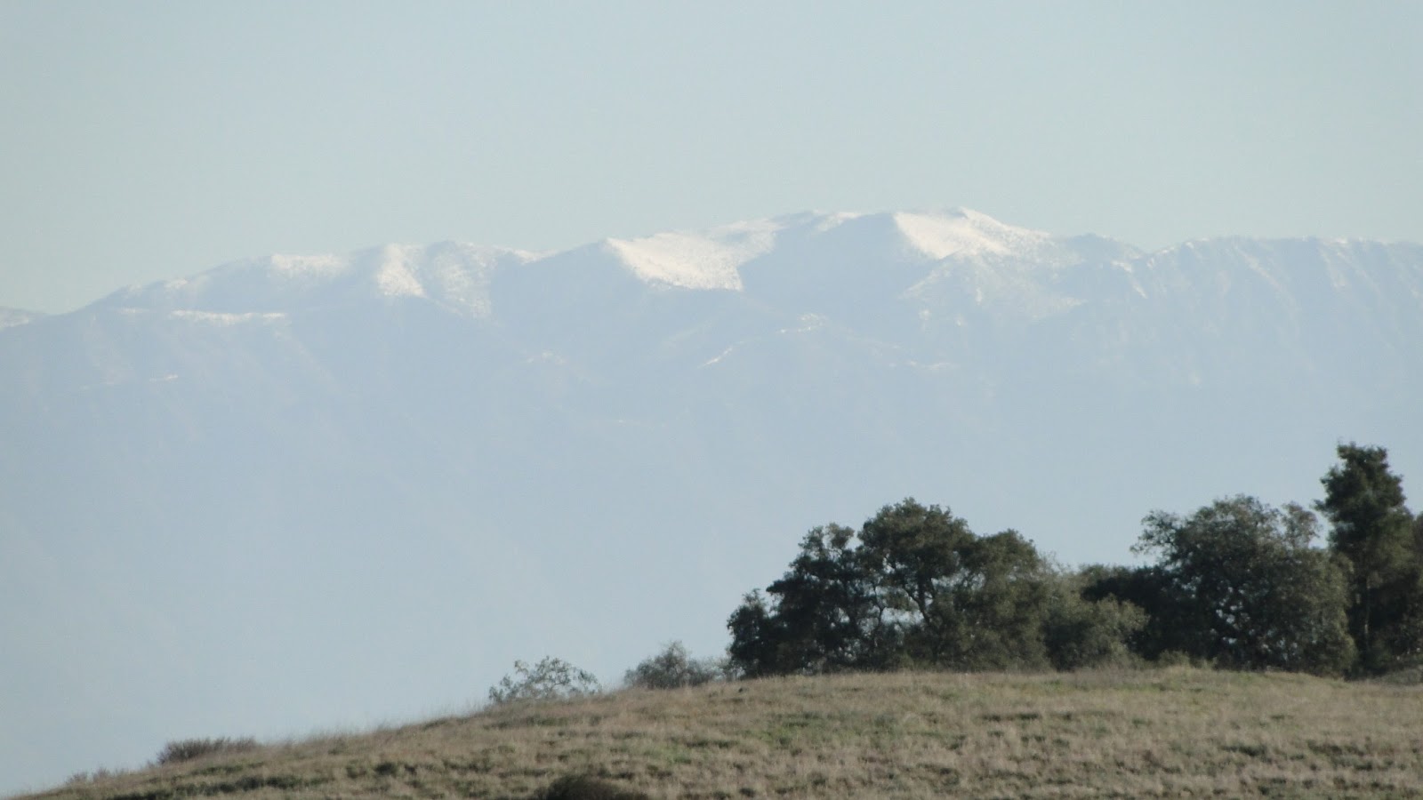 |
| Mt. San Gorgonio |
 |
| Boucher Hill at Palomar Mountain |
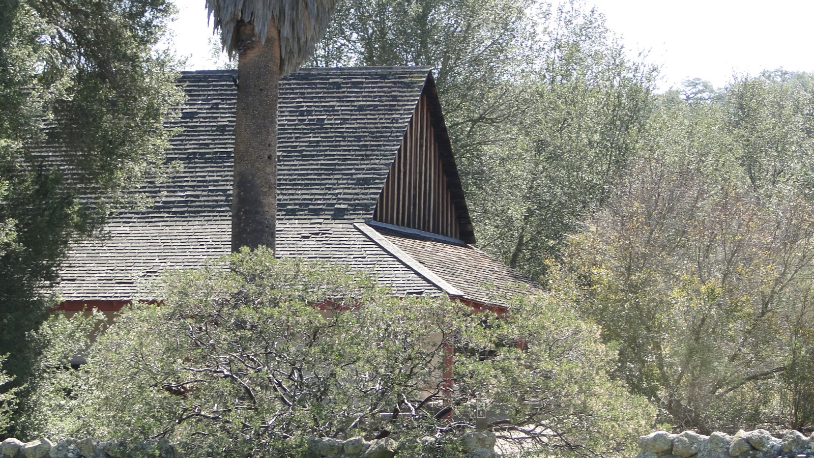
After a long, hot stretch through a chaparral-draped canyon, I emerged at the Adobe. Apparently, this is the oldest structure in Riverside County, and the site is a great place to sit and relax. While the adobe is impressive, it is nowhere near as impressive as the live oak that towers over the site. Very rarely do live oaks grow this spectacularly, and this is definitely a choice specimen.

After another half-hour break, I strolled the last 1.7 miles up the hill, past the Vernal Pools Boardwalk, and then back to the car. I had wandered the reserve and seen maybe half of what is here. This is a rich place that deserves repeated visits and yields rewards easily, since there are very few uphill segments here. In a wetter year, there would also be a number of wildflowers. Too bad it’s been so dry this year. Even the vernal pools are bone dry.

