
About one year ago, I posted this blog to showcase what I think are the best hikes in San Diego. Since then, I’ve experienced more and changed my mind a few times, thus necessitating some updates. This updated version features ten more hikes, ranked in a purely subjective way. You may consider this a resource should you be looking to explore San Diego more thoroughly. Each title will link to the blog that describes the hike, in addition to a picture and a briefer description.
I hope you enjoy exploring San Diego County as much as I have.
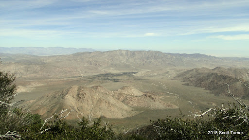
Note: I’m not including Anza-Borrego Desert. There are a number of fine hikes there, but I haven’t really explored it. I’m not particularly comfortable being out there alone.
Also note: I haven’t included Cedar Creek Falls. I haven’t included it because I haven’t done it. I haven’t done it because I hear that a lot of people have problems on it – dehydration, injuries – and therefore I don’t think it needs any encouragement. People always seem to hurt themselves around waterfalls.
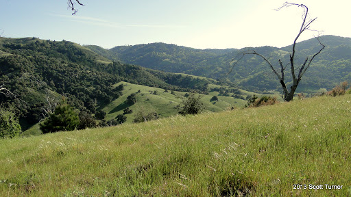
25. Mt. Gower
24. Guatay Mountain
23. Batiquitos Lagoon
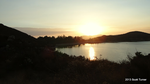
22. Blue Sky Ecological Reserve and Lake Poway
21. Black Mountain (Ramona Edition)
20. Stonewall Peak
19. Monument Peak
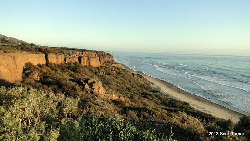
18. San Onofre State Beach
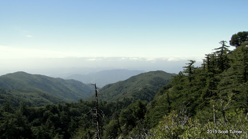
17. Agua Tibia Mountain
16. Observatory Trail
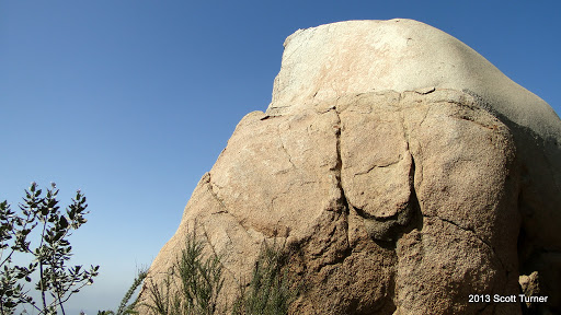
15. Mt. Woodson
Click here for directions to the Lake Poway trailhead
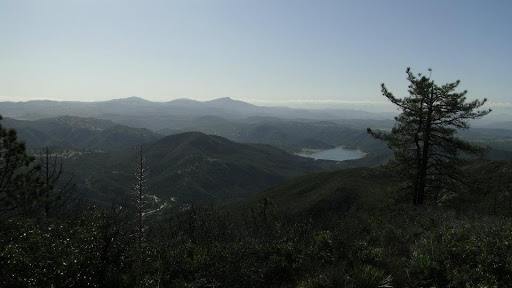
The ever popular Woodson Mountain dominates the topography around Poway and for miles in either direction. This relatively tall coastal peak features commanding views, as well as an array of granite boulders that includes the popular Potato Chip Rock. While it’s up to you if you want to wait around to get your picture snapped on a sliver of granite, you will enjoy great views in all directions regadless of what you came for. Be warned: this trail is steep, and it is almost always hot, even when it’s looks like it will be an otherwise cool day.
14. Cuyamaca Peak

Click here for directions.
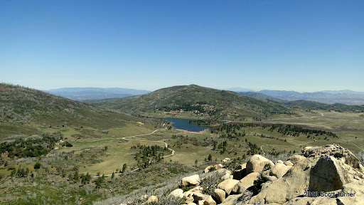
Cuyamaca Peak is the highest accessible peak in San Diego County. Climbing Cuyamaca is both and exhilarating and depressing at the same time. On one hand, there are tremendous views of San Diego County, encompassing northern Mexico, the coast, the city of San Diego, the desert to the east, the Peninsular Ranges, and the Transverse Ranges in Los Angeles. The views are so good that they are enough of a reason to visit. However, the trek to the summit is taken almost entirely on asphalt – never too enjoyable, and the trail passes through a ghost forest that is all that remains of the once vibrant forest incinerated in 2003 during the Cedar Fire. In spite of its flaws those, this hike and this peak are memorable experiences, particularly if you love an expansive view.
13. Boden Canyon
12. Santa Margarita River

Click here for directions.
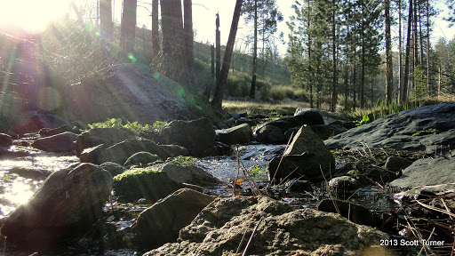
The Santa Margarita River drains the eastern Santa Ana Mountains above Temecula, and it only skirts the top portion of San Diego County, passing just north of Fallbrook and draining out to the sea at the southern end of Camp Pendleton. The isolation doesn’t mean that you shouldn’t go; in fact, it’s all the more reason for you to go. The isolation, and the chance to lounge around a river that hasn’t been dammed, diverted, or paved in Southern California is nearly unique. You can explore a 6 mile stretch of this river and pass through vegetation so thick that it looks like you’ve wandered into a Hawaiian rainforst. Wild grape vines grow in profusion here, draping the oaks and sycamores and covering every spare bit of ground. This lushness gives this hike a unique character that I haven’t seen anywhere else in Southern California.
11. Volcan Mountain

Click here for directions
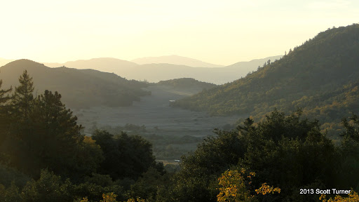
This relatively brief hike to the summit of Volcan Mountain, just north of Julian, offers a little bit of everything for which the San Diego mountain ranges are known. There are lovely stretches of oak and conifer woodland, far-ranging views toward the ocean and of the desert, and a fair amount of huff-and-puff. This hike is at its best in Spring and Fall when the black oaks are either newly dressed or about to shed their leaves. At the top, you have gorgeous views of the desert to the east, Julian and the Cuyamaca Mountains to the south, Ramona and Santa Ysabel Valleys, plus all of the mountain and hills of central San Diego county, and more mountains directly north. There are also some old structures up on top, including a site that was considered for an observatory before ultimately being constructed at Palomar, as well as an old airplane beacon.
10. East Mesa Loop, Cuyamaca Rancho State Park
Click here for directions
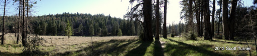
This trail features one of the few major areas of unburned landscape in Cuyamaca Rancho State Park. Most of the park was thoroughly incinerated during the 2003 Cedar Fire, and most of the trees that once blanketed the slopes of Cuyamaca, Japacha, and Middle Peak are now ghostly, blackened pillars. However, on East Mesa, Jeffrey pines and black oaks line wide-open green meadows that play host to a parade of deer, coyotes, wild turkeys, and an assortment of other critters. Be warned that the full loop would take you through Harper Canyon, which is chronically overgrown, and therefore difficult to navigate. A better alternative would be to pass through Dyar Springs and Juaquapin Creek in a truncated loop. It’s also possible to tack on Oakzanita Peak for a longer and more inclusive hiking experience.
9. Torrey Pines Reserve, Extension, and Beach
Click here for directions
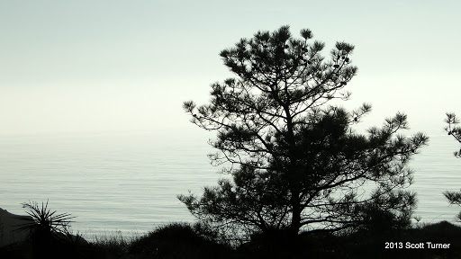
Add coastal bluffs, pristine beaches, ocean views, and the rarest pine tree in North America, and your sum will be one of the most popular natural areas in San Diego. This State Park protects two or the last three natural stands of Torrey Pines, but all three aspects of the park – reserve, beach, and extension – offer much more. The Beach, from the main entrance to Black’s Beach, offers pristine and natural oceanfront that recalls what Southern California was hundreds of years ago (minus naked men doing jumping jacks). The reserve features the famous bluffs and trees. The extension is removed from the main portion, but it offers quiet and peace in contrast to the always crowded main reserves.
8. Engelmann Oak Loop, Daley Ranch
Click here for directions
The Engelmann Oak Loop, which swings around Burnt Mountain and includes a rare Engelmann Oak woodland, is the highlight of Daley Ranch in Escondido. Gnarled, weeping Engelmanns drape their long branches over the trail. Grass carpets the rolling hillside while all manners of birds sing in the trees or screech through the sky. Wildflowers burst forth in profusion during the Spring months, and sage spices the air with its musky fragrance. Take a side trip down the Bobcat Trail, and you’ll walk through a riparian section so dense that it’s more of a forest. No signs of the outside world remain, and yet the whole loop is an easy 5.1 miles.
7. Kanaka Flat, Santa Ysabel Open Space Preserve
Click here for directions
Kanaka Flat in the Santa Ysabel Open Space Preserve is a beautiful example of what makes the California hill and oak regions so beautiful. Each hill curves softly downward to a creek bed. There you find a watercourse lined with gnarled, weeping live oaks and tall, reaching sycamores. Granite boulders sit in a picturesque sea of grass, which ripples and bends with the wind. Wildflowers of every shade dot the slopes, the edges of the trail, and the shady places beneath the trees. Come here during April and early May, and you will see a pastoral landscape that typifies this classic image of California. Once you climb up to the Flat, the landscape opens up to a vast, rolling meadow that is rimmed by Coulter pines. One word of warning, however. The cows in the big herd that grazes here can get a little ornery, and if it wasn’t for the need to constantly get out of their way by cutting or looping around large sections of trail, thus exposing yourself to snakes in the warmer months, this trail would get a higher ranking.
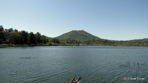
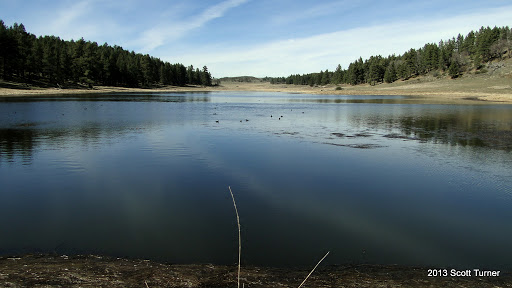
6. Lake Cuyamaca
5. Los Penasquitos Canyon
Click here for directions to the west trailhead
Click here for directions to the east trailhead
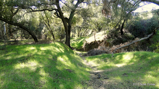
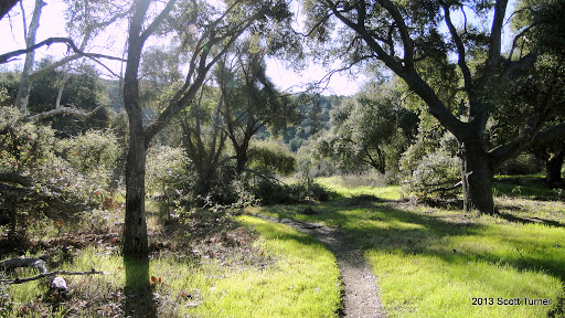
Penasquitos Canyon features a year-round creek that supports lush riparian habitats before it drains into the Pacific Ocean just north of Torrey Pines. The western half of this trail is more open, featuring hillsides, grasses, and the occasional plunge into the riparian wilderness.A waterfall that tumbles over a rocky section of the canyon bisects the canyon about halfway through the trail. The western segment is enjoyable in itself, but it is the eastern half of this trail that becomes magical. Not long after the waterfall heading east, you come to a point where you can choose the well-developed and well-traveled fire road, or you can choose the single track trail that plunges into the trees along the creek. If you walk onto the single track trail (forbidden to mountain bikers), you will soon find yourself on a three mile stretch of trail that is dense, lush, and gorgeous. At times, you get the sense of being so deeply enmeshed in another world that you forget that you are sitting in the heart of central San Diego county. You’re surrounded by the rich, earthy smells of wet earth, drying grasses, wildflowers, oak and sycamore leaves, and the dampness created by the creek. It’s a magical place.
4. Full Loop, Palomar Mountain State Park
Click here for directions
There are numerous ways to enjoy Palomar due to an extensive network of trails built into the relatively diminutive park. While any number of smaller loops are rewarding, a full loop around Palomar State Park, which includes Boucher Hill, the Baptist Trail, Upper and Lower Doane Valley, French Valley, Doane Pond, Thunder Spring, Chimney Flat, and the Silvercrest Trail, might be one of the most satisfying and varied hikes in San Diego. This loop takes into account nearly all of Palomar State Park, giving you a comprehensive Palomar State Park experience.
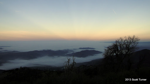
3. Eagle Crag/Cutca Valley
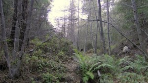
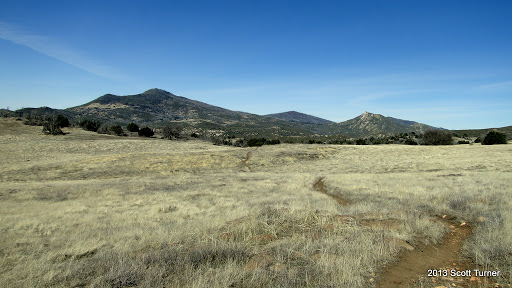
This hike is remote, requiring a half an hour on a bumpy dirt road, which is already way out in the middle of nowhere (Aguanga). It’s 18 miles from start to finish, and the last mile is all uphill. So what makes it so great? Everything else. Take your pick: densely forested canyon, epics views of San Diego, rolling meadows and oak woodlands, equally epic views of the high country of Riverside and San Bernadino, and perfect backcountry campsites. Yes, this is an epic trek, and were it not for lack of accessibility and degree of difficulty, this would be the best hike in San Diego.
2. Big Laguna Trail
Click here for directions (Note that these directions take you to the trailhead that will lead directly to the PCT. I recommend starting on the PCT, particularly if you’re doing this in the morning.)
This hike is the crown jewel in the San Diego hiking system. It features a stretch of the PCT that overlooks the Anza-Borrego desert. It travels through beautiful Jeffery pine forests (sniff the trees; they smell like vanilla cake), past huge meadows, long lakes, and even by a planted stand of giant Sequoias (not so giant down here, though). This is beautiful country, and it’s unlike anything else you’ll find in San Diego county. It’s easy to find oak trees and creeks. It’s more difficult to find conifers, but not impossible. There are a few man-made lakes, but little that occurs naturally. And there are desert views. However, none of those aspects come together quite so compellingly as on the BLT. Plus, you can call it the BLT. Even this vegetarian can get behind that.
1. Upper and Lower Doane Valley Loop, Palomar Mountain State Park
Click here for directions.
The previous Palomar hike included this hike (the stretch from Doane Pond to Thunder Spring). However, this is an example of the maxim “less is more.” This hike through both of the Doane Valleys, which can also include French Valley and the Weir Trail, is serene, tranquil, loaded with wildlife, and easy to boot. It includes the finest coniferous forest in San Diego, creeks, a pond, and lush, rolling meadows. I almost always see some form of wildlife here, and this hike never fails to please the senses. While this is all a matter of my own opinion, I believe that hikers would be hard-pressed to find a place more lovely than the Doane Valleys anywhere in San Diego, or even Southern California for that matter.

Great insight, thanks!
I really appreciate on your post…. and I got an useful information about the matter… I just tried to write the same post here San Diego Granite
So far this is my favorite “Best hikes..” blog or article concerning trails in and around San Diego. Thanks for your thoughts and observations.
Thank you so much for your post! For 3 years, I kept coming back to this site for my hiking references.
First off, thank you for being such an amazing source for hiking; I'm choosing my next hike for this Saturday and am now torn between 4 of these on this site!
That's why I'm following up with information I think you'd want to know about. The Santa Margarita Valley trails in Fallbrook (San Diego County) are being sold. As of now, there has been no official writing or documentation to say that these trails (popular for hiking and horseback riding!) will be continue to be open and maintained for the public.
Local citizens started a petition to make sure that the Santa Margarita Valley trail system would continue to be open and maintained for public use. You can learn more at the actual petition:
http://www.ipetitions.com/petition/save-public-use-of-santa-margarita-trails
As a pair that supports California hikes and trails, would you be open to sharing this?
Cheers!