

Since December of 2014, I have been conducting field work for a full revision and update of Jerry Schad’s hiking guide, Afoot and Afield in San Diego County. With one hike remaining (Dawn’s Peak/Peak 6582), I estimate that I have now hiked over 1600 miles of distinct trail and terrain in the county, with about 1,420 miles of that represented in the book. Part of my work included hiking every inch of those 1,420 miles to determine what had changed and what was new.

Although I had already hiked about 40% of the guide during the previous two years, I knew that I had a colossal undertaking ahead of me as I set out to hike every route from the book. I also had to hike as many of the new or previously undocumented trails that have opened in the past decade to provide new routes to keep the guide current.
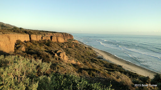
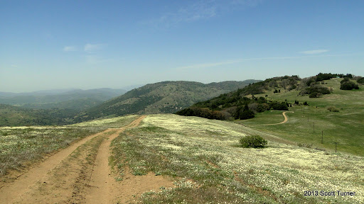
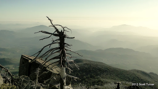
From the perspective of being inches away from the finish line on a grueling marathon of sorts, I have concluded that what Afoot and Afield is, above all else, is one of the most magnificently constructed scavenger hunts ever devised. Under Jerry Schad’s instruction (and through my own research), I have found my way to waterfalls, windswept summits, lonely desert ridges, vast meadows, sparkling creeks, islands of preserved habitat in a sea of urban development, whispering coniferous forests, remote campsites, and nearly silent desert canyons.

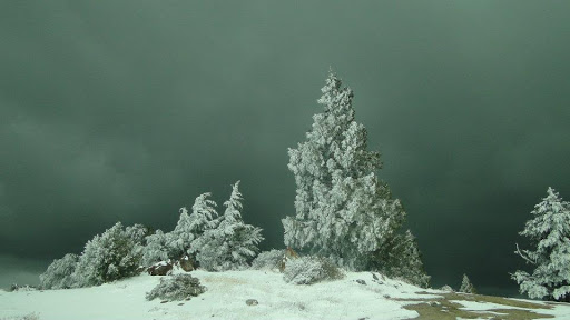
To get there, I’ve plowed through a dozens of miles of deep snow, crossed desert bajadas in 95 degree heat, trudged through mud so thick that it pulled my shoes off, warded off hordes of mosquitos, been charged by cows, battled through blisters and repetitive use injuries, learned how to be a smarter hiker because of those injuries, sweated enough to fill a swimming pool, woken up at 3:00 a.m. to follow a remote desert ridge my moonlight, driven over 25,000 miles on backcountry roads and urban highways, burned my way through I’m guessing about a dozen pairs of shoes, shredded several pairs of pants, and lost God knows how many pairs of sunglasses. I even found a baseball hat that I had left hanging from a sign in Palomar Mountain State Park exactly where I had left it six months earlier.

I’ve learned how to battle off the psychological fatigue that sets in around mile 20. I’ve learned how to apply that determination and discipline to the rest of the things I do in life. I’ve overcome my apprehension of solo hiking in the desert. I’ve walked through nearly every habitat and ecotone in the county, and I’ve documented nearly all of it on camera, through GPS tracks, and now in writing. I’ve met countless people who have devoted a substantial part of their time and energy into loving and caring for the backcountry. I’ve gained insight into how land management (and its politics) functions. I’ve encountered a tremendous variety of hikers, learned about their preferences and biases, and made a number of friendships that I suspect will endure. I’ve crossed paths with every type of animal in the county except for the elusive mountain lions. I’ve pulled my share of cholla spines out of my legs with a pair of pliers.
I see the landscape differently now. Where I used to see unidentified peaks and valleys, I now see a vast portrait of old friends reminding me of the countless hours I spent exploring. Where I used to see hillsides carpeted in uniform green, I see dozens of microclimates born from variations in drainage, slope aspect, and sun exposure. Where I used to look at rocky slopes with apprehension, I now see a challenge to relish, as well as geological nuance and transitions between biomes. Where I saw restrictive policies that seem onerous and overly restrictive, I now see attempts to corral irresponsibility and ignorance into sustainable use. And where I once saw a map of a vast landscape that was incomprehensibly complex and impenetrable, I can now visualize just about the entire county in my mind as if I carry around a 3D map of it in my brain.
In order to revise a guide book – especially this one – I needed to learn to move past my preferences. Nearly every hiker I’ve ever met carries preferences for what hikes they take. Some prefer to approach mountaintops as conquests. Others prefer the safe and familiar. Still others prefer to explore slowly and gradually while others want to book it. Some desire novelty. Others will only hike within a few dozen miles of their home. Still others are willing to wake up hours before dawn and drive a hundred miles to dayhike in the absolute middle of nowhere.

I was the sort of hiker who preferred to explore, but only where my natural preferences (primarily whether an area had a forest of sorts) led me. I was also a bucket list hiker, meaning that I sought out certain hikes based on notoriety or difficulty. I sought to check them off of an exhaustive list – think Mt. Whitney, Half Dome, Cactus-to-Clouds, etc. Moving past my preferences meant that I had to meet each hike on its own terms. I had to appreciate the merits of each hike without considering it in comparison to anything else.

Every hike became worthy of consideration, and my consideration must always be sincere. I had to actively seek out what was great about each individual place rather than seeking out things that I thought I preferred. This is essential in guide book writing since it’s on the writer to provide a comprehensive spectrum of experiences that caters to the taste of all possible users. In order to do it right, I had to learn to appreciate every hike regardless of whether it was a .3 mile loop through a lagoon or a 25 mile odyssey in the desert. I had to learn how to appreciate every moment spent on the trail, for who knows what small detail might be the thing that turned a stranger on to the wilderness.
I was tasked with completing the scavenger hunt. I was also tasked with seeing it objectively, describing what made each destination great, and finding ways to inject my enthusiasm into Point A to Point B-style prose. The end result is that, beyond knowing the county really, really well, I have developed a deep love and attachment for nearly every corner that isn’t covered by concrete, structure, or manicured landscape. And even there, I enjoyed several hikes through developed regions that forced me to reconsider what constituted a worthy outdoor experience.
So what does that mean to you? It means that you will soon have access, should you wish to seek it, to a comprehensive record of hikes that can provide you with an astonishingly deep and satisfying natural experience. This experience is one you can’t get from ticking off the checklists on the most recent “Top Ten Best Hikes” blog that your thumb will scroll through on Facebook. If you were to attempt to hike even a quarter of the next edition of Afoot and Afield, you will encounter one of the most diverse landscapes in the entire country, let alone the entire world. You would find yourself in a position to pursue experiences you never thought you’d have in a place that you might realize you only barely know. You will develop skills, accrue knowledge, and discover a place that really ought to be considered a world-class hiking destination.
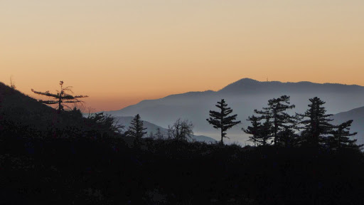
But above all, you will gain a tremendous wealth of experiences. You’ll witness world-class sunrises and sunsets, push through previously assumed limitations, survey a metropolis of millions of people from a lonely, isolated summit, enjoy numerous wildlife encounters, maybe wake at dawn and observe the world from a spot miles from the nearest human being, and perhaps even discover that a connection to the natural world is as essential as having money in the bank or friends to call when you’re sad, lonely, happy, or triumphant. I am absolutely positive it will make you change the way you see the outdoors. I am fairly certain that it will change your life.

So true, all of it.
The 3D map in the mind especially.
I rely on it . . . regularly.
🙂
What an absolutely wonderful post, Scott! I can’t wait for the new edition of the book.
Thanks, Alex! I can’t wait either. I’m tired of staring at the Word doc. : )
Hi Scott. Beautiful post. Glad you are doing this.
One suggestion. Please correct the bit about the Agua Tibia hike where Jerry said the old growth manzanitas there were unnatural, being a product of past fire suppression. This is completely untrue. Those manzanitas were perfectly natural and represented one of the last remaining old growth chaparral stands left in southern California.
I told Jerry about this, but he didn’t correct it in his final edition.
All the manzanitas were burned during fires in the 1980’s and ’90s.
Please email me if you want to discuss this further.
Hi Richard,
I’m happy to correct the text. I reviewed an article from Jim Hart about the manzanitas in question, and I know which section of the text you’re referring to. If you have any information on bigberry manzanita that you’re willing to share that describes their life cycles just for me to cross-reference my facts, it will help me keep the facts straight. I’m not an expert on chaparral (although I enjoy it quite a bit).
Beautiful. Glad to have met you and looking forward to many hikes and conversations to come. I only wish I could have accompanied you on more hikes.
I’m glad I met you too!
And, so you know, it’s never too early to start field work for the 6th edition. I’m looking into adding more desert stuff, which probably means hitting some benchmarks. . . you know, if you’re into that whole peakbagging remote summits thing.
Beautiful post! When can we look forward to the new edition of the book?
Thanks! Right now I’m hoping for the end of the year – November/December.
This is so great Scott. Congratulations on this tremendous achievement, and many thanks for all the inspiration along the way. San Diego County is lucky to have you.
Thanks!
Awesome work Scott. Been following Jerry’s footsteps for years.
Scott, thanks for what you are doing. I set out in 2014 on a goal to hike all of the trails in the 4th edition of the book. I originally thought it would take me around 5 years. I’m only about 1/4th of the way done after 3 years (including the trails I had done before setting the goal). So this is about a 10 year (or longer) goal most likely. Knocking it out in a few years is a major accomplishment. Can’t wait to buy the new edition and add your new trails to my list!