

 |
| Moraine Lake |
The High Sierra Trail runs between Crescent Meadow in Giant Forest and the summit of Mt. Whitney. This trail traverses the high country of the Southern Sierra protected by Sequoia National Park. Highlights include Giant Forest, Bearpaw Meadow and the High Sierra Camp, Hamilton Lake, Kaweah Gap and the Great Western Divide, Big Arroyo Creek, Moraine Lake, Kern Canyon, Wallace Creek, Guitar Lake, and Mt. Whitney.
Day 2:
Distance: 13.1
Elevation Gained: 3,600′
Time: 9:00
Critters: Marmots, mountain chipmunks
Details:
 |
| Climbing out of Hamilton Lake Basin |
I recently heard an interesting radio broadcast about a phone application that allowed people to track their moods throughout the day and log the ups and downs of their “happiness.” The app would send questions at intervals, such as “are you doing what you want to be doing?” and “do you need to be doing what you’re currently doing?” Through the answers to these questions, the app is able to chart fluctuations in mood based on what a person is doing and how they feel about it.
 |
| Hamilton Lake |
It turns out that people are at their least happiest when their minds are wandering, hence adding support for the saying that “idle minds are the devil’s playground.” Basically, the more you think, the unhappier you are. That seems like a fair assertion to me, and my experience on day two – or rather, the second half of day two – supports the hypothesis.
 |
| Looking back toward Middle Fork Canyon |
The day started out rather auspiciously. The deer of Hamilton Lake, which the previous post described as salt deprived, did not mess with any of my gear. However, I awoke at 4:30 am and watched mist from Middle Fork Canyon rolling up into Hamilton Lake Basin. As I put on my headlamp to take my camp apart, I noticed a large buck about 50 feet away. Every time I turned toward him, my headlamp illuminated his eyes, creating that creepy sensation of glowing eyeballs. The buck watched every move I made, presumably in the hope of catching me distracted in order to take a bite out of my gear.
 |
| Hamilton Lake again |
I avoided the deer and managed to pack up without incident. The night had been very humid, and there was a lot of condensation on my gear. I strapped both parts of my tent to the outside of my pack and began the long, hard climb out of Hamilton Lake Basin and up and over Kaweah Gap. For the next 3 miles, I would gain about 2,300′ before reaching the Gap and entering the Kern River drainage.
 |
| Mist rolling in |
As I climbed, I looked back frequently to watch the mist continue to rise and become denser in Middle Fork Canyon. Occasionally, the mist would splash up against the Valhalla formation or creep out over the lake. I’ve found that the best times to be hiking are either before or after a weather event, and with the mist following the previous day’s rain storm, I was treated to some beautiful scenes of mist flowing in and out.
 |
| Notice the notch on the right where they carved a trail out of sheer cliff |
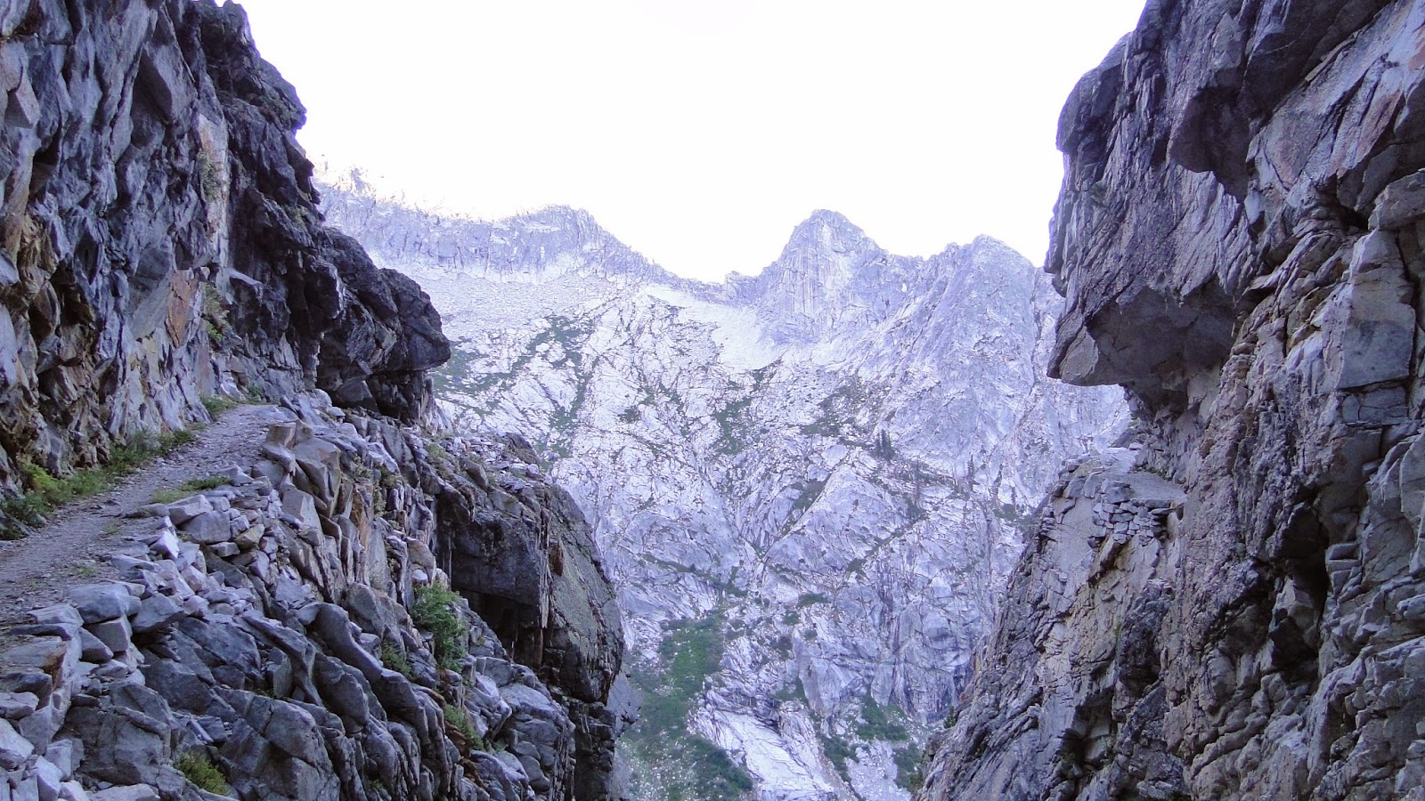
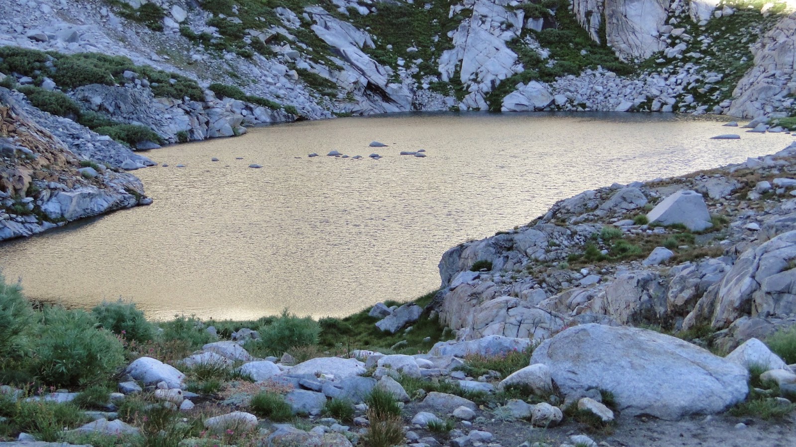
As the trail approached the higher elevations, it passed in and out of some ravines that required some extremely creative trail-building before passing numerous streams supporting lush growths of wildflowers. Eventually, the trail came up over a moraine and revealed the third of the Hamilton Lakes. This small-ish lake was pretty barren and austere, being past the treeline, but it had a kind of desolate beauty to it.
 |
| The last Hamilton Lake |
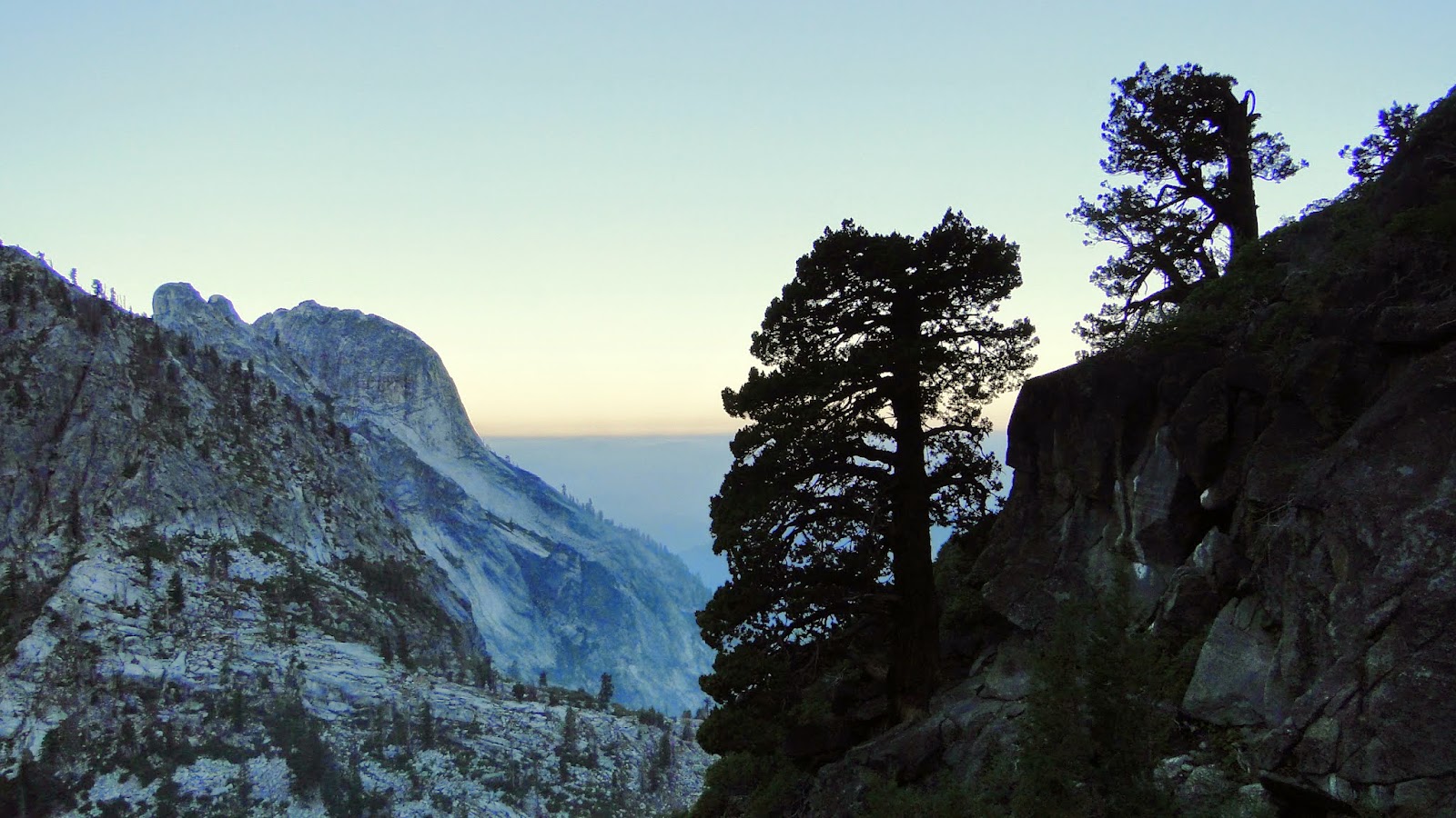
After the final Hamilton Lake, the trail resumed its climb before entering what might be the most magical stretch of the High Sierra Trail that I hiked. After cresting another moraine, the trail bent around to reveal Precipice Lake. Precipice Lake is a deep, sapphire blue lake set against a sheer cliff streaked with streams coming from a small glacier above the lake. The lake was made famous by Ansel Adams, and the image of the cliff on the opposite side of the shore has been photographed by countless other photographers since.
 |
| Famous view of Precipice Lake |
 |
| Clear aquamarine waters |
I didn’t realize that there were campsites up on Precipice Lake. I figured that the area was too rocky and remote to allow the necessary flat spaces to sleep properly. However, I discovered no fewer than six spaces not far from the lake, and, had I known that this was there, I almost certainly would have altered my plans to stay at Bearpaw Meadow on night one and then camp at Precipice on night two. In addition to the views of the lake, which are hypnotic, one would also enjoy a pretty spectacular sunset over Alta Peak and the Tablelands a few miles west.
 |
| Small pond just past Precipice Lake |
There was no letup after Precipice Lake, as the trail entered a high country fairyland full of meadows, trickling streams, ponds, crags, and wildflowers. There was water everywhere, even in the midst of a historically bad drought. The trail wove in and out of wet tussocks of grasses and mosses, while the summit of Eagle Scout Peak beckoned tantalizingly over head.
 |
| Toward Kaweah Gap |
The trail climbed up gradually through more ponds and streams before Kaweah Gap became evident in the ridge ahead of me. As I crossed the last creek and took the last switchback, I stepped up onto a granite slab and enjoyed having one foot in the Kern watershed and one foot in the Kaweah watershed. To the east, the long, sloping canyon of Big Arroyo Creek bent southward while first of the 9 lakes in the Nine Lakes Basin shimmered in the morning sun. Again, the stretch between Precipice Lake and Kaweah Gap was the most beautiful on the whole trip, and possibly one of the most beautiful spots in Sequoia National Park.
 |
| Straddling Kaweah Gap |
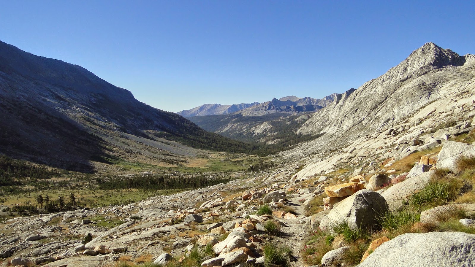 |
| Big Arroyo Canyon |
The trail switchbacked down to come alongside Big Arroyo just after re-entering treeline. After a few miles of walking through stunted whitebark and lodgepole pines, I arrived at Big Arroyo Campground, which is marked by signs as well as a large cabin that used to function as a ranger station (I think). I stopped here to eat another peanut butter and nutella burrito while I set up my tent to really dry off. I took a snooze beneath a whitebark pine and then bathed my feet in the creek, thinking all the while that Big Arroyo Campground would not be a bad place to spend some time.
 |
| Big Arroyo cabin |
 |
| Big Arroyo Creek |
 |
| Swamp Onion |
As I sat there, some part of me began wishing that I had not set such an ambitious pace so that I would have had more time to enjoy the sites along the way. I did not yet know that the stretch from Crescent Meadow to this point were probably the most scenic, and definitely featured the lushest parts of the HST. I didn’t know what consecutive days of 13-15 mile hikes with a full pack would do to my morale. I certainly did not want to consider that such a pace would be unsustainable, and that it would have been wiser to take a slower pace.
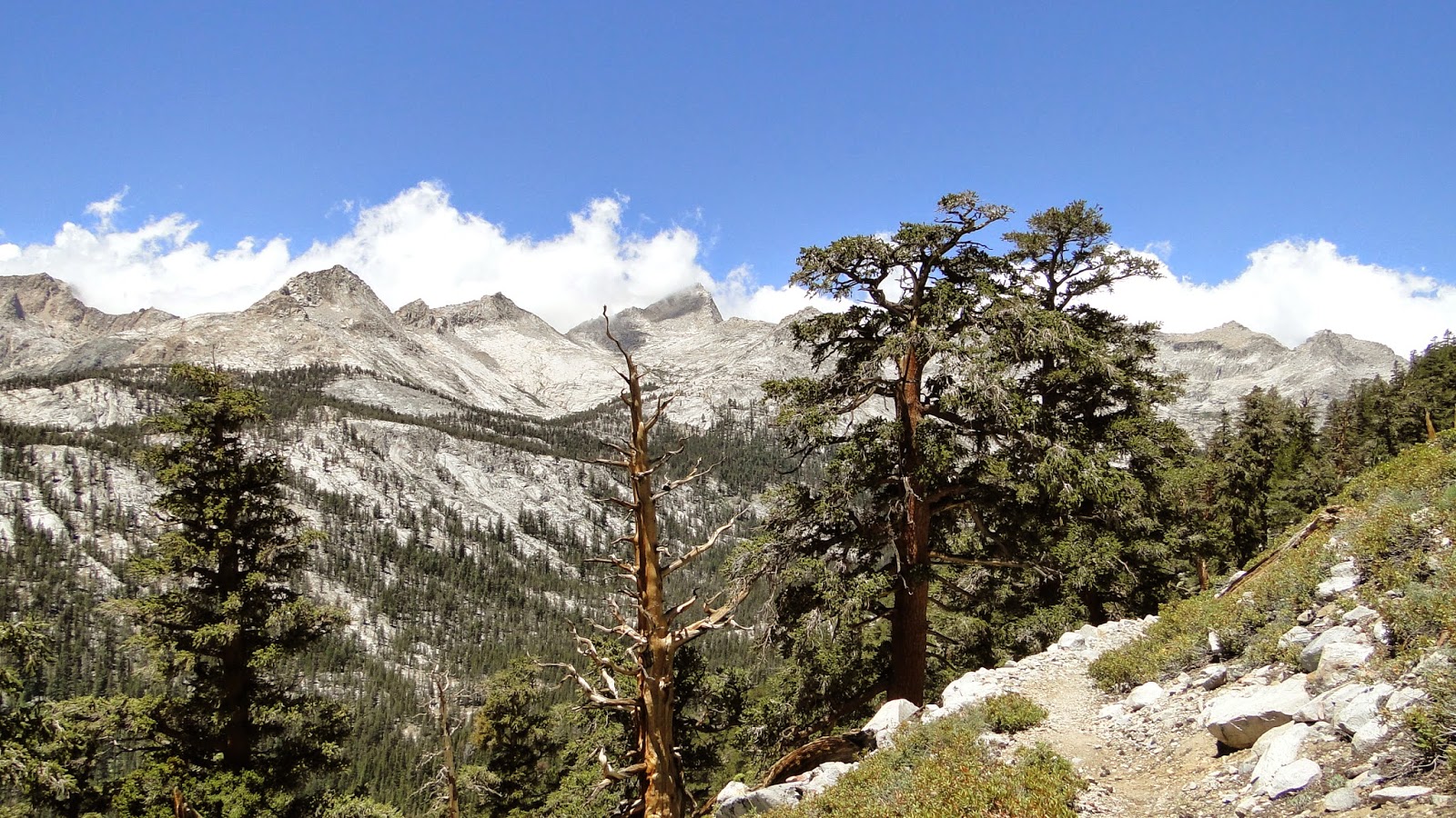 |
| Foxtail pines and the Great Western Divide |
Morale on a hike can vacillate wildly, even on a relatively short day hike. On a long hike, those swings in moods can go up and down just as wildly, although with the extreme lengths of time spent backpacking, the changes can be amplified. This can be especially true if one is hiking by one’s self, which I was. To this point, I had engaged in almost no conversation, meaning that, aside from my wife and the ranger from the day before, I had spent about 30 hours entirely alone with my thoughts.
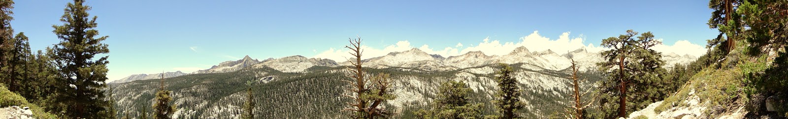 |
| Great Western Divide |
As a relatively introverted person with a passion for being out in the wilderness, usually alone, I can cope with this for a decent amount of time, say 12 hours, without any noticeable effect on my mood and outlook. Add in to the mix a heavy pack, an unsustainable pace, frankly unappetizing food, and the prospect of a dry, grueling climb ahead after Big Arroyo, I confess that I became a little down-spirited. A negative tape began to play, and for the first and certainly not last time, I found myself wishing I was at home with my wife.
 |
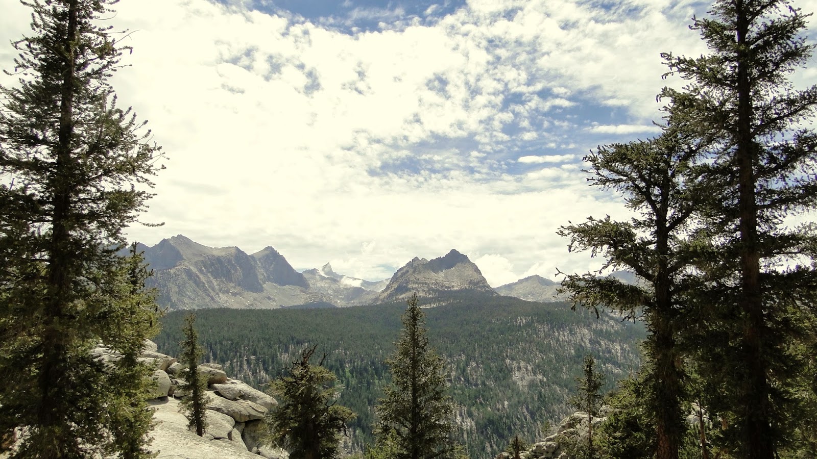
| Mt. Kaweah |
However, I was now 24 miles into the wilderness with only the options of backtracking or pushing ahead for another 50 miles before I could even entertain the idea. Hiking only two days and quitting was completely out of the question, but for the first time I had begun to entertain the notion of finishing early. The thought rolled through my mind periodically as I made my way up the dry eastern wall of Big Arroyo Canyon through foxtails and lodgepoles. The lack of streams for the next 5 miles or so did little to lift my spirits as it necessitated tanking up on a hot day and adding another 6 pounds to my already heavy pack.
 |
| Sawtooth Peak left of center |
I have to confess that I did not really enjoy the last 5 miles between Big Arroyo Camp and Moraine Lake. The terrain was generally dry and monotonous, excepting the fabulous views of the east side of the Great Western Divide. The highlight of that was mist splashing up against Sawtooth Peak, which I had made an aborted attempt on the month before. However, as the trail continued a long, monotonous grind over the Chagoopa Plateau toward Moraine Lake, which seemed ever further and further away no matter how far I walked, I began to catch flashes of true grumpiness, of which I am unfortunately prone.
 |
| Meadow on the way to Moraine Lake |
The culprit, as mentioned at the outset, was that my mind was wandering excessively. And, in the curious fashion of a mind left completely to its own devices, it wandered to some of the more negative and pessimistic regions. The result was that I interpreted my experience as a slog, when it wasn’t really that at all. It wasn’t the best part of the Sierra. It also wasn’t an endless stretch of chaparral on a 90 degree day. My mind went to places that started to hinder the enjoyment of the hike.
 |
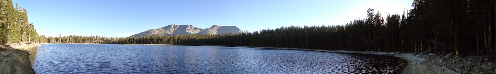
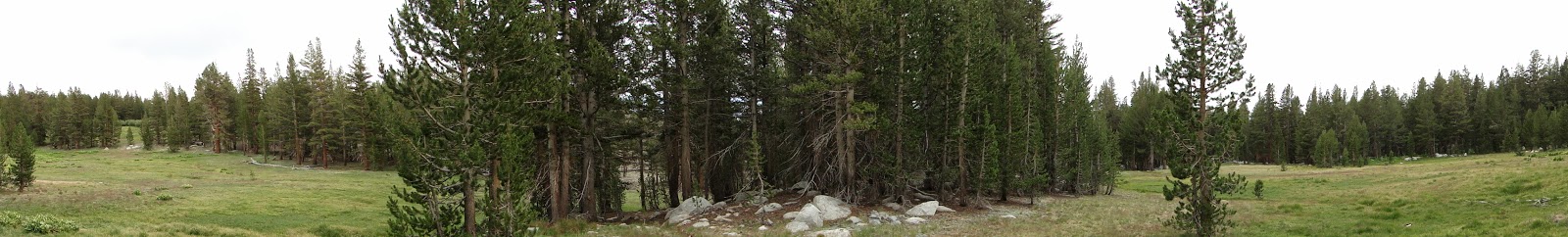
| Moraine Lake |
Just as I was starting to get worried about whether I had somehow gone astray, I caught a snippet of shimmering blue in the distance. I quickened my pace, and within another 45 minutes, I found that I had finally arrived at Moraine Lake. Moraine Lake does not have an obvious water source feeding it, and it appears to exist due to the depression within which the water resides. Given the severe drought of the last three years, the water level at the lake appears to have dropped about three feet. The warm-ish water also supports a deep, rich mud that feels absolutely disgusting on the toes, which precluded any wading or swimming. Instead, I set up camp and prepared for another meal in a bag and took a long leisurely loop around the “beach” that had been created by the water’s recession.
 |
| Lodgepole at Moraine Lake |
It turns out that Moraine Lake is a really beautiful spot. The surrounding mountains, which include the Kaweah Ridge/Peaks, the Great Western Divide, Mt. Langley, and even Mt. Whitney, sit in contrast the flat, tranquil waters. From the multiple angles around the lake, each peak/ridge became visible, providing a gorgeous and invigorating scene from every angle. Gradually, the sun sank while a gentle breeze picked up. The golden evening light highlighted a lot of small details, and I wiled away a pleasant evening enjoying the warm air, warm light, and cool sand beneath my feet.
 |
| Great Western Divide beyond Moraine Lake |
Keeping with the erratic moods of the day, my spirits lifted somewhat, and I ended the day resolved to keep at it, with an improved outlook on my prospects for finishing the entire 200 miles. I had completed the first 29 miles, and I had made good time. I felt strong. I was already getting kind of sick of the food, but I was also excited to see Kern Canyon and take a dip in Kern Hot Springs. With this shift in mood plus a few chapters of Herman Hesse’s Siddartha under my belt, I curled up into my sleeping bag with a generally optimistic outlook for the following day.
 |
| More lodgepoles in the evening |
