

 |
| Middle Fork Canyon from Eagle View |
The High Sierra Trail runs between Crescent Meadow in Giant Forest and the summit of Mt. Whitney. This trail traverses the high country of the Southern Sierra protected by Sequoia National Park. Highlights include Giant Forest, Bearpaw Meadow and the High Sierra Camp, Hamilton Lake, Kaweah Gap and the Great Western Divide, Big Arroyo Creek, Moraine Lake, Kern Canyon, Wallace Creek, Guitar Lake, and Mt. Whitney.
Day 1:
Distance: 16 Miles
Elevation Gained: 2,200′
Time: 10:00
Critters: Black Bear, Pikas, marmots, mule deer
 |
| Giant Forest |
Kelly and I pulled up to the trailhead around 7:00 am. We could hear some distant booming sounds, and being coastal Southern Californians, neither of us realized what it was for a while. The sky was gray, and rain appeared to be a likely prospect. We gradually began to realize that the distant booming sounds were thunder claps, and inwardly I began to feel a mixture of excitement and apprehension.
 |
| Looking out toward Three Rivers |
Kelly intended to walk the first mile or two along the High Sierra Trail before saying goodbye somewhere around Wolverton Cutoff. As we made our way past Crescent Meadow and along a heavily wooded and fern-bedecked slope, Kelly spotted a black bear foraging up the hill. Kelly had a good look at the bear and concluded that she would go no further. We stopped a hundred yards up trail from the bear and said our farewells. We both knew we would miss each other over the planned 16 days of hiking. As we said goodbye, I felt closer to her than I ever have, and I knew that my fears about missing her being the main challenge of the hike were anything but unfounded.
 |
| Past Eagle View |
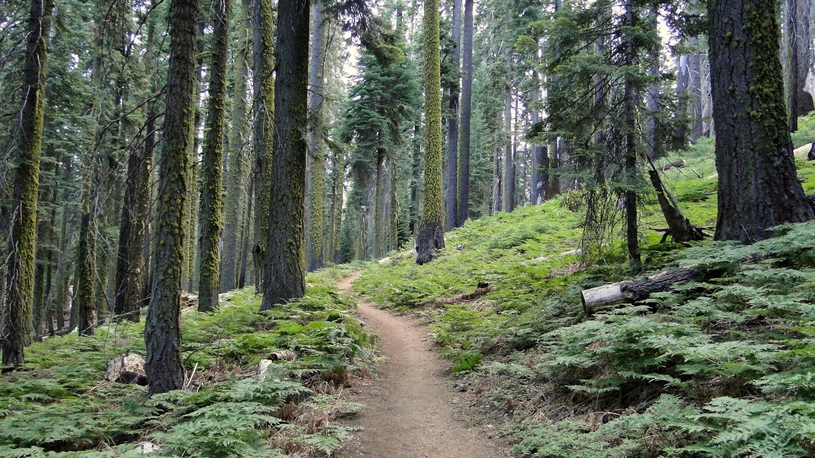
As Kelly walked back to the car, I made my slow, methodical way up the slope to the ridge that divides two separate worlds. On one side is Giant Forest, the world’s most famous and beautiful sequoia grove. Geographical and climatological factors have combined to create ideal climate for the growth of ancient sequoias as well as numerous emerald green meadows. As the grove sits on a gentle, north-facing slope, it holds its precipitation for a long period of time, allowing the sort of preposterous growth one sees in the sequoia trees. It is one of the most beautiful forests in the world, and it is lush in a way that most Southern Californians don’t experience.
 |
| Castle Rocks from the crossing at Mehrten Creek |
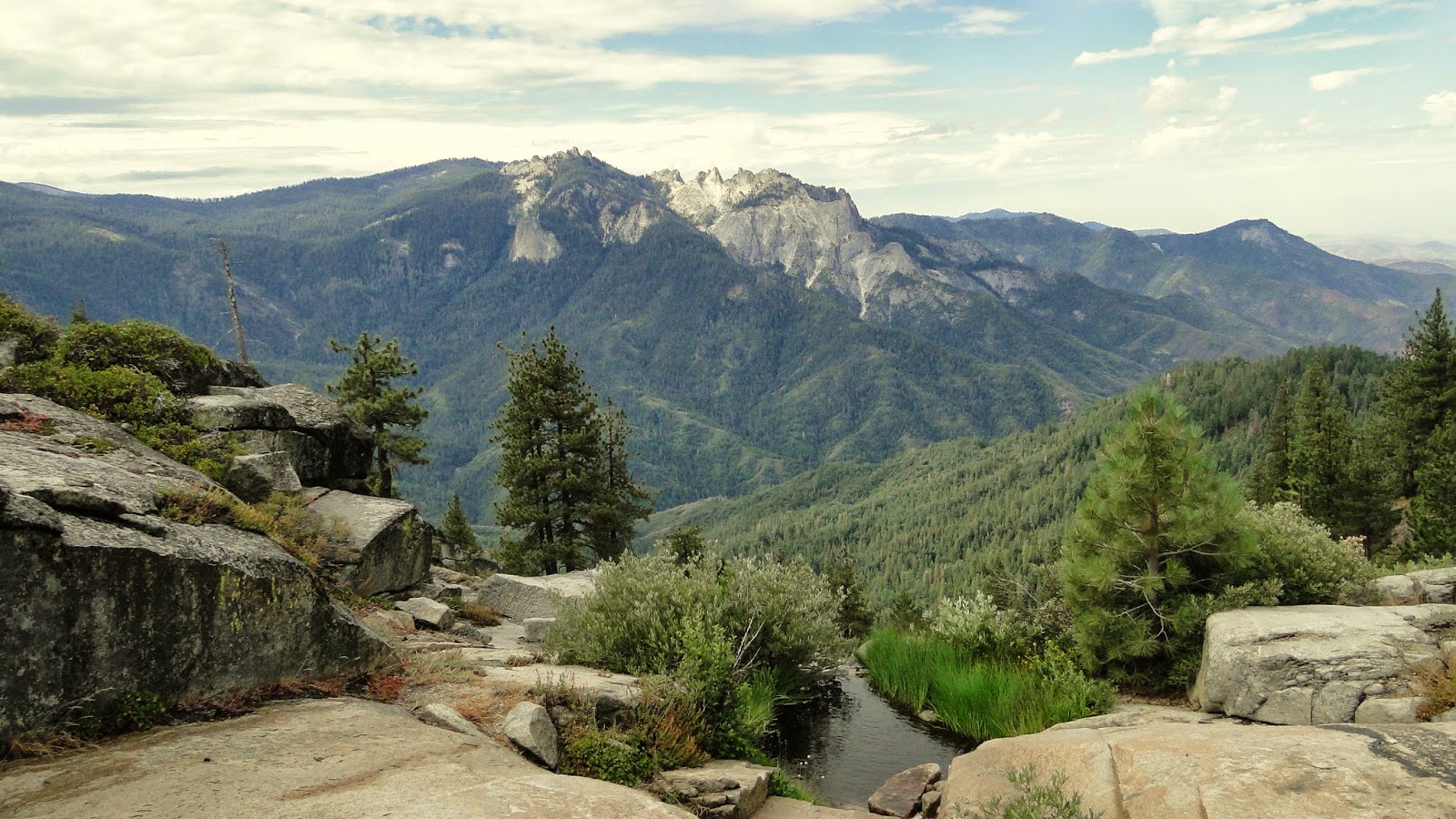
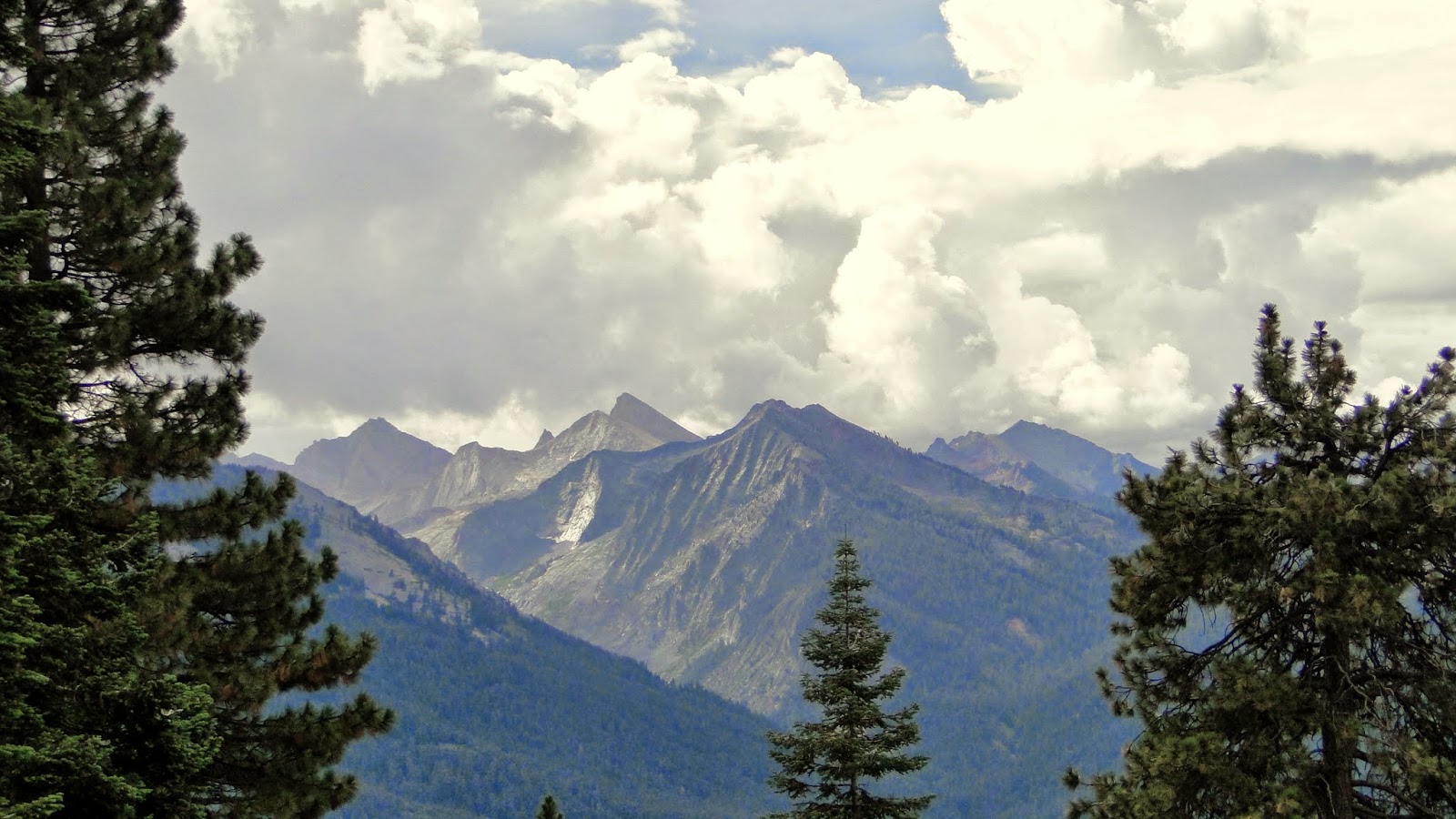
On the other side of the ridge is a thick blanket of chaparral with occasional Jeffrey pines, sugar pines, white firs, and black oaks. This south-facing slope receives more sun exposure, and thus loses much of its moisture to evaporation. However, what this slope lacks in lush forest, it makes up for with stunning views of Middle Fork Canyon and the Great Western Divide, a long ridge of 12,000’+ peaks separating the Kaweah and Kern watersheds. I would cross this divide at Kaweah Gap, but that would not occur until the second day. Until then, I would follow the High Sierra Trail as it traversed the northern slope of Middle Fork Canyon through a tapestry of chaparral and pine woodland, dense red fir forests, countless creeks and streams, the occasional meadow, a few canyons carved out by ferocious creek drainages, and, finally, a steady climb up to gorgeous Hamilton Lake.
 |
| Rain coming down over Timber Gap |
From the steady, consistent booming coming from due south over Mineral King, it sounded like I was going to make the day’s hike in the rain. Within an hour of hiking, the first raindrops began to fall, and within 15 minutes, I had covered my pack and withdrawn under my poncho to avoid being cold and wet. The main body of the storm cell was still due south over Timber Gap, and given the direction of the wind, it would likely pass east of me over Bearpaw Meadow long before I could reach that point. I kept a wary eye on the dense curtain of rain obscuring Empire Mountain and experienced that uncomfortable feeling when a bolt of lightning fires across the sky.
 |
| The Great Western Divide |
The separation between lightning flash and thunderclap gradually became less and less, and I soon found myself in a steady, moderate rain shower. The ground started to saturate, and numerous tiny streams began flowing through cracks in the rockier sections of the trail. The main body of the cell was now just in front of me, and my visibility was whitling down to about 5 miles to the south and east. Fortunately, the closest lightning strike had a few seconds of delay, and after that strike, the storm seemed to lose some steam and there were only sporadic thunder claps off in the remote distance.
 |
| Buck Creek |
As the sky began to clear, I came to Buck Creek, which is set in a shallow side canyon. Buck creek is one of the creeks that drains the Tablelands, which are mostly above treeline and therefore collect and hold a large quantity of snow. Buck Creek clearly looks like it has been the victim of numerous flash floods, and I filed that awareness away should the rain pick up again. Flash floods aside, I was running low on water, and even though I wasn’t hungry, I knew I’d need to force myself to cram down a peanut butter and nutella burrito.
 |
| One of the many dense patches of forest |
As I sat eating my modestly appetizing burrito, a ranger came up to check my permit. She warned me that there was a 50% chance of thunderstorms and that it would not be wise to linger along the creek for long, as concrete slabs are excellent lightning conductors. I took her advice and quickly crammed my burrito before making off up and over a ridge to Bearpaw Meadow. The High Sierra Camp at Bearpaw features a lot more comforts than the typical backcountry camp, including cots, somebody to cook the food, and tent cabins, and it is accordingly popular. At first, I thought I felt a vague, smug superiority, until the smell of fried onions wafted in my direction and accordingly knocked me down a peg. I love fried onions.
 |
| High Sierra Camp at Bearpaw Meadow |
I wouldn’t linger long, as I had only covered 11 of the 16 miles I had planned. This was to be my biggest day, as I was saving the later days (3 and 4) for a more measured approach. Plus, I wanted to get to Hamilton Lake, which I have long wanted to visit. I was feeling good to this point, and, heavy as my pack was, I was making pretty good time. I figured I would make Hamilton Lake before those 50% thundershowers showed up to ruin my afternoon.
 |
| Past Bearpaw |
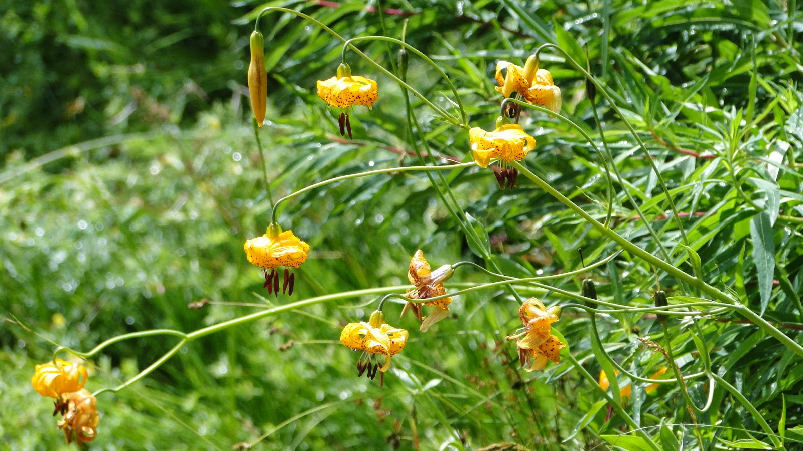 |
| Lillies |
The trail between Bearpaw Meadow and Hamilton Lake is perhaps my favorite section of what I hiked on the High Sierra Traiil. Immediately after Bearpaw, the trail passes through a lush section of spring-fed wildflowers as the trail clings tenaciously to an ever-steeper slope. Down below, the sound of Pine Creek echoes up with a dull roar, as the massive monoliths of the Great Western Divide become more and more dominant in the landscape. At a bend in the trail, I could see the valley containing Hamilton Lake and could see Hamilton Creek cascading over moraines in the deep, glacially-carved valley.
 |
| Wrecked Bridge at Pine Creek Canyon |
The trail reaches Pine Creek Canyon, which requires a crossing over a bridge. The bridge is a good 80 to 100 feet up above the canyon, through which rages Pine Creek. Pine Creek also drains the Tablelands, and it does such an efficient and effective job that Pine Creek has wiped out past attempts to bridge the canyon. You can see the evidence of Pine Creek’s destructiveness in the destroyed bridge about 30 feet below the current one.
 |
| Valhalla |
 |
| Crag-topia |
After Pine Creek, the trail begins to switchback up rocky slides studded with junipers and red fir. The trail approaches one of the cascades of Hamilton Creek, crosses it, and then opens up to views of the Vallhala Formation. This 1,000′ sheer cliff is one of the dominant landforms around Hamilton Lake, and it is pretty hard to take the eyes off of it. The cliff is pretty popular with rock climbers as well, as it presents a challenge somewhere along the El Capitan continuum.
 |
| Hamilton Creek Crossing |
The trail passes a smaller lake that had me pretty excited and then pretty letdown as I realized I still had a half mile to go. After an extremely long 16 miles, I crossed a ridge and dropped through lodgepole forest before emerging at the scattered campsites around Hamilton Lake’s western shore. The lake is set deep into a heavily glaciated bowl at an altitude that is generally lower than most alpine lakes (8,400′). Up above the lake are numerous crags and rock formations. They aren’t as iconic as Yosemite’s rock formations, but they have a grandeur that rivals, and perhaps even exceeds Sequoia’s more famous cousin to the north.
 |
| Hamilton Lake |
I set up my tent on a slab with the awareness that the deer around Hamilton Lake are salt deficient. This means that the deer will seek out any possible source of salt to supplement their meager intake. Possible sources of salt for a deer at Hamilton include, but are not limited to: your clothes, your hiking poles, your backpack, your socks, your shoes, your sleeping bag, and, for all I know, you yourself. I kept everything locked up tight to avoid being a dietary supplement.
 |
| More rock formations and moody lighting |
After that, I settled in to enjoy the lake. I waded out about 20 feet to “ice” my sore knees and hips. I strolled around to catch a decent view on the sunset. I cooked my mildly appetizing and flavorful dinner of rehydrated chili and couscous. The afternoon thunderstorms had never shown up, and everything was cool and calm. This was a perfect way to end the first day of what I intended to be a 16 day backpacking trip. Day two would see me with an early wake-up to tackle the first pass of the trip before making my way up and over the Chagoopa Plateau to Moraine Lake. Morale and mood-wise, I was a little homesick, but I felt strong and confident that I could do it.

