


In 2013, I hiked 945.3 miles while gaining 149,365′ of elevation. I spent 432 hours and 33 minutes on the trails, which amounts to 18 days hiking. My average hike was about about 6.3 miles with 1,010 feet of elevation gain. I didn’t ultimately keep track of how many calories I burned, but I know it was well over 150,000. This goes to show that hiking is great for weight loss.
In less technical terms, this year was much less intense than the previous year, during which I was hell bent on hiking as far as possible. This determination led me to a foot injury, which sidelined me for a month and a half. This year was far more moderate, and even though I spent more time hiking, I went slower, which led to fewer miles.

Despite the fewer miles, I actually took more new hikes than last year (80 to 55). The greater variety and the slower pace tended to make hiking more enjoyable as I was less hell bent on reaching some magic number. Ironically, I came within 55 miles of reaching that same number and did so without injury, which says something about the virtues of moderation.
I’m including a chart that breaks down where the bulk of my hiking took place. This is mainly because I’m a ridiculous dork who likes to make charts and spreadsheets. However, it is kind of fun to review where I spent the bulk of my time (Cleveland National Forest and San Diego County).

Tonight, I’ll post my goals for the new year, which should also be an epic year of hiking. To round this off, here are the hikes (all 150 of them) I took this year in spreadsheet form:
Date Location Distance Elevation Gained
| 1/1/2012 | Whale Peak | 9.2 | 1800 |
| 1/4/2012 | Bernardo Mountain | 7.6 | 1000 |
| 1/5/2012 | Mission Trails | 6.9 | 1300 |
| 1/8/2013 | Batiquitos Lagoon | 3 | 50 |
| 1/10/2013 | Batiquitos Lagoon | 3.5 | 250 |
| 1/12/2013 | Marble Falls Trail | 4.8 | 1200 |
| 1/13/2013 | Giant Forest | 7.7 | 1000 |
| 1/18/2013 | Sitton Peak | 9.5 | 2150 |
| 1/19/2013 | Penasquitos Canyon, East | 6.4 | 300 |
| 1/22/2013 | Cuyamaca – Oakzanita, East Mesa | 12 | 1600 |
| 1/25/2013 | Calavera Hills | 4.4 | 850 |
| 1/29/2013 | Spitler and Apache Peaks | 13.1 | 3100 |
| 1/31/2013 | Batiquitos Lagoon | 3.2 | 50 |
| 2/1/2013 | Torrey Pines Extension | 1.5 | 150 |
| 2/2/2013 | Batiquitos Lagoon | 3 | 50 |
| 2/4/2013 | Hosp Grove | 2.2 | 300 |
| 2/5/2013 | Guatay Mountain | 5.7 | 1600 |
| 2/5/2013 | Agua Dulce Loop | 6.3 | 600 |
| 2/8/2013 | Dry Lakes Ridge | 5 | 1600 |
| 2/10/2013 | San Onofre State Beach | 6.1 | 150 |
| 2/12/2013 | Daley Ranch Figure 8 | 8.9 | 1300 |
| 2/15/2013 | Charleston Urban Hike | 4 | 0 |
| 2/16/2013 | Old Wide Awake | 1.1 | 0 |
| 2/17/2013 | Cypress Gardens | 2.2 | 0 |
| 2/22/2013 | Boden Canyon | 11 | 500 |
| 2/23/2013 | Los Pinos/Trabuco Peaks | 13.5 | 2600 |
| 2/26/2013 | Santa Rosa Plateau | 13.2 | 1000 |
| 2/28/2013 | Penasquitos Canyon | 12 | 500 |
| 3/1/2013 | Torrey Pines Extension | 2.1 | 300 |
| 3/5/2013 | Agua Tibia Loop | 20.8 | 4100 |
| 3/9/2013 | Engelmann Oak Loop | 5.1 | 800 |
| 3/11/2013 | Danielsen Monument | 6.2 | 1150 |
| 3/11/2013 | Sycamore Canyon | 8.7 | 0 |
| 3/12/2013 | Mt. Lowe | 14.8 | 4100 |
| 3/16/2013 | Santa Rosa Plateau | 3.5 | 400 |
| 3/19/2013 | Superlative Laguna Trail | 15.1 | 1750 |
| 3/20/2013 | Torrey Pines Extension | 2.1 | 300 |
| 3/22/2013 | Beach Hike | 3.8 | 25 |
| 3/26/2013 | Palomar Loop | 8 | 1250 |
| 3/26/2013 | Love Valley | 2.2 | 300 |
| 3/28/2013 | Torrey Pines Reserve | 5.2 | 500 |
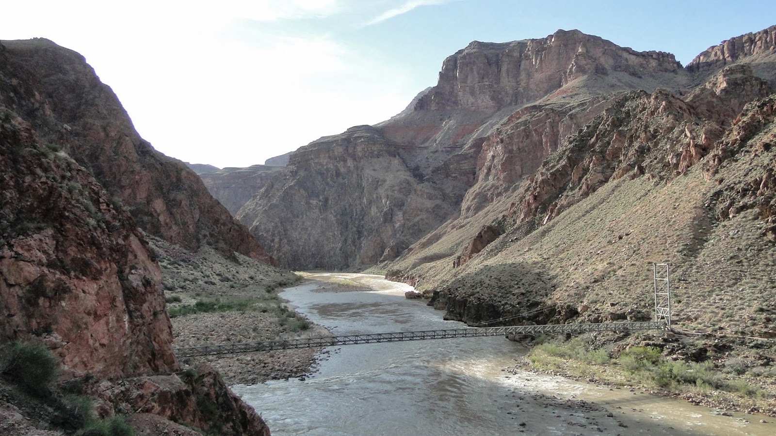
| 4/1/2013 | South Kaibab Trail | 7 | 0 |
| 4/1/2013 | River Trail | 2.2 | 300 |
| 4/2/2013 | Bright Angel Canyon | 7.2 | 1600 |
| 4/2/2013 | Ribbon Falls | 3 | 350 |
| 4/3/2013 | North Rim | 17 | 4400 |
| 4/4/2013 | South Rim | 17.1 | 4300 |
| 4/6/2013 | Doane Valley Loop | 4.4 | 300 |
| 4/9/2013 | Boden Canyon | 9 | 500 |
| 4/11/2013 | Bell Canyon – Caspers | 7.6 | 1200 |
| 4/13/2013 | Cedar/Baptist Trail Loop | 5.3 | 800 |
| 4/16/2013 | Penasquitos, East | 5 | 200 |
| 4/20/2013 | Santa Margarita River | 3.7 | 200 |
| 4/22/2013 | Stonewall Peak/Cuyamaca Resevoir | 8.7 | 900 |
| 4/22/2013 | Cuyamaca Peak | 5.4 | 1500 |
| 4/23/2013 | Cuyamaca Reservoir | 3.8 | 200 |
| 4/23/2013 | Volcan Mountain | 5.2 | 1200 |
| 4/27/2013 | Kanaka Flat | 7 | 1200 |
| 4/30/2013 | Penasquitos, East | 6.5 | 200 |
| 5/4/2013 | Doane Valley Loop | 5.4 | 300 |
| 5/6/2013 | Daley Ranch – Cougar Ridge/Jack Creek Meadow | 8.1 | 1200 |
| 5/7/2013 | Tahquitz Valley | 9.4 | 2300 |
| 5/9/2013 | Batiquitos Lagoon | 3 | 50 |
| 5/11/2013 | Santa Margarita River | 3 | 50 |
| 5/14/2013 | Dry Lake | 13.7 | 2200 |
| 5/21/2013 | Mt. San Jacinto | 16 | 4200 |
| 5/24/2013 | Penasquitos, East | 6.8 | 300 |
| 5/27/2013 | Three T’s Trail | 16.4 | 4960 |
| 5/31/2013 | Palomar Mountain, Adventure Edition | 9.9 | 2400 |
| 6/3/2013 | Wills-Rice Loop | 6.5 | 500 |
| 6/4/2013 | Mishe Mokwa | 6.4 | 850 |
| 6/7/2013 | Aliso/Wood Canyons | 11 | 1100 |
| 6/10/2013 | Trail of the Sequoias | 6 | 700 |
| 6/10/2013 | Tokopah Falls | 3.8 | 400 |
| 6/10/2013 | Moro/Sunset Rock Loop | 6.7 | 600 |
| 6/11/2013 | Lakes Trail | 11 | 2270 |
| 6/24/2013 | Doane Valley Nature Trail | 1 | 200 |
| 6/24/2013 | Palomar Shuttle Hike | 6 | 350 |
| Begin Hiatus | |||
| 7/11/2013 | Buena Vista Peak | 2 | 405 |
| 7/12/2013 | Muir Grove | 4 | 800 |
| 7/12/2013 | Hanging Rock | 0.2 | 200 |
| 7/13/2013 | Beetle Rock/Round Meadow | 2.1 | 100 |
| 7/14/2013 | Redwood Canyon | 6.8 | 1500 |
| 7/14/2013 | Stony Creek Walkabout | 1 | 300 |
| 7/22/2013 | Observatory Trail | 5 | 1000 |
| 8/3/2013 | Batiquitos Lagoon | 3.2 | 50 |
| 8/25/2013 | Doane Valleys | 5.4 | 300 |
| 8/29/2013 | Wooded Hill | 1.6 | 215 |
| 8/29/2013 | Laguna Meadow | 7.9 | 200 |
| 8/29/2013 | Kwaymii Point | 1.2 | 300 |
| 8/31/2013 | Batiquitos Lagoon | 3 | 50 |
| 9/3/2013 | Various Hana Trails | 1.5 | 300 |
| 9/3/2013 | Pipiwai Trail | 4 | 900 |
| 9/6/2013 | Kalalau Trail | 8 | 1200 |
| 9/8/2013 | Powerline Trail | 6 | 1300 |
| 9/9/2013 | Pihea Trail/Alaka’i Swamp | 8 | 2000 |
| 9/12/2013 | Penasquitos, East | 5 | 200 |
| 9/16/2013 | Batiquitos lagoon | 3.2 | 100 |
| 9/17/2013 | Guajome County Park | 3.3 | 250 |
| 9/19/2013 | Tahquitz Peak | 8.2 | 2700 |
| 9/20/2013 | Rancho La Costa Reserve | 4.4 | 500 |
| 9/24/2013 | Double Peak | 5 | 1000 |
| 9/26/2013 | Reyes Peak | 9.2 | 1300 |
| 9/27/2013 | Paramount Ranch | 3.9 | 450 |
| 9/27/2013 | Calabasas Peak | 3.7 | 1000 |
| 9/27/2013 | Ladyface Mountain | 2 | 1150 |
| 10/1/2013 | Piedras Pintadas/Bernardo Bay | 5.5 | 600 |
| 10/3/2013 | Blue Lake | 7.7 | 1600 |
| 10/3/2013 | Convict Lake | 3.3 | 400 |
| 10/4/2013 | Methesulah Walk | 4.5 | 800 |
| 10/4/2013 | Kearsarge Pass | 9.2 | 2440 |
| 10/7/2013 | Highland Valley Trail | 4.8 | 150 |
| 10/11/2013 | Manzanita Flat | 8.8 | 2400 |
| 10/11/2013 | Monserate Mountain | 3.9 | 1220 |
| 10/14/2013 | Sycamore Canyon/Goodan Ranch | 5.2 | 500 |
| 10/18/2013 | Palomar Full Loop | 8.5 | 1250 |
| 10/21/2013 | Black Mountain | 3.6 | 800 |
| 10/21/2013 | Knott Grove | 3 | 100 |
| 10/24/2013 | PCT: fage’s monument to scissors crossing | 17 | 1500 |
| 10/25/2013 | Nature Trail, Heise Park | 0.6 | 150 |
| 10/25/2013 | Cuyamaca Resevoir | 3 | 150 |
| 10/25/2013 | Kelley’s Ditch Trail | 6.2 | 1100 |
| 10/25/2013 | Inaja trail | 0.5 | 100 |
| 10/28/2013 | Stanley Peak | 5.5 | 1200 |
| 10/31/2013 | Trabuco Canyon | 12 | 2950 |
| 11/4/2013 | Crystal Cove SP | 8.3 | 1400 |
| 11/8/2013 | Daley Ranch | 9.1 | 1800 |
| 11/14/2013 | West Mesa Loop | 7.2 | 1200 |
| 11/14/2013 | PCT: Desert View/Laguna Loop | 12.1 | 1100 |
| 11/18/2013 | Batiquitos Lagoon | 3.2 | 50 |
| 11/21/2013 | Split Mountain | 12.5 | 600 |
| 11/21/2013 | Palomar Lower Doane Valley | 2.5 | 300 |
| 11/22/2013 | Tenaja Canyon | 7.6 | 1800 |
| 11/22/2013 | Santa Rosa Plateau: Adobe Loop | 3.7 | 400 |
| 11/23/2013 | Batiquitos lagoon | 3 | 50 |
| 11/26/2013 | Batiquitos Lagoon | 3.2 | 200 |
| 11/28/2013 | winter creek | 5 | 1100 |
| 11/29/2013 | Malibu Creek State Park | 5.3 | 700 |
| 12/2/2013 | Mt. Woodson via Blue Sky | 11 | 2800 |
| 12/5/2013 | Bow Willow and Rock Canyons | 8.7 | 1200 |
| 12/5/2013 | Mountain Palm Springs | 2.5 | 500 |
| 12/5/2013 | Santa Ysabel West | 4.3 | 1200 |
| 12/9/2013 | Caspers: Juaneno/Bell Canyon Loop | 10.2 | 1860 |
| 12/16/2013 | Black Mountain | 3.5 | 700 |
| 12/19/2013 | Santa Ynez Canyon | 5 | 900 |
| 12/20/2013 | Mt. Wilson | 13.7 | 4000 |
| 12/27/2013 | Santa Rosa Mountain | 7.2 | 1270 |
| 12/29/2013 | Engelmann Oak Loop | 5.1 | 800 |
