
 |
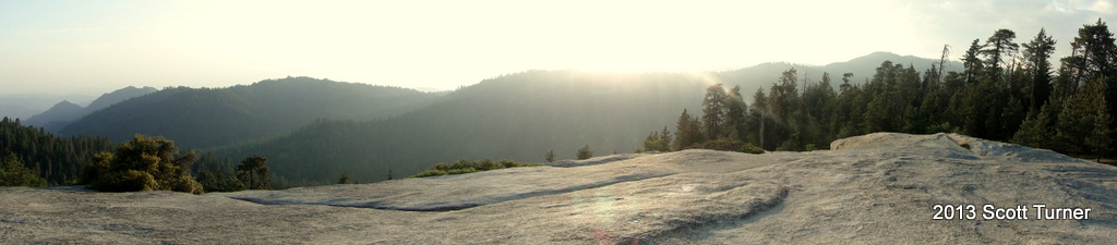
| Moro Rock and Kaweah Canyon from Hanging Rock |
 |
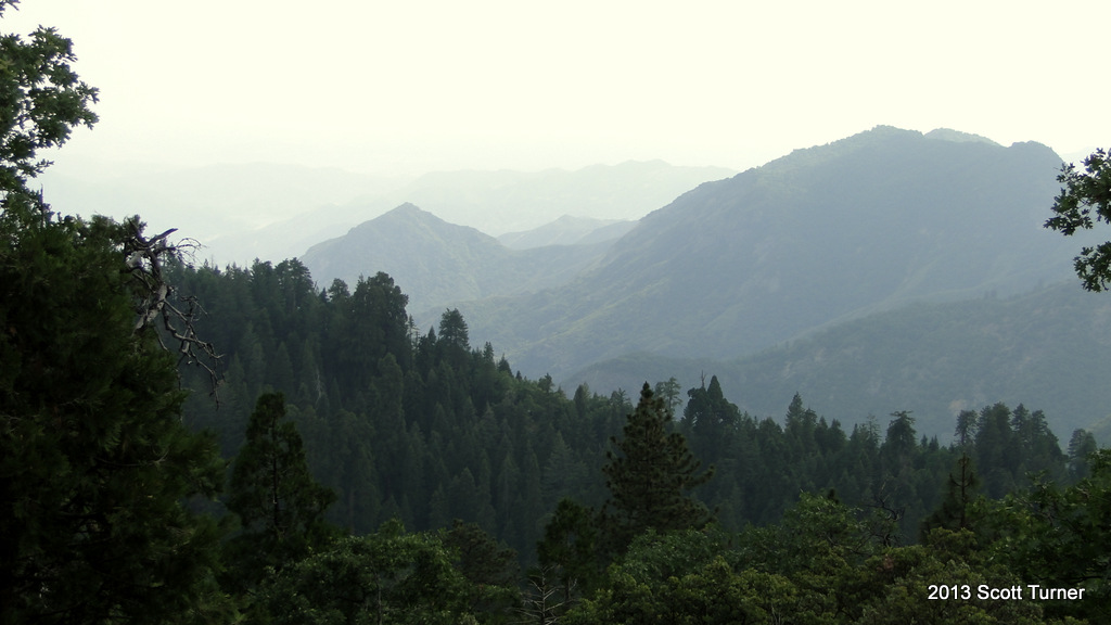
| Marble Fork Canyon from Sunset Rock |
This moderate 6.5 loop travels between two outstanding view points in the Giant Forest area, Moro Rock and Sunset Rock, by way of the Moro Rock Trail, the Soldiers Trail, and the Alta Trail. While there are fewer meadows and big trees on this loop, there are also more expansive views and plenty of solitude, which make this an outstanding, but frequently overlooked hike.
Distance: 6.5 Miles
Elevation Gained: 600′
Difficulty: Moderate
Time: 3:15
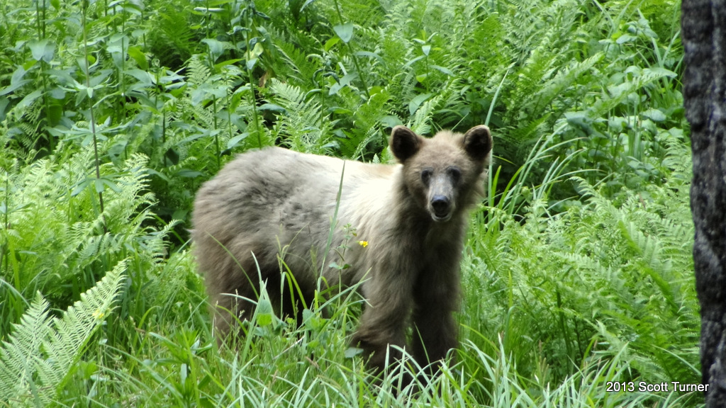
Critters: 1 black bear, three deer
Note: There is a $20 fee to visit Sequoia National Park
One of the things that makes Sequoia so delightful as opposed to a more famous and visited place like Yosemite is that, even during the peak season when the campgrounds still fill up on a Tuesday, you can spend an entire hike without seeing any people. At Sequoia, it turns out that most people congregate in just a few places: the Sherman Tree, the Congress Loop, Crescent Meadow, the Museum, Tokopah Fall, and Moro Rock. Walk a half mile in any direction away from those attractions, and you are likely to be on your own. With Yosemite, you need to walk a hell of a lot farther to get solitude, and even then you’re not likely to find it.
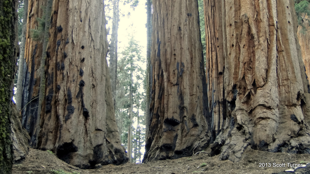
But enough with comparisons. Here again is another part – the south part – of Giant Forest that I have not experienced. This loop starts at the museum on the Moro Rock Trail, which passes along the south edge of Giant Forest and offers views toward the hazy Central Valley. While doing so, it passes through narrow meadows and dense patches of forests with more ferns and lupines on the ground. Eventually, this trail terminates a Moro Rock, which is a hub of activity that I ultimately decided to avoid when I heard an adolescent shouting about how his mentally disabled sister had just peed on him. Instead, I visited Hanging Rock, which doesn’t offer the same expansive view, but still provides a pretty spectacular one without the crowds or the sketchy stairs.
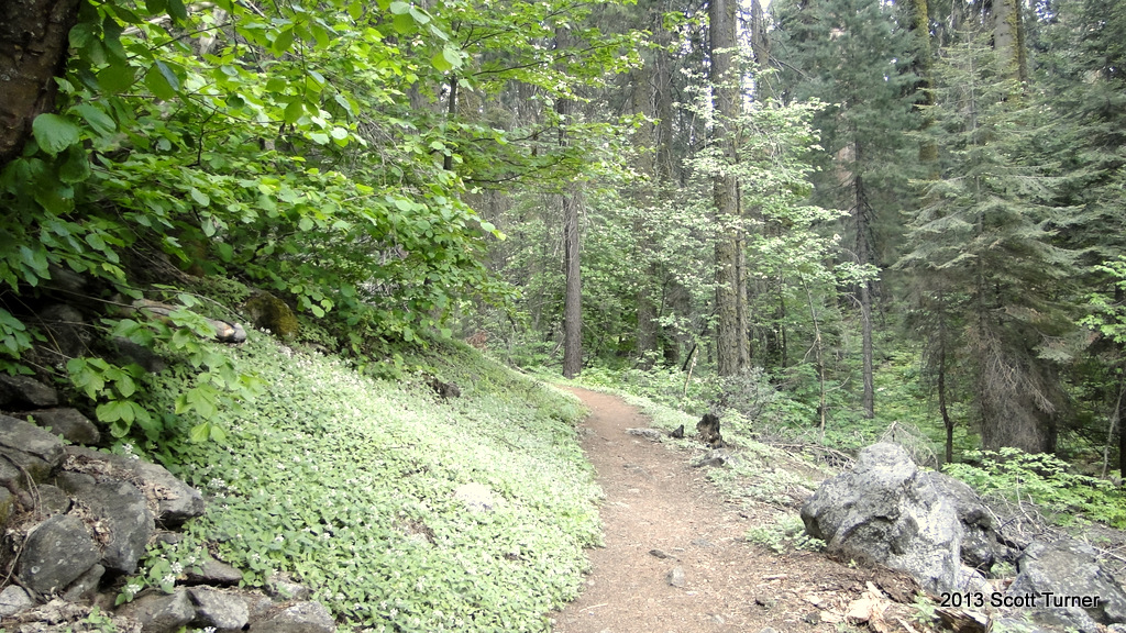
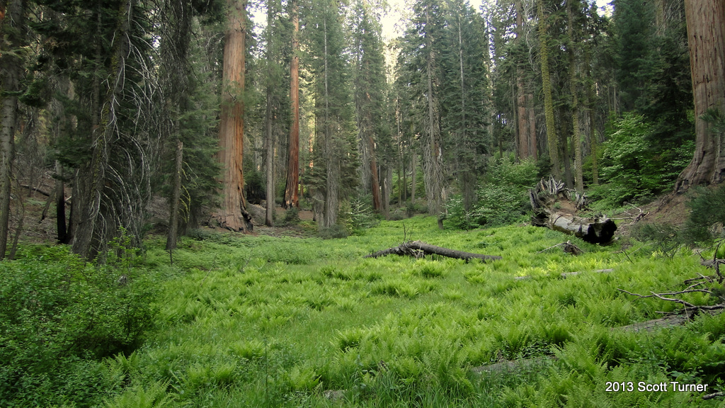
There are a couple of options from the Moro Rock parking lot. One can take the Sugar Pine Trail back toward Crescent Meadow for a long loop around the border of Giant Forest. Another option, which I took, is the Soldiers Trail, which crosses back toward the museum and runs in parallel with the Moro Rock Trail. The Soldiers Trail does not pass through any noteworthy trees or features. Instead it passes through quiet stretches of Giant Forest, which I’ve already established is pretty alright by me.
Eventually, the Soldiers Trail dead-ends at the Alta Trail in a somewhat confusing junction that required several map consultations. If there’s a drawback to hiking in Giant Forest – or any forest – it’s that route-finding by landmark is very difficulty, and it becomes pretty easy to lose bearings. A map is a crucial thing in Giant Forest since there are so many different trails going in so many different directions. Ultimately, any hiker will find his or her way back to one of the hubs, where buses area available back to the original trailhead. However, that’s more stressful and frustrating, so any hike in Giant Forest should be guided by a map and at least a general route in mind.
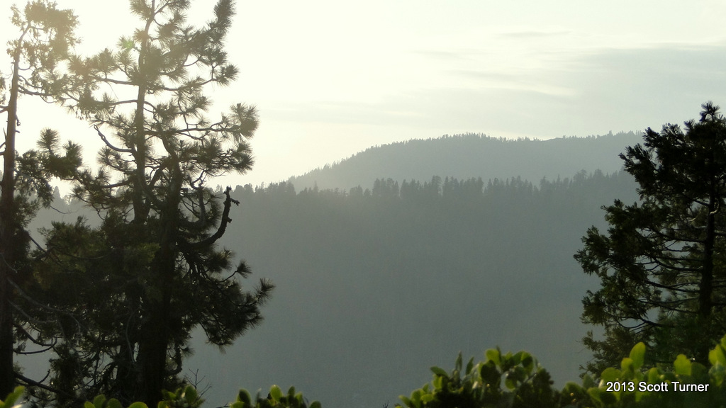
After finding the right direction at the Alta Junction, I headed back toward the museum for the last leg of this hike. I intended to pass by Round Meadow and the Big Trees Trail in order to make my way to Sunset Rock, which is another destination here that I’ve never seen before. The trail to Sunset Rock winds alone a ridge on the western side of Giant Forest, where it offers view over Marble Fork Canyon, through which the Marble Fork of the Kaweah River runs. The view here isn’t as nice as that at Hanging Rock, but it still quite a view, and Sunset Rock itself is unexpected and intriguing as it is remarkable smooth and massive for a granite outcrop. I enjoyed a light snack here while taking in the views west and east.
 |
| Sunset Rock |
 |
| East |
 |
| West |
Finally, it was time to head back before the sun sunk too low. There are other places in Sequoia where I don’t mind walking back in the dark, but those are places where I am pretty familiar with the trail and topography. The Sunset Rock Trail is pretty simple, but since this was my first time, I missed the sunset here. I watched the sun setting through the trees, however, which is its own kind of magical since the light transforms the forest into something hushed and pensive. You can almost feel nocturnal creatures emerging from their hiding spots, stretching, and surveying the bright orange sun sinking into darkness.

After another little side trip on the Beetle Rock Nature trail, I found myself back at the parking lot with another memorable Giant Forest hike under my belt. I don’t think there is a bad hike to take here, and while I already cautioned against going mapless, it would be quite a day to simply wander aimlessly under the forest canopy without any goal in mind just to see where one would end up. Or, it would be something to take a comprehensive 15 mile loop through the area. Then again, it’s quite fantastic to take the 1.5 mile loop around Crescent Meadow around dusk. Either way you go, it’s pretty hard to lose in this place.

