
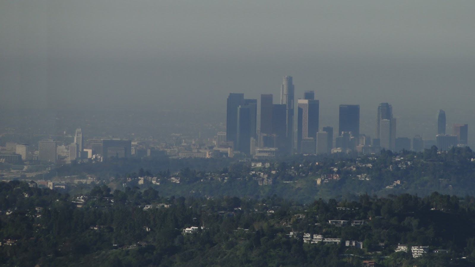
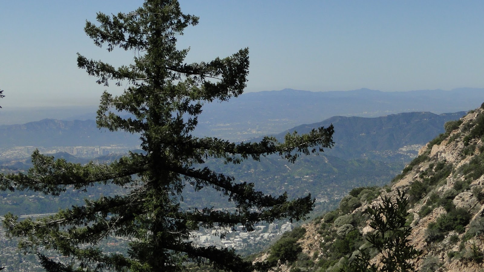
The front range of the San Gabriel Mountains has played host to a myriad of colorful characters looking to create recreational opportunities, as well as a little money. The trip through Echo Mountain, Inspiration Point, and up to Mt. Lowe and past Camp Lowe, offer a glimpse into old Los Angeles history, as well as many glimpses into the dramatic geography of the Los Angeles Basin.
Distance: 14.8
Elevation Gained: 4,100′
Difficulty: Strenuous
Time: 9:40
Critters: lizards, hawks, and a few mountain bikers.
The story of Thaddeus Lowe plays like a cautionary tail with vague similarities to Citizen Kane. Lowe was a meteorologist, chemist, and aeronautic engineer who also invented aerial reconnaissance. His tactics were used by the Union in the Civil War, and Lincoln named Lowe the chief aeronaut of the balloon corps at that time. When the Civil War began, he invented a process through which large amounts of hydrogen could be created and stored from steam and charcoal. He also held patents on ice making machines, and the two endeavors made him rich.
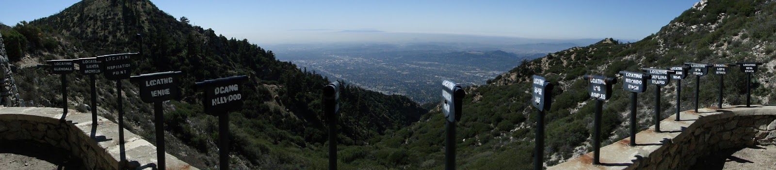
After the Civil War, Lowe moved to Los Angeles, where he built a massive home. He soon met David McPherson, a civil engineer who had drawn up plans for a scenic railway ascending into the San Gabriel Mountains. Originally, this railway was intended to go up to Mt. Wilson, but the two men could not procure the rights. Instead, they redirected the railway to run from Pasadena, up to the Echo Mountain Promontory, then along a ridge line until it reached what would soon become Ye Alpine Tavern.
Starting in 1893, a steep 2,800′ furnicular transported folks from Alta Dena to Echo Mountain, where Lowe had also funded Echo Mountain House, an 80-room hotel, and an observatory. As the construction of the railway progressed, Ye Alpine Tavern eventually opened, and to this point, Lowe had constructed about 7 miles of track at great expense.
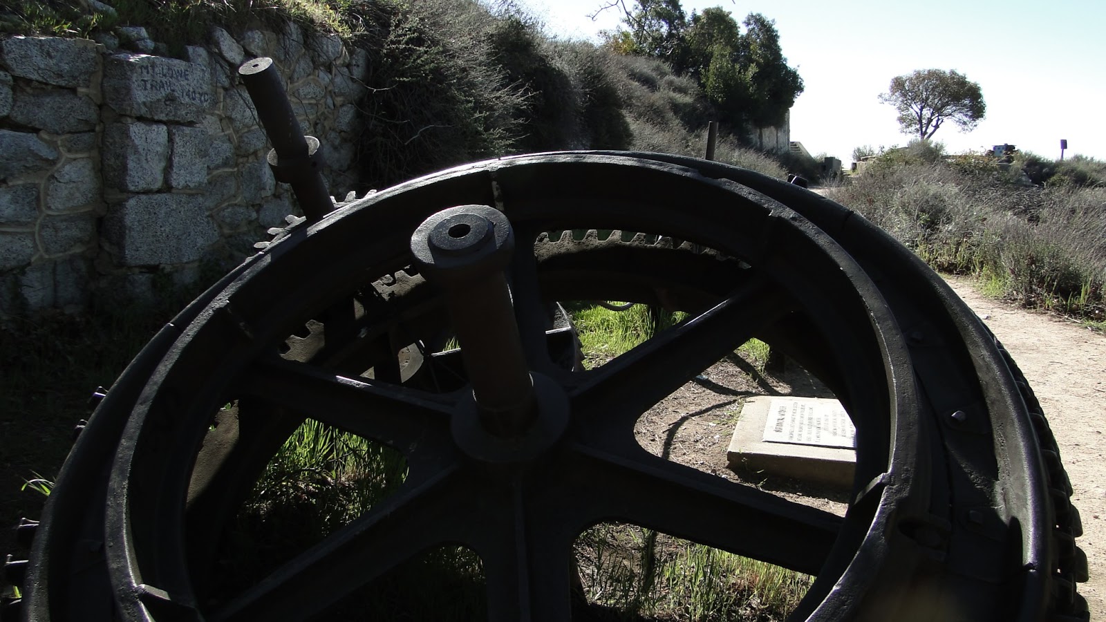
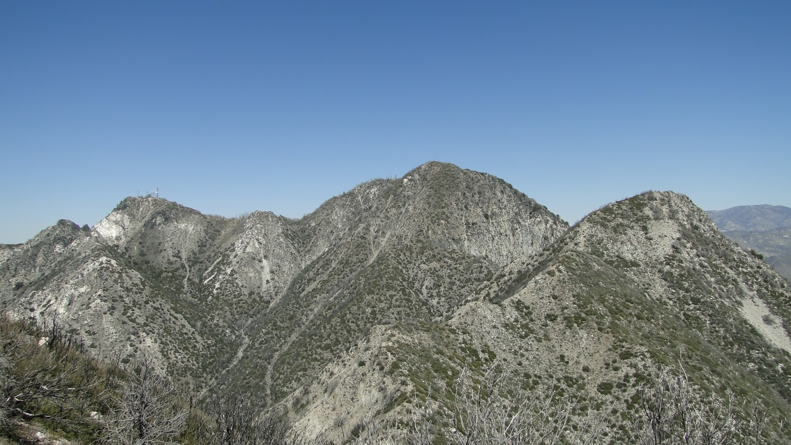
Sadly, the San Gabriel Mountains are a forbidding place for development. In certain areas, such as Santa Anita Canyon and Mt. Wilson, historic structures remain standing and have remained protected throughout the years. However, the combination of wild fires, earthquakes, and deluges ensured that nothing built into these mountains would last long. Fires swept through, destroying one building after another. Floods swept away railroad track. Lowe went broke trying to continue building his dream of Angeleno mountain leisure.
Tragic though the hubris may seem, Lowe’s legacy is an extensive network of trails and historical color that can be explored from hundreds of different angles. My friend Kyle explained that there are countless ways to get around this area. Some trails are old fire roads. One trail follows the old railway path. Another old indian path winds nearly straight up the side of a steep canyon. It’s possible to piece together nearly infinite trips throughout the front range of the San Gabriels, including short day hikes, long day hikes, and backpacking trips.

Historical remnants lie scattered about, making possibilities for a historical Los Angeles tour. Numerous peaks lie in close proximity, making a peak-bagging adventure possible. Note that if you want to peakbag, the easiest way to do so is to drive up to the Mt. Wilson area and set out from one of the trailheads here. Kyle and I did this the hard way, which included walking up from Altadena, all the way up to Mt. Lowe. This trek represents about 3,700′, and it is no picnic.

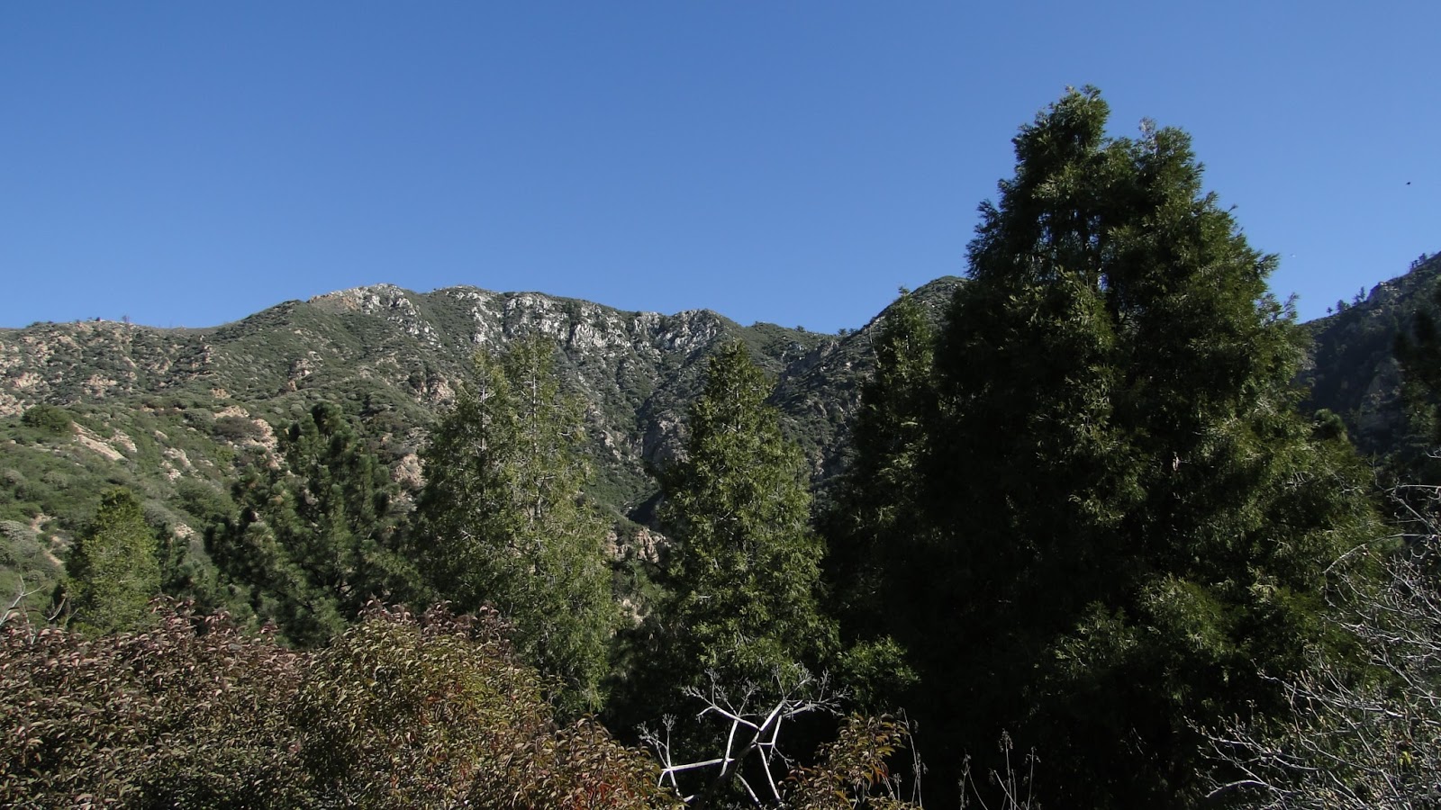
Note also that this area was heavily affected by the Station Fire. While the vegetation, specifically the chaparral, is showing signs of a robust comeback, there are still numerous hazards to mind. First and foremost is the presence of Poodle Dog Bush, also known as Turricula. This pungent-smelling plant can cause major blistering, itching, and irritation if touched. Additionally, rock slides and downed trees present obstacles, and the lack of plant cover in areas can make hiking here brutally hot during late spring and summer.

Come during winter, however, and you may be treated to all kinds of weather, which, according to Kyle, can range from fog, sunshine, rain, snow, wind, and spectacularly clear days. While the hiking here isn’t always easy due to the famously steep slopes of the San Gabriels, there are numerous rewards awaiting anybody with an adventurous spirit.

