
Spitler and Apache Peaks are two prominent bumps standing at 7,500′ on the Desert Divide, which includes the southern portion of the San Jacinto Mountain range. This portion of the range gets its name from the fact that it separates two distinct desert environments contained in the Coachella Valley and the Anza Valley.
Distance: 13.1 miles
Elevation Gained: 3,100′
Difficulty: Strenuous
Time: 5:50
Critters: birds and squirrels
Guatay Mountain
http://www.everytrail.com/swf/widget.swf
EveryTrail – Find the best Hiking in Californiahttp://www.everytrail.com/trip/widgetimpression?trip_id=2005714
Get there like this.
Note: You’ll need an Adventure Pass

I loved everything about this hike. I loved the mature elfin forest of mid-elevation chaparral that clothed the lower elevations of this hike. I loved the fragrant ribbonwood, giant manzanitas, and yuccas, which were punctuated here and there by Coulter pines. I love the shady, north slopes that were blanketed in snow and shaded by oak trees. I love the mixed conifer forest that emerged close to the junction with the PCT. I loved the expansive view of the Coachella Valley on one side and Garner, Anza, and San Jacinto Valleys on the other. Most of all, I loved the windy solitude of the peaks and the unobstructed views they offered.
 |
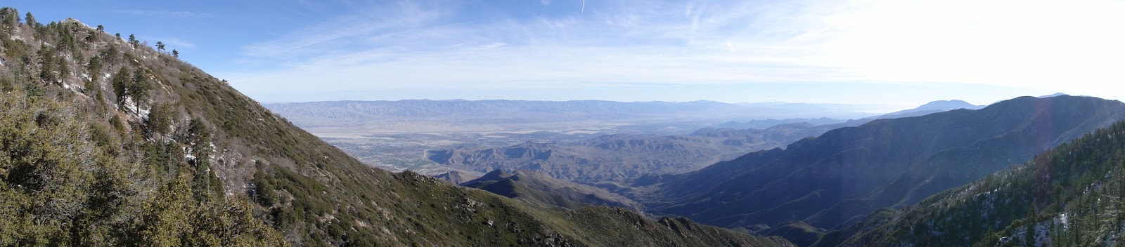
| Looking south from Spitler Peak |
Even the drive in is a great drive. I came in from San Diego, which meant I had to drive to the trailhead through beautiful Garner Valley. I didn’t know that this broad, grassy valley studded with pine trees even existed, and I know now what a lovely place it is. If the valley has a flaw, it’s that most of the land is privately owned, which means there are few opportunities to go walking around.
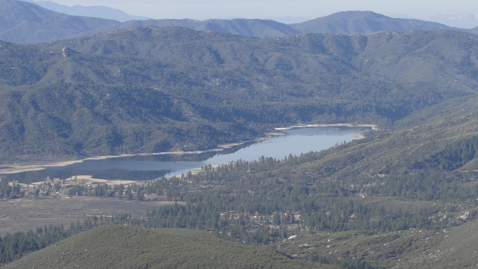 |
| Lake Hemet |
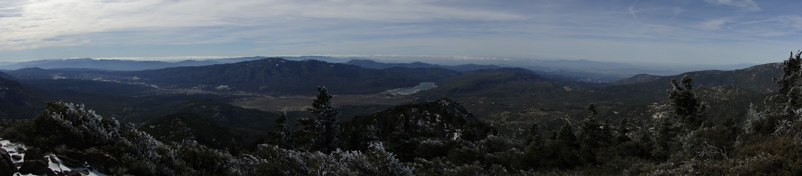
The trail takes you 5 miles from Apple Canyon Road near the Tahquitz Zen Center all the way up to the main ridge of the San Jacintos. The PCT runs along this ridge and allows access to a number of peaks over 7,000′ in elevation, including Spitler, Apache, Antsell Rock, Tahquitz, and Red Tahquitz, all before reaching the town of Idyllwild. Endless desert views and coastal views are available east and west, respectively, and the scenery never once gets boring to look at.
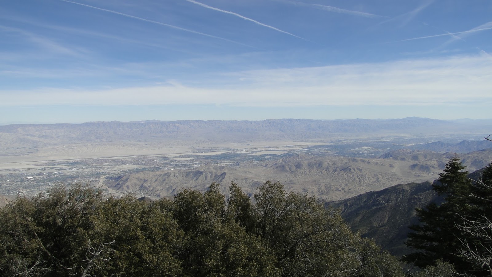 |
| Coachella Valley from the PCT |
Initially, the trail runs through mature chaparral. Chaparral undergoes a transition around the 5,000′ mark, during which the less interesting chamise and ceanothus are replaced by manzanita and ribbonwood. Ribbonwood is particularly attractive as it emits a lovely fragrance and attracts the eye with its feathery foliage and perpetually peeling red bark, which peels away in long strips that look like ribbons. Chaparral is rarely an exciting experience, but what is here is lovely.
 |
| Ribbonwood |
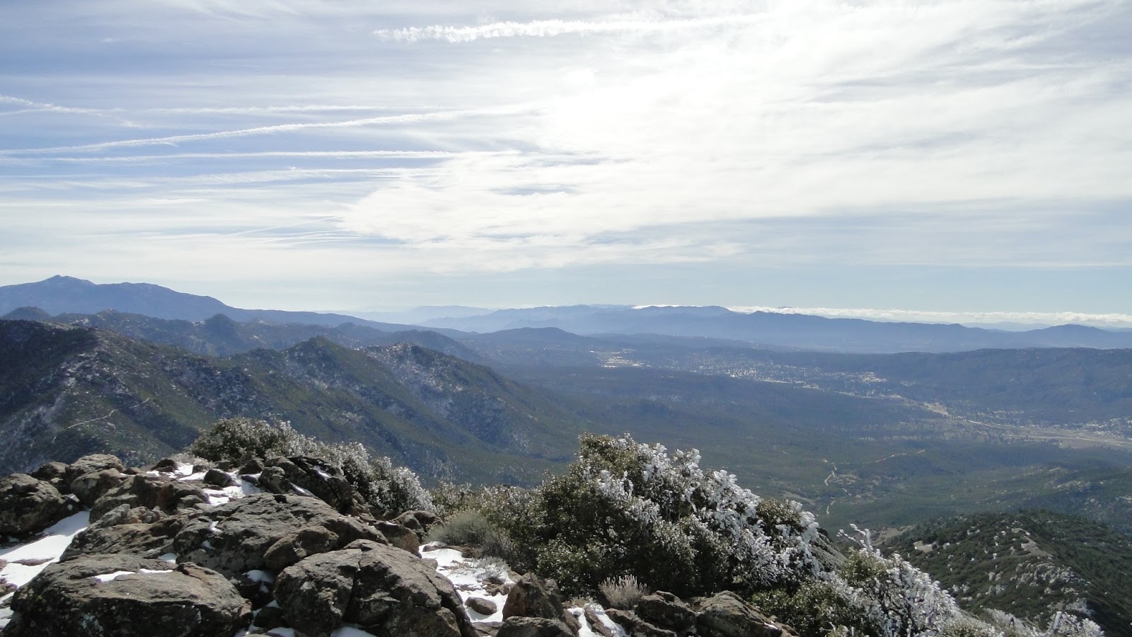
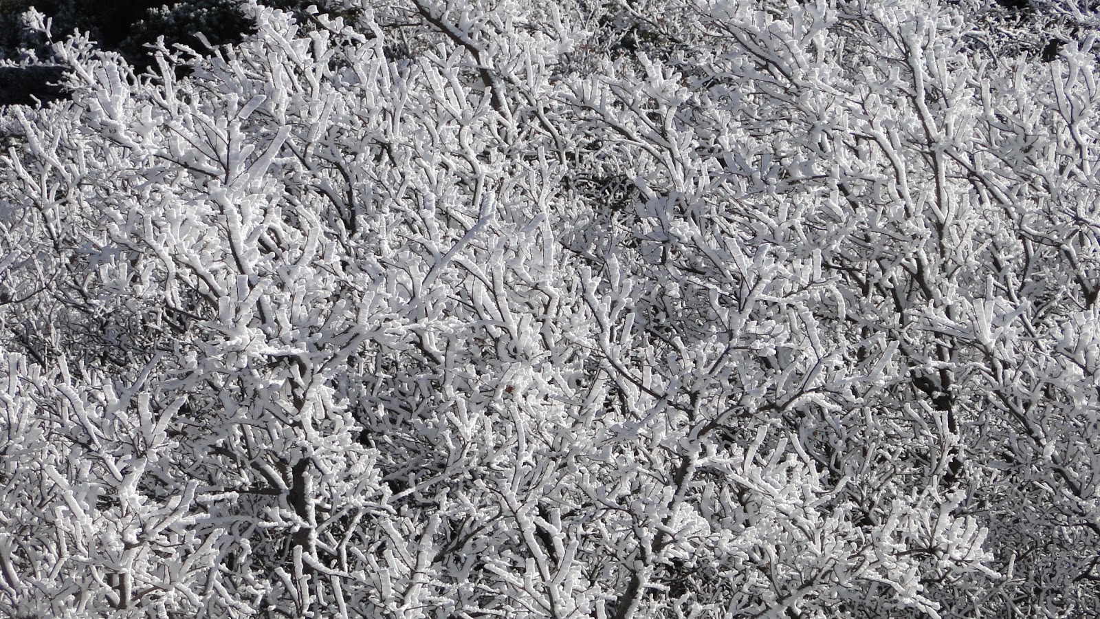
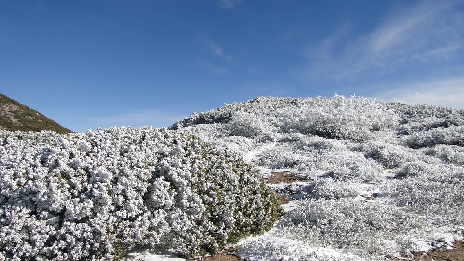
Soon, the trail winds around to a north-facing slope, which supports oak and pine woodland, along with cedars and firs along a few small, seasonal streams. A few inches of snow lay on the ground here, and many of the trees remained iced-over with hoar frost from the freezing temperatures and precipitation of the past few nights. This icy wonderland didn’t last long, since the day warmed up nicely, but during the early morning hours there was plenty of snow and frost to enjoy.
I reached the PCT and immediately encountered an expansive desert view. At this point, I chose to tackle Apache Peak, which is less severe in terms of incline than Spitler Peak, but more accessible due to thick chaparral growth. The views from both peaks are nearly identical, with Apache perhaps offering the better view of the major peaks of the San Jacintos. One drawback of the lack of tree cover though is that Apache Peak received strong wind gusts, and I couldn’t enjoy the view for long.
 |
| Mt. San Jacinto and lesser peaks from Apache Peak |
After I could no longer endure the cold, I set off for the mile-long stretch of PCT between Spitler and Apache. The trail to Spitler is easier to follow and perhaps more pleasant since it goes through the best mixed-conifer forest you’ll find on this section of the trail. However, it’s really steep, and so there’s a lot of work climbing up the 500 or so feet in the span of half a mile. The view is also more restricted, yet the presence of the coniferous trees reduces the wind and makes it more enjoyable to rest there.
 |
| Garner Valley and Lake Hemet in the foreground. The Palomar and Santa Ana Mountains are in the background of the left and right, respectively.
After enjoying the views, I hustled back down the main trail in order to make it back home in time for school. It was unfortunate that I had to rush so much because the pounding made my feet ache, and I would have enjoyed taking a more leisurely stroll through the chaparral. However, this is a really long hike, so there wasn’t much I could do aside from hustle. Time is limited, and having enough time to do a hike like this is a luxury I will take advantage of, even if it isn’t perfect.
 I thoroughly enjoyed this hike, and I have every intention of coming back and doing more on the PCT over the Desert Divide. Along with the PCT in the San Gabriel Mountains, this may be the best stretch of that trail in Southern California. While there are a number of places that feature great views in Southern California (Mt. Baldy, Santiago Peak, San Gorgonio, and San Jacinto), not all of them have the great range of scenery present on this section of trail. From the ocean to the Salton Sea, this view encompasses A LOT.
 |
