
Cuyamaca Rancho State Park comprises one of the largest public parks in Southern California. It features mountains topping out at 6,500′, rolling meadows, shady canyons, rare cypresses, and a plethora of wildlife. There is a vast network of trails that can create easy hikes, masochistic hikes, and everything inbetween.
Distance: 12 Miles
Elevation Gained: 1,600′
Difficulty: Moderately Strenuous
Time: 4:40
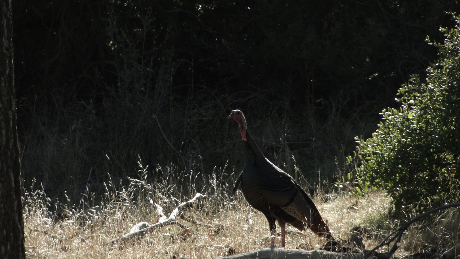
Critters: 4 deer, three flocks of turkeys, 2 flocks of quail, rabbits, hawks, songbirds.
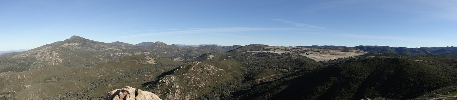
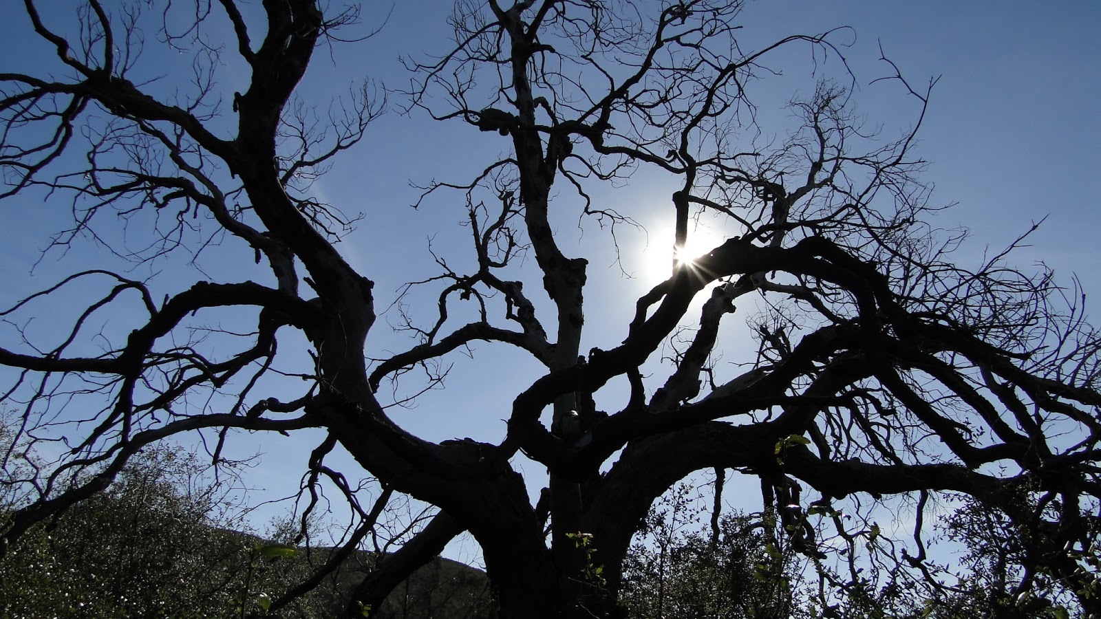
Cuyamaca is both one of the greatest natural recreational areas and the site of one of the greatest ecological tragedies in San Diego County. This 26,000 acre park offers numerous peaks over 5,000′, a lake, rolling meadows, and endless views. However, the 2003 Cedar Fire incinerated most of the parks forest. Although Cuyamaca is recovering, skeletal ghost forests now intermix with new growths of manzanita, ceanothus, and live oaks.
Of course, this tragedy doesn’t discourage a visit. It only makes a visit here bittersweet, particularly if you’re somebody who enjoys forests as much as I do. While the forest continues to make its modest comeback, much of the park remains a beautiful respite from the city, particularly during the spring or after snow has fallen.
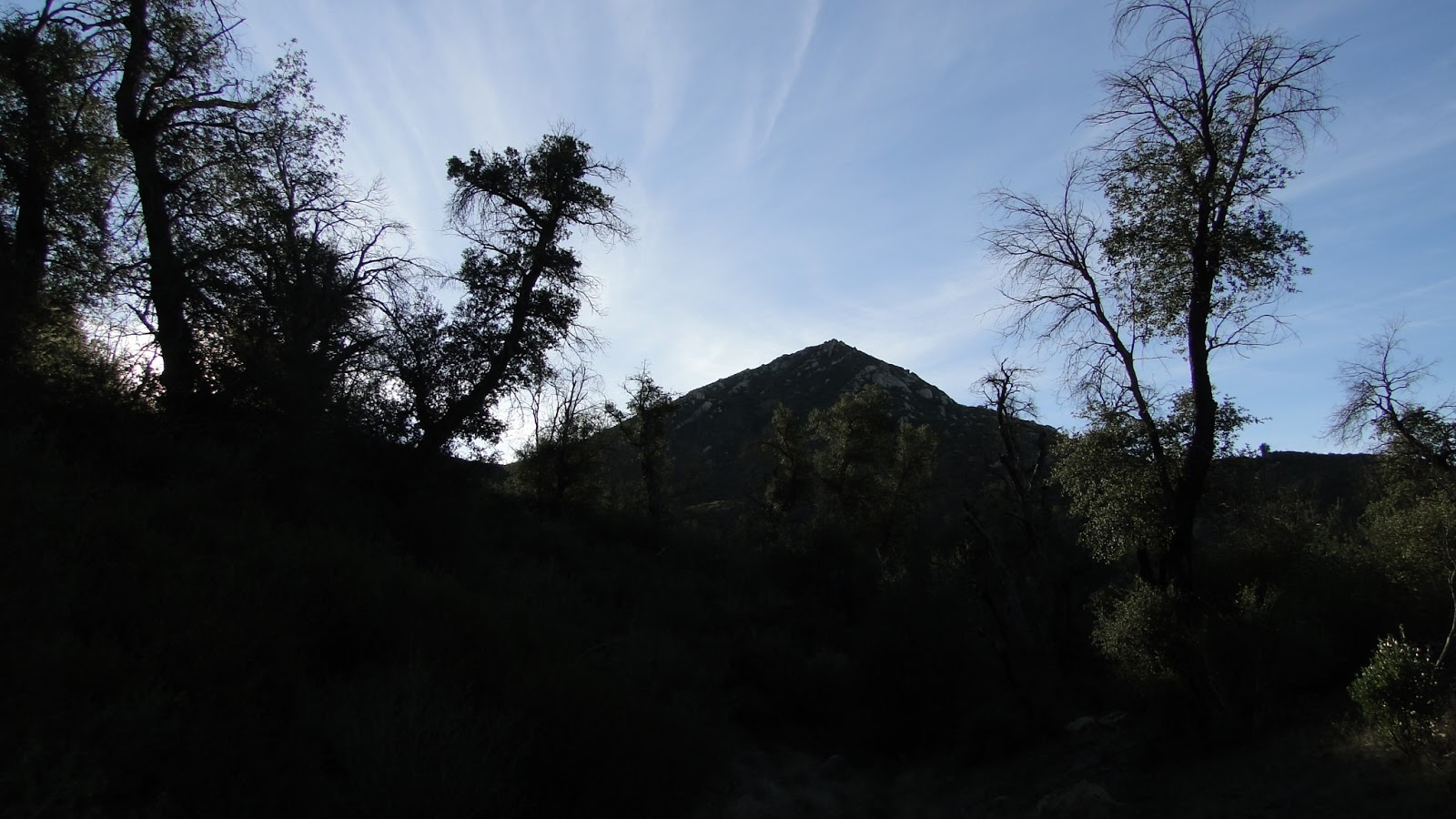
I chose a route that would take me up to the top of Oakzanita Peak, which is a modest 5,045′ peak that affords a great view of central San Diego and the adjacent mountains. Oakzanita gets its name from the combination of Oak and Manzanita, which at one time covered the slopes of the peak. There is still abundant manzanita, which recovers quickly after fires, but the oaks will take longer to recover, if they recover at all.

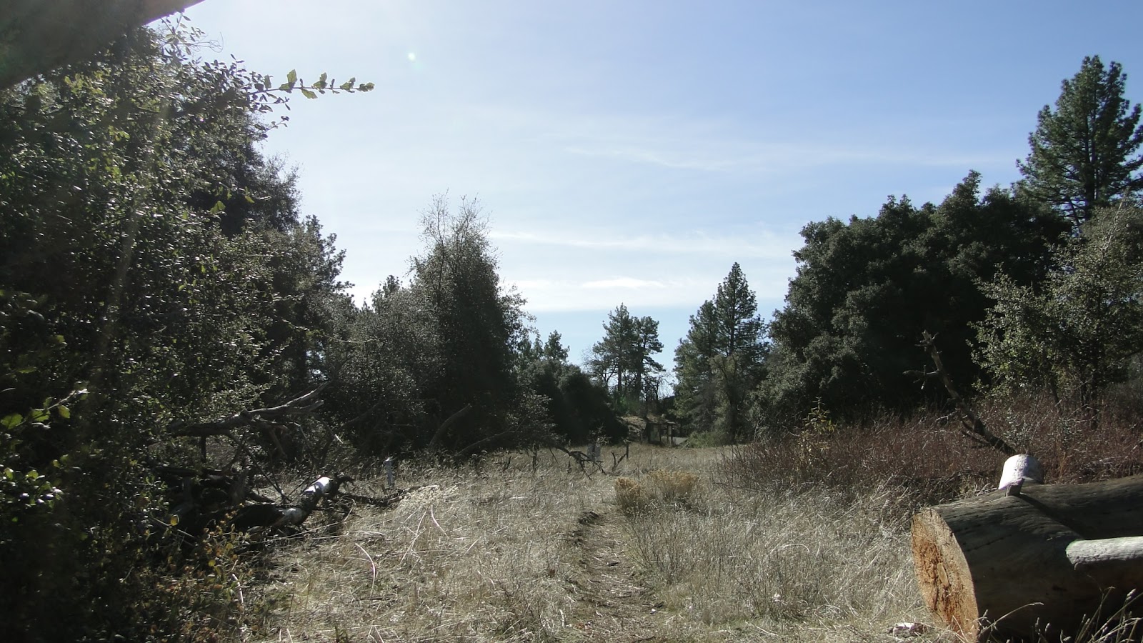
After enjoying my peanut butter and banana sandwish at the summit, I headed down the slope and hit the connector trail that would ultimately lead me to Granite Springs Primitive Camp, which lies on the far eastern edge of East Mesa. East Mesa isn’t a mesa in the traditional sense of a plateau bounded on all sides by cliffs. East Mesa is more of a large, flat, rolling meadow that sits about 600-1,000′ up from the Green River Valley, through which Highway 79 runs.

Granite Springs offers backcountry camping just outside the state wilderness area that covers East Mesa. Here, you’ll find a shady oak and Jeffrey pine woodland reminiscent of the nearby Laguna Mountains. This area is about as serene a place as one can find in San Diego County, as it sits far removed from any roads and sheltered by Cuyamaca Peak from obtrusive light and air pollution streaming in from the city. I hope to camp back here some day.
This was my turnaround spot, and I stayed just long enough to eat some fruit and watch some turkeys trying to hide from me under a dead tree. That’s right. There are several flocks of wild turkeys roaming the Cuyamaca, Volcan, and Palomar Mountains. I guess somebody introduced them years ago for sport hunting, and they’ve multiplied prolifically. Lord knows why somebody would introduce turkeys for hunting. They’re slow and stupid, and can’t possibly make for great sport. About all their good for is providing a buffet for mountain lions.

From here I headed west again to complete a meandering loop through East Mesa. I would cross over the rolling grass lands, rimmed with conifers, until I hit the Dyar Springs trail, which will take you through recovering live oak woodland to a modest stream that feeds the fantastically named Juaquapin Creek. As I walked around, I had the word stuck in my head like an obnoxious melody. I don’t know how to say it properly, and I tried out just about every variation. The best variation to my ears is “Hwa-kwuah-pin.” Say it to yourself. So weird, yet so satisfying.
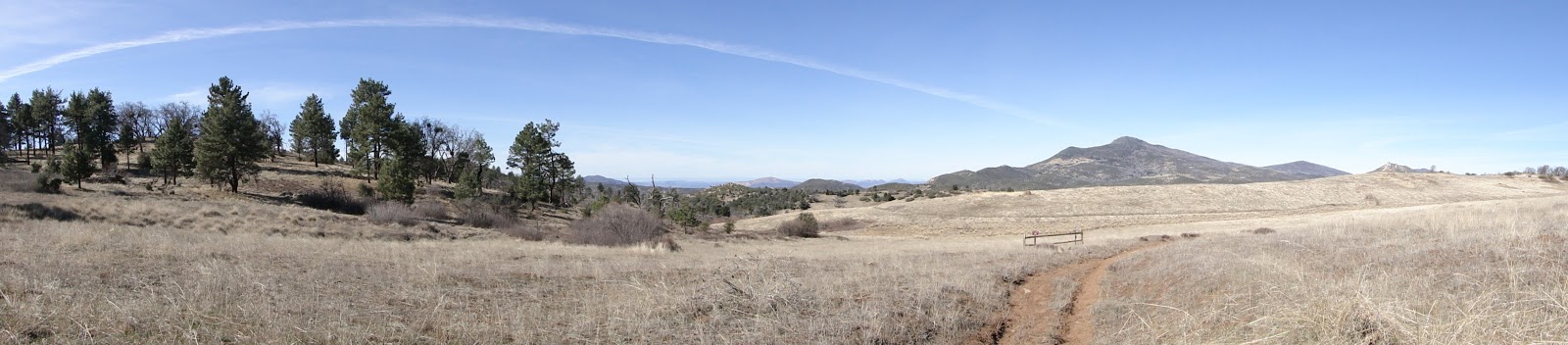
I followed Dyar Springs to Juaquapin Creek and took the trail back the rest of the way. All-in-all, I had covered 12 miles of territory that included a fair amount of ecotones, including chaparral, pine woodland, oak woodland, meadow, and grassland. I can’t imagine how gorgeous this place must be during the spring following a solid rainy season. With so much post-fire recovery going on and so much open space, there must be millions of wildflowers here. I’ll probably come back in the spring to hike Cuyamaca Resevoir/Stonewall Peak, and maybe even take another shot at Cuyamaca Peak for good measure.

