
Lookout Fire Road – Burnt Pines Trail – West Mesa Trail – Monument Trail – West Side Trail – Harvey Moore Trail – Granite Springs Trail – East Side Trail – Upper Green Valley Fire Road – Cold Spring Trail – Cold Stream Trail
Distance: 20.7
Elevation Gained: 3,600′
Difficulty: Masochistic
Time: 9:15
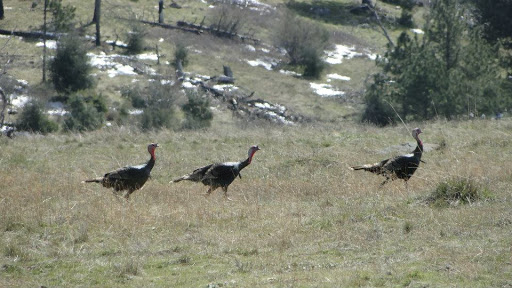
Critters: 17 deer, 7 wild turkeys, one coyote, countless squirrels, rabbits, and hawks
Pros:
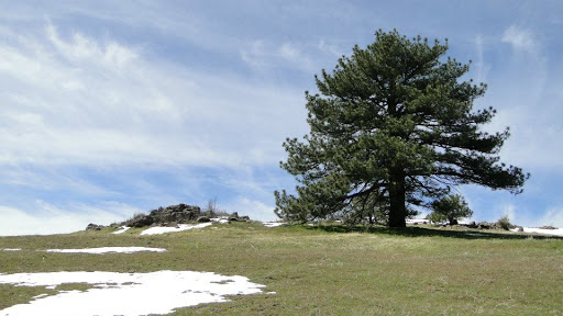
– Brilliant views from Cuyamaca Peak
– Gorgeous rolling, green meadows and pine/oak woodland on East Mesa
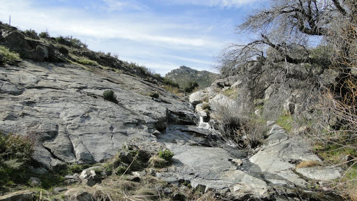
– Water everywhere
Cons:
– I Hate You Canyon
– Lots of snow on the trails makes for slow going
– Cold Stream Trail
– Thoroughly incinerated forests and vegetation
Details:
Cuyamaca Rancho State Park, located in east-central San Diego County, has a long and varied history. This mountainous region is crossed by rivers and streams and once featured wide-open, rolling meadows surrounded by dense montaine forests. People have been coming here for thousands of years, starting with indians migrating to higher elevation in the summer, Mexican rancheros, European mining prospectors, and finally with hikers, mountain-bikers, and people seeking a bit of mountain-respite.
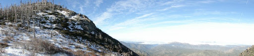
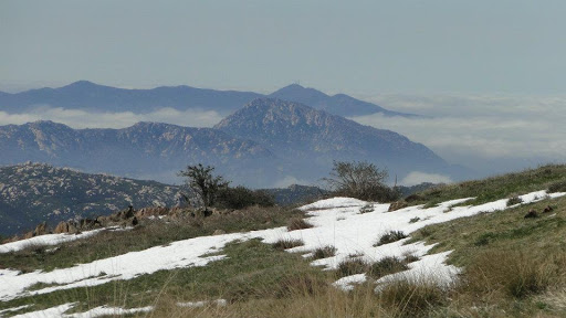
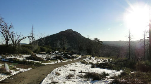
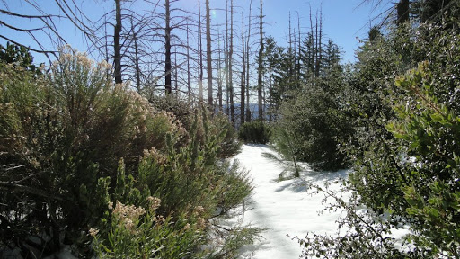
In 2003, the park was thoroughly incinerated by the Cedar Fire. Most of the structures were saved, but only a few pockets of the old forest remain. The slopes of Cuyamaca Peak, which is the second highest point in San Diego County after the inaccessible Hot Springs Mountain near Warner Springs, are now covered in blackened “ghost forest.” The ground vegetation has mostly recovered, and fire-adapted oak trees are staging a comeback. However, the mixed-conifer forest of the higher elevations are likely gone forever.
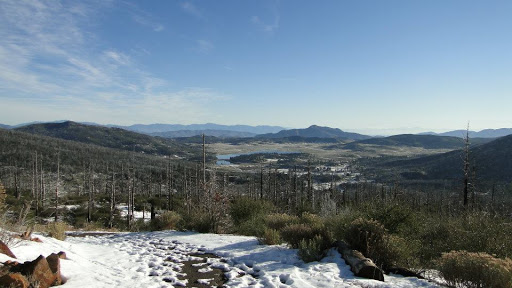
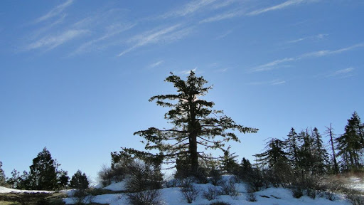
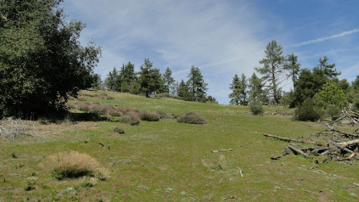
The devastation from the fire could be considered a con for those who are hoping to find lush forests without omnipresent signs of apocalypse. For that, you should go to Palomar or head north to the San Gabriel or San Bernadino Mountains. The loss of the forests here is irreplacable, and yet Cuyamaca remains a beautiful place. The meadows on the slopes of both Cuyamaca and on the East Mesa remain beautiful, open, and green, featuring many great views of surrounding mountains and San Diego County. East Mesa features a lovely coniferous woodland with Jeffrey Pine, canyon, and black oaks. The valley of the Sweetwater River and Upper Green Valley remain beautiful examples of mountain valleys. If you can get past the destruction, this remains a beautiful place to visit.
On this day, I had intended to walk a “marathon” of over 26 miles from Cuyamaca Peak, across East Mesa, then through the valley that separates Cuyamaca State Park from the Laguna Mountains. I set out at 7:00, and immediately encountered snow up to a foot and a half deep while summiting Cuyamaca. The snow slowed me down so much that I had to abort the marathon hike.
I instead “settled” for a 20-mile loop that led me up Cuyamaca Peak on the most accessible trail (the Lookout Fire Road), through and down the rolling meadows of West Mesa, past the curious airplane monument (an airplane engine perched on a concrete slab), up the sun-blasted slopes of East Mesa, through the beautiful green meadows of East Mesa, past the Granite Springs trail camp, down through I Hate You Canyon (Harper Canyon, but my name is more appropriate), through Upper Green Valley, up and over the ridge on the Cold Spring Trail, and along highway 79 on the Cold Stream Trail. “Shorter” though it was, this trek still felt every bit like a marathon.
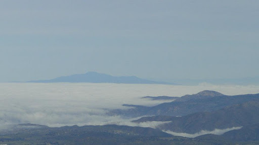
The peak, West Mesa, and East Mesa easily highlight this trip. Any one of those areas would easily qualify for a great full-day hike. The peak has fantastic views, including the usual mountains (Gorgonio, Jacinto, Baldy, Santiago, Palomar, etc), but as well of San Diego, which on this day was obscurred by a sea of clouds. West Mesa also has great views, but the sea of green, gentle streams, and recovering oaks are what make it truly lovely. East Mesa impressed the most, particularly since it felt the most like an escape from the typical chaparral and oak scene so omnipresent in SoCal.
However, there were a lot of stretches of this hike that were brutal, annoying, or simply unenjoyable. I Hate You Canyon, with its tedious and un-scenic descent, a dense overgrowth of ceanothus who branches constantly slapped me in the face, and a forest of dead, blacked oak trees, should be avoided at all costs. Additionally, Cold Stream is a trail I wouldn’t recommend to anybody. The trail runs right next to the highway, making car noise is omnipresent. Additionally, the stream itself is choked off, and you spend a fair amount of time with the face slapping ceanothus, as well as picking ticks off your clothing and person. Not funneeeeeee!
Still, I enjoyed most of this hike, and would go back to Cuyamaca again. It offers more opportunity for hiking than Palomar, which is frustratingly hemmed in by private landholdings. Of these three ranges, though, Laguna, with its cool pine forests, meadows, lakes, and desert views, remains my favorite of the mountain ranges in San Diego County.
Final note: I’m lagging in March. I missed a few opportunities to hike because of weather, the ridiculous amount of driving I’ve had to do, and a combination of working and schooling. I’m glad I’ve been able to knock off 76 miles this month, but I still hope to get up to 110. I also hope I can push 140 next month and make it halfway before May, when I start taking on the big boys in the San Gabriels and San Bernadinos. Fingers crossed!
March: 78.1 Miles
Year-to-Date: 324.8 Miles
