

I recently gave a pair of presentations at the two San Diego-area REI’s about my work on the 5th edition of Afoot and Afield San Diego County. Most of the presentations I’ve done on the subject began with how I ended up with the project and ended with info on some cool hiking spots. With these last two presentations, I included a fairly impassioned statement regarding the utility and relevance of print hiking guides. This is the essay that I wrote before the presentations to help me organize my thoughts.
A Tale of a Knucklehead
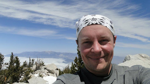
Early May, 2012. I was a novice hiker who had just begun to discover the sport. I had never summitted a mountain higher than 3,000 feet, and through a bit of Googling, I learned about Mt. San Jacinto. Inspired by what I read, I determined that the next step for me was to start conquering the “big boys.”
Like most novice hikers, I was getting my information in a scattershot manner, and in that manner I discovered something called the “Six-Pack of Peaks” through EveryTrail, which has since become AllTrails. I loaded the GPS track onto my smartphone, drove out to the trailhead, and started hiking.
The hike got off to an uneventful start, but by the time I neared the PCT junction, I was walking through 2-3 feet of snow. By the time I reached Little Round Valley, the snow was so deep that the trail sign for the summit trail was nearly impossible to locate. I quickly became lost. I referred back to my GPS track and discovered that my phone was down to 32% battery life.
In an effort to preserve the battery, I shut off the app and began to work my way uphill on what I thought was the trail. After nearly 2 hours hopping over boulders on a steep, snow-covered slope, I topped out, only to find that I had summitted nearby Jean Peak instead of Mt. San Jacinto. I was able to work my way over to my true objective, post-holing all the while.
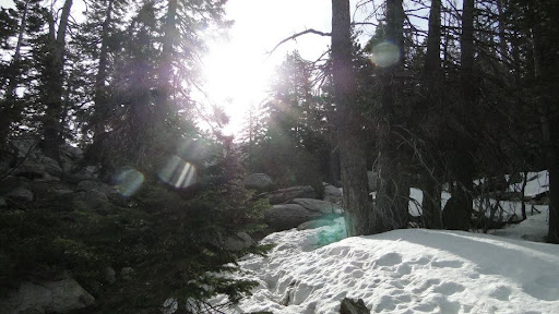
The real trouble began when I returned to Little Round Valley. I found the trail, but quickly lost it again. I looked at my phone. Somehow, my phone had dwindled down to 8% battery life, despite my best efforts to preserve it. I shut off the phone to keep enough battery to use for an emergency call should the occasion merit one.
I kept going, doing my best to think the situation through. I ended up in a ravine. I deduced that if I went down the ravine, I’d probably run into the PCT eventually, which I only knew of because I had glanced a map the night before. I broke my trekking pole and cut my hand. I stumbled and fell several times. Finally, I ended up on the PCT and was able to backtrack to the trailhead, fortunately without further incident.
However, had I not reviewed the map, it is very possible that I might have enjoyed an unplanned night in the snow. I could have become hypothermic since I didn’t bring enough clothing. I didn’t have enough food for a night, and I didn’t have any means of emergency contact once my phone died in an area with almost no reception. I was lucky I looked at that map.
The Online Information Revolution
 The approach I took isn’t too different from the way many hikers approach hiking. AllTrails has quickly become one of the go-to’s for hikers looking to find new routes. Many other hikers use platforms like Instagram and Facebook to learn more about area hiking trails. The availability of free information has revolutionized how people are able to learn about trails, and this convenience has led to an ever-growing number of hikers to rely exclusively on digital, crowd-sourced resources.
Concurrent to this information revolution, Cleveland National Forest has pulled about 100 people out of the combined Three Sisters Falls and Cedar Creek Falls trails on a yearly basis. The story is familiar: a hiker starts at 11:00 am on a July morning with 0.5 liter of water, footwear with poor traction, and a lack of sun protection. Before long, the San Diego River Gorge’s prodigious summertime heat produces symptoms of heat stroke, and the hiker becomes disoriented and lethargic, either becoming lost or finding it impossible to continue. Somebody calls in the emergency request, and another hiker finishes their day on a helicopter. Several people have died in these incidents.
This situation has become of primary concern to me, as I understand that the vast majority of hiking-related incidents are avoidable provided that people are prepared for trail conditions. The primary question is: how do we get knowledge to people so that they can be prepared? This is followed by: how do we get people to act on the knowledge once they have it?
The latter question may have no answer. I have learned both through observation of the hiking community and through my practice as a therapist that some people will not change their behavior no matter how much information and insight you provide. However, for the former question, the solution seems clear: provide people with reliable information that has been thoroughly vetted and encourage them to develop their skills in conjunction with that information.
Print Hiking Guides: Textbooks on Self-Reliance
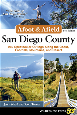
Guides like Afoot and Afield contain more than just descriptions of area trails. They contain detailed information on safety, trail etiquette, and wilderness ethics. They contain contact information that allows you to learn more about specific trail conditions from the people who oversee those trails. They provide general information about local history, climate, flora, fauna, and hazards. They point readers in the direction of more in-depth resources for specific topics so that hikers can broaden their knowledge.
Print hiking guides are also the product of numerous experts and are subjected to extensive oversight and vetting. Afoot and Afield took 2.5 years to produce, and I worked with editors, cartographers, copyeditors, and fact-checkers. I consulted with virtually every land management agency and several local Native-American tribes in the county, and I also consulted with many of the non-profit park partners. This process ensures a level of reliability that is uncertain or nonexistent with online resources.
Print hiking guides encourage reliance on traditional skills such as the use of map and compass, which are not subject to technological failure. They encourage the sort of self-reliance that is only possible through preparation, knowledge, and skill. They provide the necessary information that, if used correctly, can ensure that hikers eliminate easily avoided mistakes like starting a hike at 11:00 a.m. on a 105-degree day or carrying 0.5 liter of water on an exposed trail.
That’s not to say that online resources aren’t useful. GPS apps are a useful supplemental tool for route-finding. Instagram and Facebooks provide inspiration and connection to other hikers. Some online resources such as Caltopo.com, are such indispensable sources of information that, if used correctly, add a great deal to preparation and knowledge. However, all of these resources work best in conjunction with the single most important ability that a hiker can develop: self-reliance.
I contend that no digital resource will ever replace a hiker’s ability to use judgment and skill to navigate a route. Sure, those digital resources will help and inform, but they can’t replace the ability to make responsible decisions informed by preparation. And to this day, I still believe there is no better resource for this than printed hiking guides such as Afoot and Afield.
Afoot and Afield taught me how to hike, and that in large part is why I became so attached to it and so determined to take care of it. I’ve engaged with people in association with this book for several years, and I hear the same refrain repeated time and again. This isn’t just a collection of trail descriptions; it’s a textbook on the art of hiking, and if used correctly, it can open up the possibility for experiences you never imagined. Furthermore, the reliability that is the product of dozens of experts that goes into a book like this is the best tonic I know for the problem of how to prepare the unprepared hiker.

All trails will use up way less battery and still track you. All due to airplane mode.
Also I bring 3 fully charged external battery packs. And a printed guide. Come on people. THINK!
In addition to the things you mentioned above, Afoot and Afield is also a collection of charming short stories and history lessons coupled with discoveries on the trail in a variety of different environments. A true treasure. My rule, unless I know the area well, is no paper map=no hike.
I still love the feel of a book in my hand. When I am browsing for my next hike, I like have a ‘traditional’ reference to skim. What I would love would be to transfer the hike from the book into something nice a portable, whether it is within an app, or even something self-printable.