

“Guys, where’s my food?”
Just as I was putting the last odds and ends into my pack, I realized that I could not find the food that I had packed for the trip up to Dawns Peak. The trip had already gotten off to an inauspicious start, as I spilled a gallon of water that I was hoping to cache at the top. I was already a little flustered since this would scuttle my caching strategy for another trip I had planned. Now, my food appeared to be missing too, which would spell disaster on my attempt to reach the summit for the final hike in the book.

Don had driven John and I up Rockhouse Canyon Road from where I had left my car at Pegleg Monument. I figured I must have left the food in my car, so Don offered to drive me back to the car to check. Half an hour later, we got back to my car. I searched through the everywhere, and to my dismay, no food. Don suggested we drive into town so I could get a loaf of bread, some peanut butter, and a few snickers bar. Meanwhile, John was still sitting around at the trailhead waiting for us to come back.
One mile down S22 toward Borrego Springs, I looked into the back of Don’s car, and saw it: My food, wrapped neatly in a plastic bag. Don graciously refrained from throwing me bodily from his car and making me walk back to the trailhead.
Ladies and Gentlemen, the co-author of the 5th edition of Afoot and Afield in San Diego County.
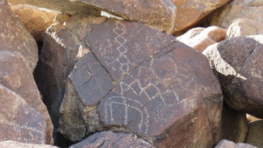
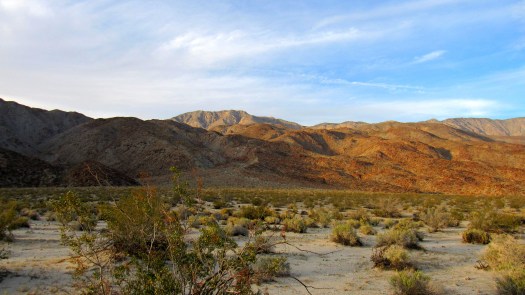
Eventually, I got my act together, loaded up my food, and hitched the 40-50lbs worth of gear, water, and food to my back. Don, John, and I set across Clark Valley heading due north to Corp benchmark, where we would check out some Cahuilla petroglyphs before beginning the ascent to Dawns Peak.
This would be my final hike before completing field work for Afoot and Afield, and I ended up saving the most difficult hike for last. To reach Dawns Peak, you must cross Clark Valley, ascend a steep, rocky ridge, and drop down into a canyon that leads to a broad, sandy valley. For most people, dayhiking Dawns is a major challenge since the entire route takes about 13-15 hours to complete.
We were to camp in the valley before propelling ourselves 1000’ up a steep, unstable, and very rocky slope. Beyond that slope, we’d cross rolling terrain to reach the base of Dawns Peak, where the real work begins. To get to the top, you must ascend an incredibly steep and rocky slope that gains about 3,000’ over the space of one mile. Yes, you read that right.

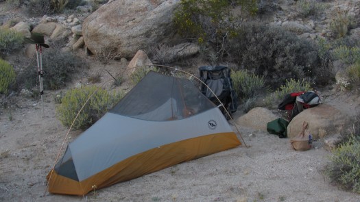
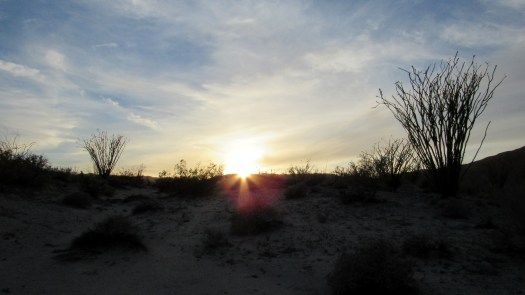
Temps were warm during our 3:30pm start, and the extra weight from the 10.5 liters of water made every step feel twice as hard. We trudged our way up the slope before finally dropping down into the canyon for a much more reasonable stroll up the sandy wash. We dropped our packs, pitched our tents, and crammed down some food before hitting the sack in order to rest up for the approach. A group of dayhikers passed our camp at 9:10pm on their way down from the summit, but aside from them, the night was silent and still with a waning moon casting considerable light over our valley.
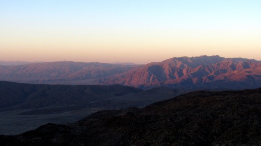
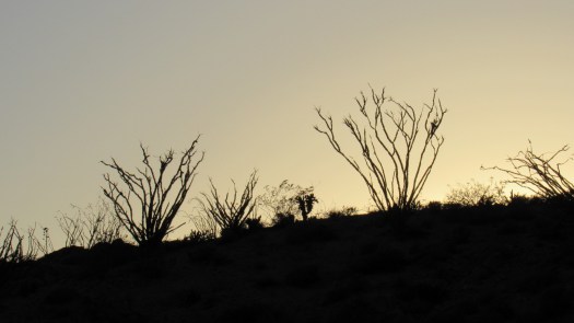
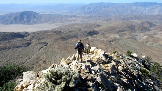
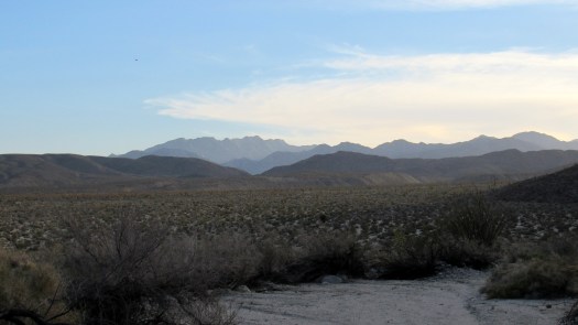
We woke before dawn,hoisted our daypacks, and set off for the peak. Our first order of business was the 1000’ ascent out of the valley, which was merely a warm up for the main event. About ¾ of the way up, the sun rose, casting rosy alpenglow across Coyote Mountain and the San Ysidro Mountains, which were now plainly visible to the south.
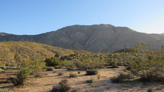
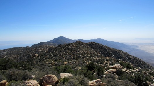
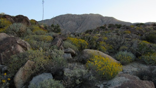
After much huffing and puffing, plus John’s encounter with a rattlesnake (no harm, no foul), we crested just west of Peak 3427 and saw the early morning light splash across Toro Peak while glowing behind Rabbit Peak to the East. Brittlebush and several other plants were still offering a fair wildflower show. About a mile north, Dawns Peak towered above us, remote, aloof, intimidating, and completely indifferent to the ordeal it would soon put us through.
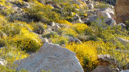
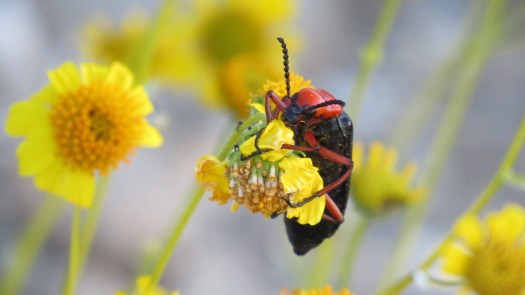
After a mile or so of navigating across a broad shelf leading to the peak, we finally reached the base of the summit ridge. The summit ridge was bathed in vivid yellows from a profuse bloom of desert sunflowers. We crammed as many calorie rich snacks as we could, and I chugged down my electrolyte special (6 caffeinated salt stick capsules, two packages of emergency, and a liter of water), and we began the steep, painstaking, and excruciating climb.
There’s really no way to put into words how challenging the ascent and descent are. According to the calorie calculator on Hiking Science, the average grade of the slope was 56%; for reference, Woodson Mountain from Lake Poway checks in at 11.5%. The equivalent number of flat miles to this one mile is about 10.75 miles, and that’s probably an underestimation since Hiking Science tends to undersell the numbers on the downhills. The calculator estimates that I burned 1,400 calories just to get up the hill.
My friend’s response to such as slope was perhaps more appropriate and illuminating than dry statistics. Her response when I told her about the 1 miles/3000’ gain ration was, “How is that even possible?” Well, it’s possible, but no picnic. We made it by taking our time, plodding along methodically and stopping frequently to gasp for air. We paused halfway at one of the first pinyon pines we met before the ridge got even steeper and rockier.
Not long after, or perhaps more than an hour later – it was hard to tell – the grade smoothed out, and we found ourselves standing at the shoulder of the peak. At this point, we encountered another traveler, Robert, with whom I had arranged to meet up top during the previous week. Robert’s a very accomplished trail runner who had previously run the Santa Rosa Crest from S22 all the way up Toro Peak and down to Highway 74, so he was no stranger to the hurt-fest that is the Santa Rosa Mountain range.

To put our suffering in perspective, Robert had lugged 40 lbs of water up from Rockhouse Canyon, starting at 1:30 am, and he had reached the summit of Dawns Peak just after sunrise. Robert was about to head down, but having met us, he decided to stick it out for another hour on the summit to make it a party of four. That’s just badass.
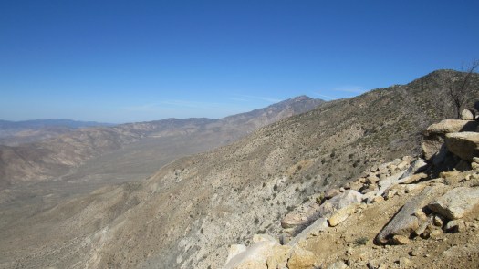
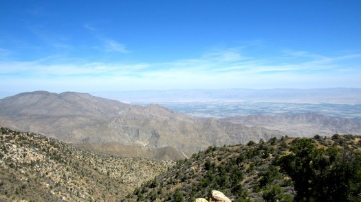
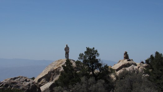
We quickly found the 7 foot rock cairn atop the summit, and we reviewed the various treasures found within the summit registry. Future visitors to Dawns Peak will enjoy a wonderful surprise in the summit registry provided by Don. The views across Borrego Valley to the south, the Santa Rosa Crest to the east and west, and the Coachella Valley to the north were nothing short of phenomenal, and the weather conditions, which can be brutal up top, were absolutely perfect: 65 degrees, sunny, with a light breeze.
We spent about an hour and a half on the summit, eating lunch, taking pictures, reviewing the register, recounting our respective journeys, sharing tales of past endeavors, adding our stories to the register, and cramming more calories down for the return journey. Given what lay ahead, I had absolutely no desire to leave the summit and start back down the hill. However, Jerry Schad warns that unless you get off the peak by noon, you likely will not return to your cars before dark. We heeded his warning, left by 12:05, and started off down the hill.
On the way down, one of us dislodged one of the thousands of loose rocks on the slope and sent it careening downhill. I saw the rock a few seconds before it got to me, and I watched it barrel toward me cartwheeling in absurd slow motion. I felt like the opposite of a goalie trying to catch a soccer ball as I tracked the boulder’s erratic course toward me. I leaned left just in time as the boulder clipped my hip before screaming downhill. I watched Don do a similar dance, and he just narrowly avoided getting clipped as the boulder took a bite out of his backpack. The desert sure doesn’t make it easy.
The rest of the journey was a slow, painstaking, but largely uneventful trek down to camp with a stop at an old Cahuilla village site and camaraderie taking our minds off of the work. We packed up and made our way back down to Clark Valley, where we parted company with Robert as he ran back to his car at Rockhouse Canyon. After a slow trudge across Clark Valley and a mild hyperextension of my right knee, we made our way back to Rockhouse Canyon Road just after sunset, where Don’s car sat waiting, mercifully, to bring us home.

Sounds like I missed out. Glad it went well…what you survive makes you stronger..right!
Tell that to my quadriceps.
You would have enjoyed the hike. I’ll fill you in on the next one soon.
Nice to read. Makes we want to get up there soon.
It’s a beast! My quads are still screaming three days later.
Wow you guys are hard core. Very inspirational.
Looks like this would be a great training hike for my first Mt. Whitney attempt in September. 🙂
Actually, you may want to use Whitney as training for Dawns Peak. It was REALLY hard.