

Modjeska Peak is the slightly lower sister peak to Santiago Peak, which forms the colloquially known “Saddleback” formation. These two high points of the Santa Ana Mountain Range provide panoramic views at a central location in the Los Angeles basin. Despite the appealing views, reaching Modjeska Peak is not an easy feat, as most paths to the top are in excess of 18 miles.
Distance: 18.3 Miles
Elevation Gained: 4,440′
Difficulty: Strenuous
Time: 7:45
Critters: Rabbits, ravens, hawks, grey squirrels
Get there like this.
Note: You will need an Adventure Pass to park in Silverado Canyon.
Details:
 |
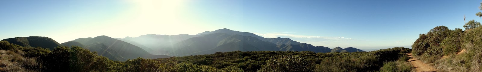
| Sun rising over Silverado Canyon |
I woke up at 4:30 in the morning with a start and was unable to gain any traction in going back to sleep. I’ve been having a lot of nights like that lately, and I’m starting to think it has something to do with not sleeping in my own bed (I’m housesitting). Had I not woken up then, I would not have done this hike. 18+ miles and nearly 4,500′ of gain is an intense time and energy commitment, and I wasn’t sure I’d be able to hack it today. Of course, anticipation is always different than the realization, and I was more than up for the challenge today.
 |
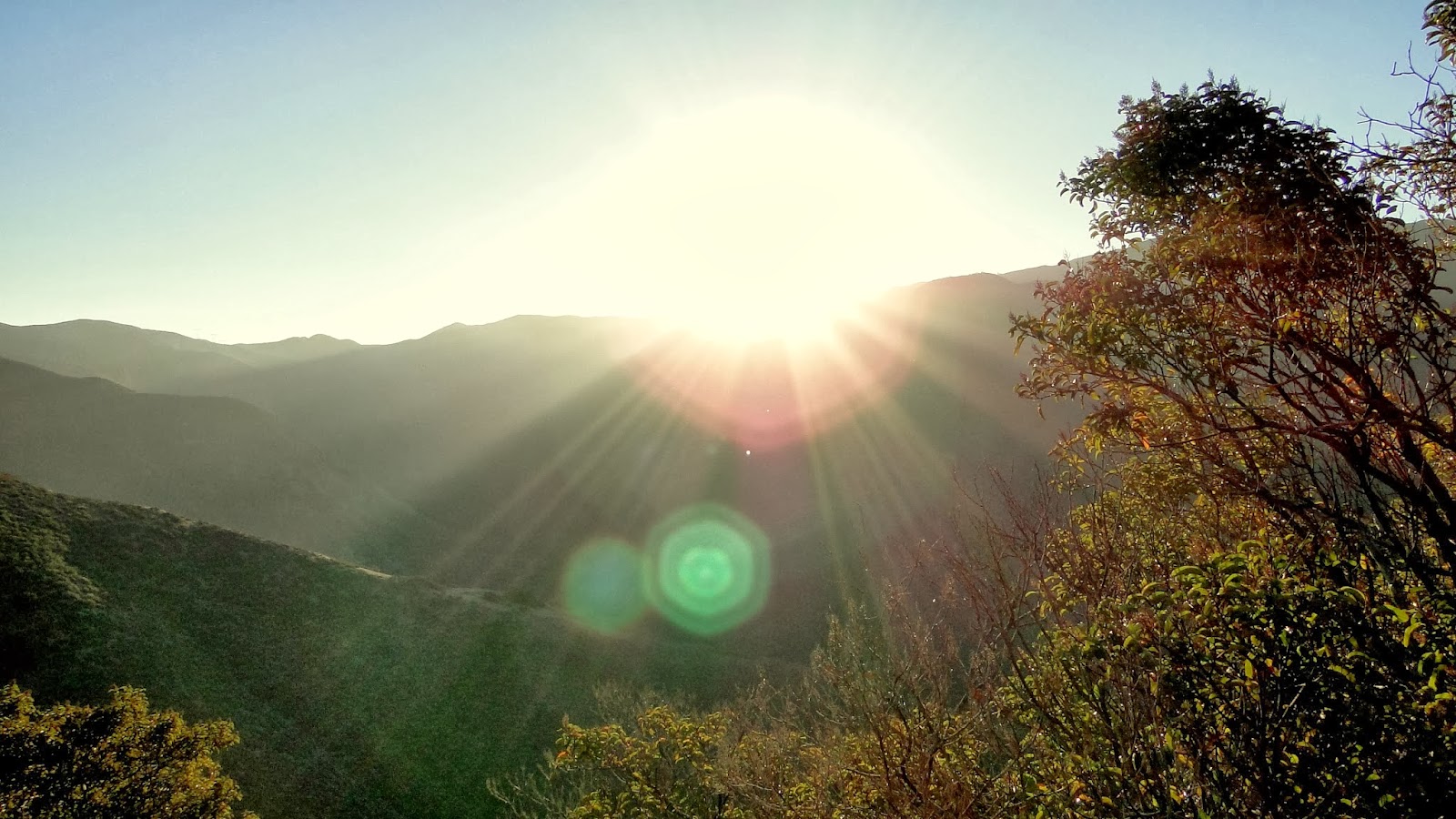
| Mt. Baldy and the high San Gabriels in the distance. |
There are a number of ways to get to Modjeska Peak, and not one of them is easy. Well, not true, actually. You can drive to the base of Modjeska Peak and hike the half mile on smooth fire road up to the summit. I saw a lot of people doing that today, either in their big, burly, noisy 4 wheel drive vehicles or in their dirt bikes. However, if you don’t want to spend all of your adventures sitting on your butt, the options for a quick and easy trek do not exist.
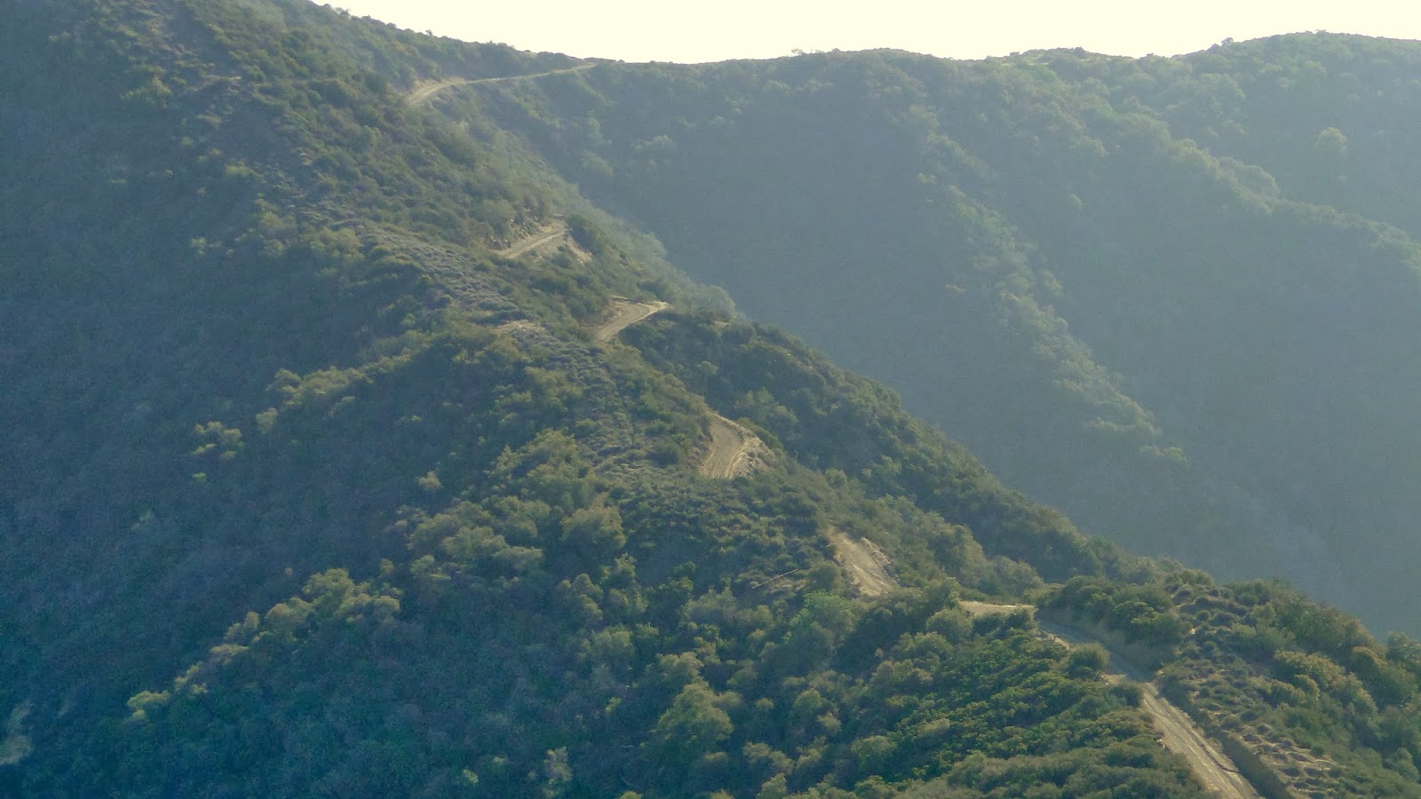 |
| Main Divide Road snaking its way toward Saddleback formation |
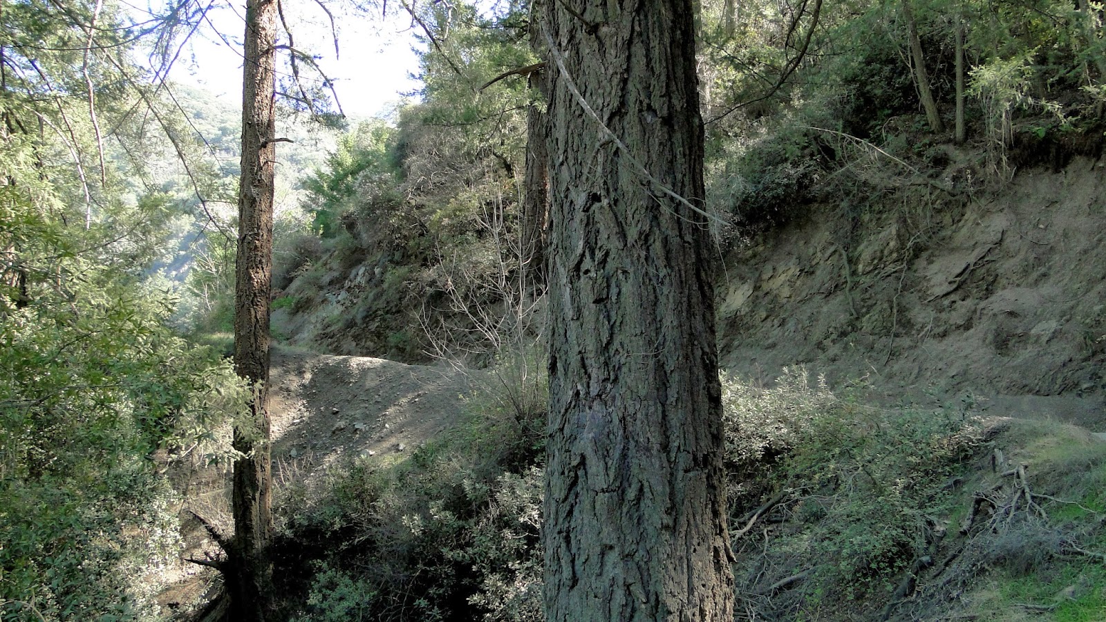
The most sensible route is probably the one I took today. Starting at the Cleveland National Forest boundary just outside the village of Silverado, I climbed up the north wall of Silverado Canyon on the Bedford Peak Trail. Then, I merged onto Main Divide Road, which is an undulating fire road traversing the entirety of the Santa Ana Mountains. The junction with Maple Springs Road, which is also the return route, also contains the spur leading off of Main Divide Road that allows one to climb up Modjeska. All told, that’s about 20-21 miles according to Google Maps (not the 18.3 that Jerry Schad lists in Afoot and Afield in Orange County). The only reason I actually hit that total was because somebody offered me a ride as I was walking back.
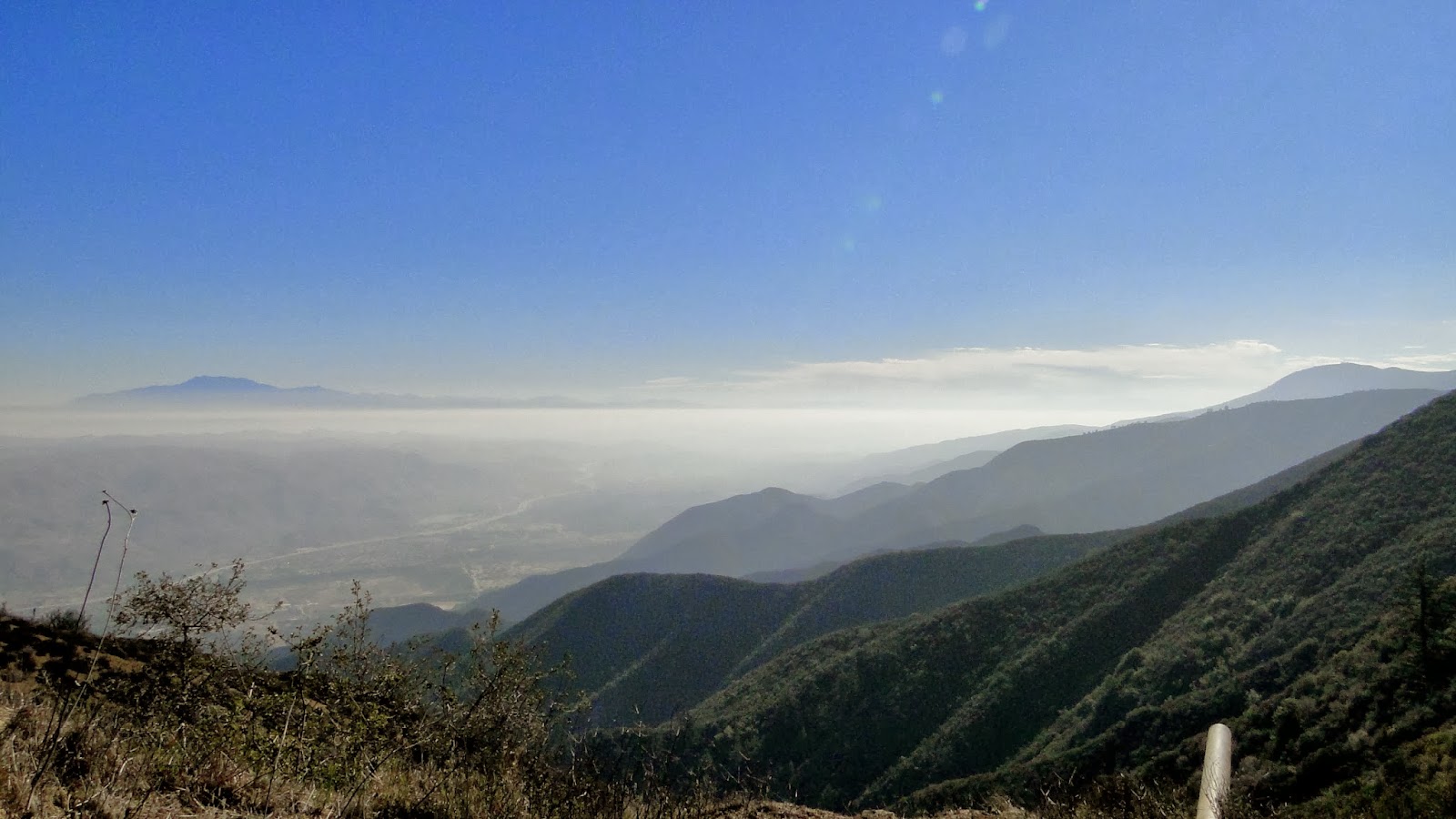 |
| East side of the Santa Anas with Mt. San Jacinto on the left, looming out of the haze |
At any rate, Modjeska doesn’t give it up for free. Nor does neighboring Santiago Peak. In fact, just about ever trip I’ve ever taken that has included Main Divide Road, whether it is Modjeska, Santiago, Trabuco Peak, or the Horsethief Loop, has surpassed 12 miles and at least 2,000′ of gain. The two high points cost me over 4,000′ of gain. The Santa Anas are hot, exposed, and anything but easy hiking. However, there are rewards that continue to bring me back, despite the fact that I rank this range pretty low on the “mountains ranges I want to hike around on.”
 |
| Santiago Peak from Modjeska Peak. See if you can spot San Gorgonio and San Jacinto on the left |
It’s not fair to knock the Santa Ana’s for what they are. Like the San Gabriels, they are steep, stark, and foreboding to the novice and average hiker. Unlike the San Gabriels, they don’t gain much elevation, topping out around 5,800′. This means a lot of chaparral, few conifers, a lot of heat, and very little shade. The main benefit comes from the views, as the Santa Ana’s sit in the middle of LA/San Diego Metro areas, and thus provide views of all of the major and minor mountain ranges in Southern California. Every single one of them, as a matter of fact. If it’s clear enough, you can see all the way from Los Podres N.F. to Mexico.
 |
| New maple leaves – about a month early |
It wasn’t particularly clear today though, as a fair amount of smog has accumulated in the basin. It was, on occasion, uncomfortably warm, although there was a cool westerly breeze pretty much from the beginning. I got halfway up the canyon before the sun came out, and enjoyed sharp morning light while traversing Main Divide Road. Aside from the views, there is little variability in the terrain, and even the view, until reaching the junction with Maple Springs Road. From there, the meaty and juicy parts of the hike kick in despite the hike being nearly halfway over.
 |
| Bigcone Douglas Firs near Bigcone Spring |
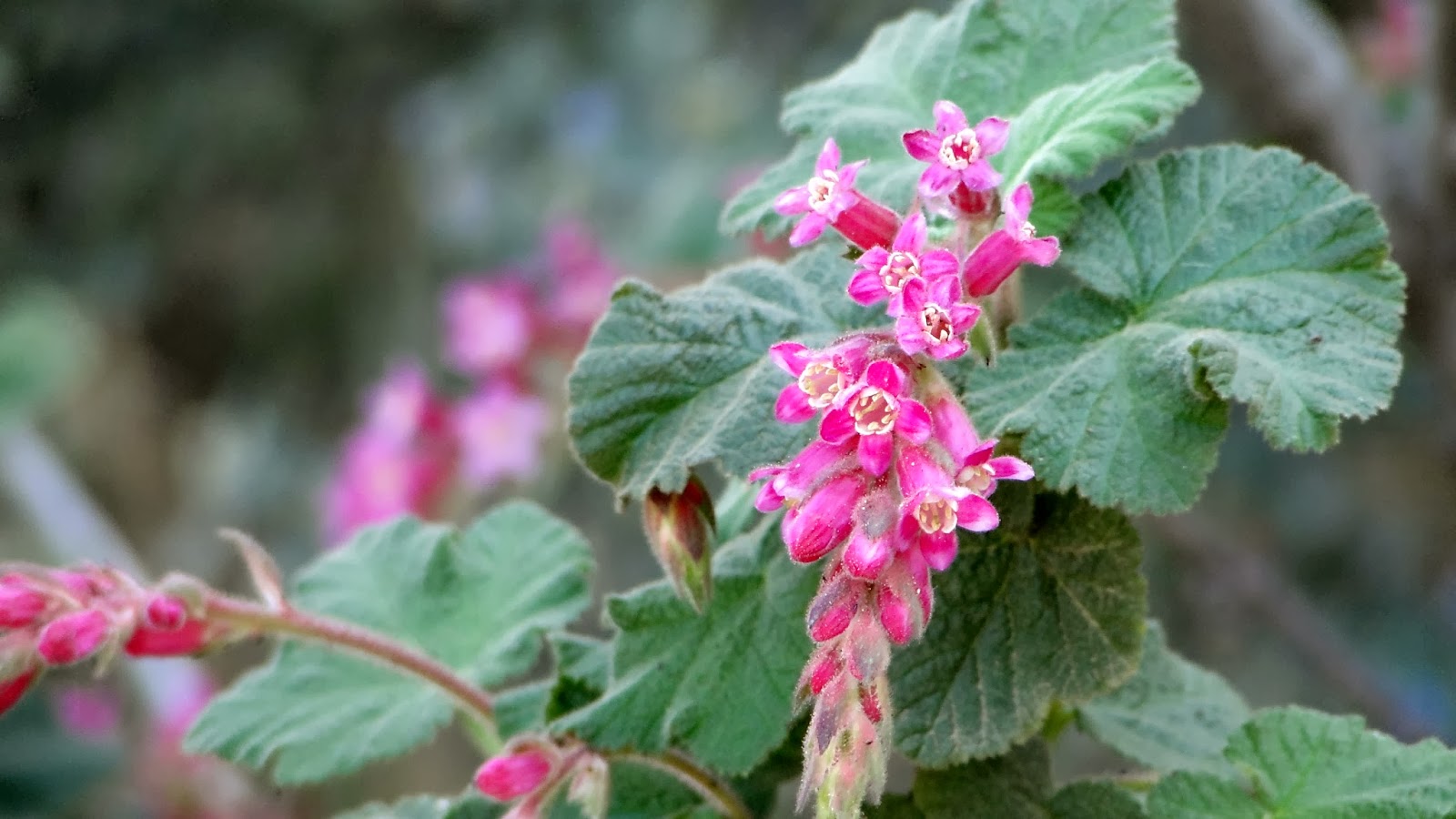
The way back on Maple Springs Road was particularly nice. As most of this road lies on north-facing peaks, there is an abundance of plant life not present elsewhere on the hike. Some of the low-altitude conifers, such as Coulter pines and bigcone Douglas firs punctuate carpets of manzanita and ceanothus. Maples, alders, and bay trees crowd in at a handful of springs and deep ravines. Oak trees fill in the gaps, and even in this terribly dry winter there were a few wildflower displays to be found. After the long descent, the road drops you off at the bottom of the canyon, which features a gently trickling stream, shaded by alders and sycamores. Lovely stuff.
The two big drags with this hike were the omnipresent motor vehicles. I didn’t see a single hiker on the trail. I saw two mountain bikers. However, I saw at least ten Jeeps/trucks, and about seven dirt bikes. I never thought I’d be grateful for mountain bikers, but at least they didn’t leave me gagging on dust and exhaust fumes. The second drag is that the trail ends on pavement, which always feels like a soul-crushing drag after miles of soft dirt and sand. Furthermore, the pavement reflects a lot of heat back, so it always feels about 10 degrees hotter on asphalt.
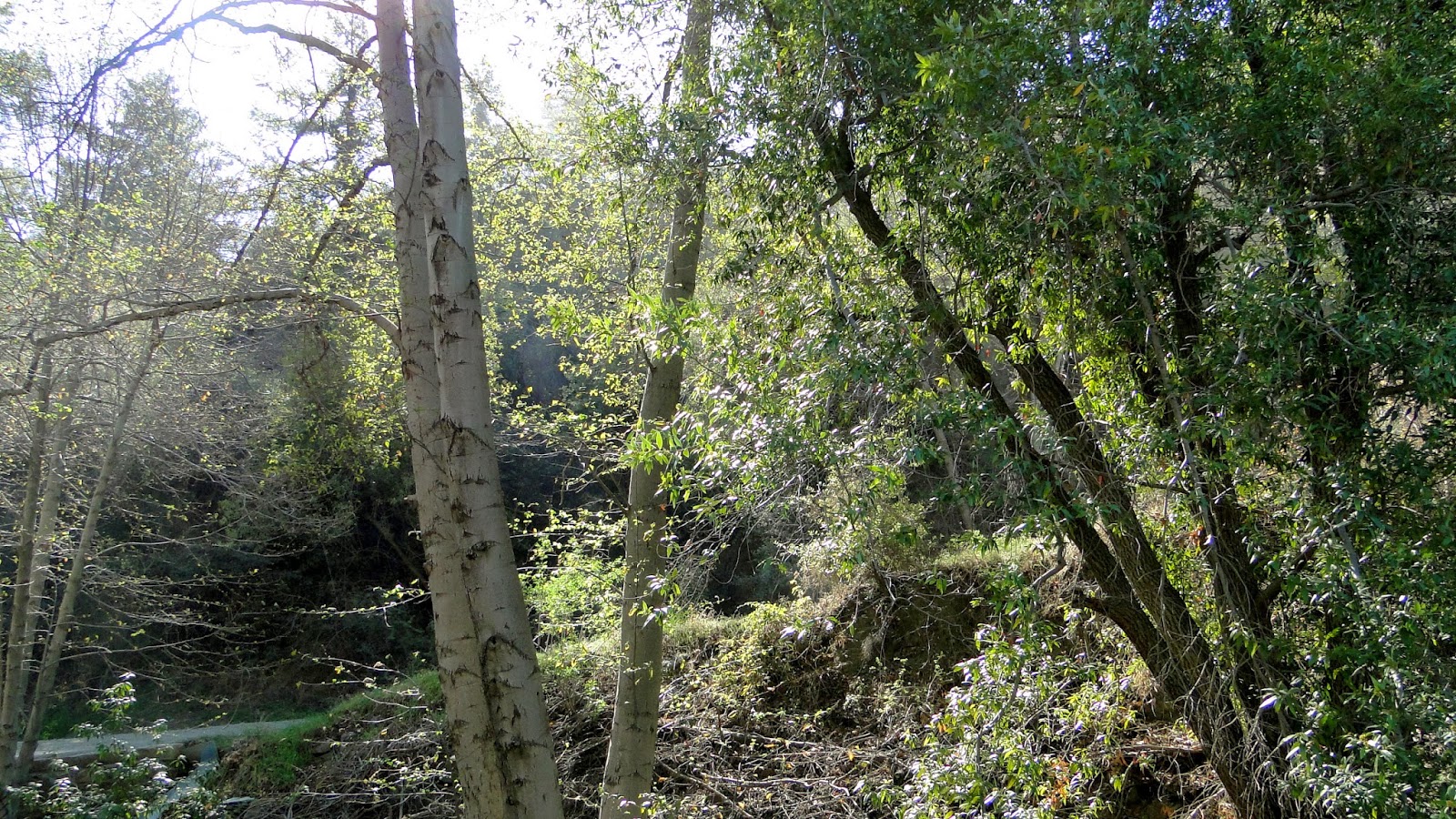 |
| Alders on the canyon bottom |
Fortunately, some other hikers who had started and then quickly stopped due to the heat took mercy on me and offered me a lift over the last 2.5 miles back to the car. This was a blessed relief, as that would have put me over 20 miles at a time when the temps were pushing 80 with an assist from the blacktop. This was a lovely stretch of trail, but walking it on the asphalt was not the way to go. The two ladies who gave me the ride were quite nice, although they did seem a little shocked that I had hiked 18 miles by myself in the heat. After all this time hiking, I am tickled to note that I was just as mildly shocked that they were mildly shocked. Sometimes, I wonder who wouldn’t want to do a hike like that. That’s when I remember that I was the only hiker on the trail today. Ohhhhhh. Hmm.
