
Santa Rosa Mountain is a sky island amidst a sea a scorched rocks and barren valley. This offshoot of the peninsular ranges demonstrates the spectacular biodiversity of Southern California while affording some of the best views in all of Southern California.
Distance: 7.2 Miles
Elevation Gained: 1260′
Difficulty: Moderate
Critters: Squirrels, ravens, hawks
Time: 3:15
Get there like this.
Note: You will need an Adventure Pass for this hike, as it lies on National Forest ground.
Also Note: You can begin this hike at any point along the road from Highway 74 to the summit. I chose this starting point based on where the conifers became dominant.
Details:
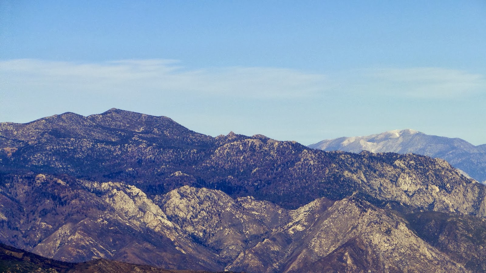 |
| Mt. San Jacinto with Mt. San Gorgonio looking over its shoulder |
Do you know which county has the greatest biodiversity in the country? Perhaps you might guess Hawaii, with its lush tropical rain forests, grasslands, and volcanic ecotones. Or maybe you might choose some county in the Pacific Northwest, where old-growth rain forests dominate before giving away to alpine meadows. Or maybe you might guess that bayou country in the south, with dense swamps, woodlands, and bald cypresses might have the greatest variety. All of these options are false. Despite the smoggy, urban sprawl, Riverside County (followed closely by San Diego County) features the greatest biodiversity in the entire country.
 |
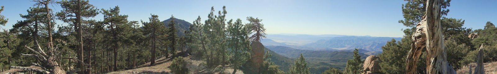
| From summit to valley floor, comprising several distinct ecosystems |
Riverside County contains towering peaks and scorching deserts and ranges from elevations below sea level to near 11,000′. This vast elevation difference, along with the western county’s proximity to the ocean, allows for a spectrum of ecosystems. Here one can find coastal sage-scrub, oak woodland, grassland, riparian woodland, creosote scrub, palm oases, pinyon-pine woodland, Joshua tree woodland, low-, mid-, and high-elevation chaparral, oak-conifer woodland, mixed conifer forest, and subalpine forest. With the exception of the massive coastal redwood forests and sequoia groves, Riverside county essentially runs the gamut of California ecosystems, which already features more diversity than anywhere else in the country.

Santa Rosa Mountain is a lesson in biodiversity. At it’s base, Santa Rosa features creosote scrub, which is the dominant desert landscape. From the near-sea level base of the mountain, one can climb through creosote scrub, pinyon-juniper woodland, oak woodland, mid- and high-elevation chaparral, oak-conifer woodland, before finally arriving in mixed-conifer forest near the 8,057′ summit.
 |
| Cuyamaca Peak in the center, with pyramid-shaped Stonewall Peak to the left |
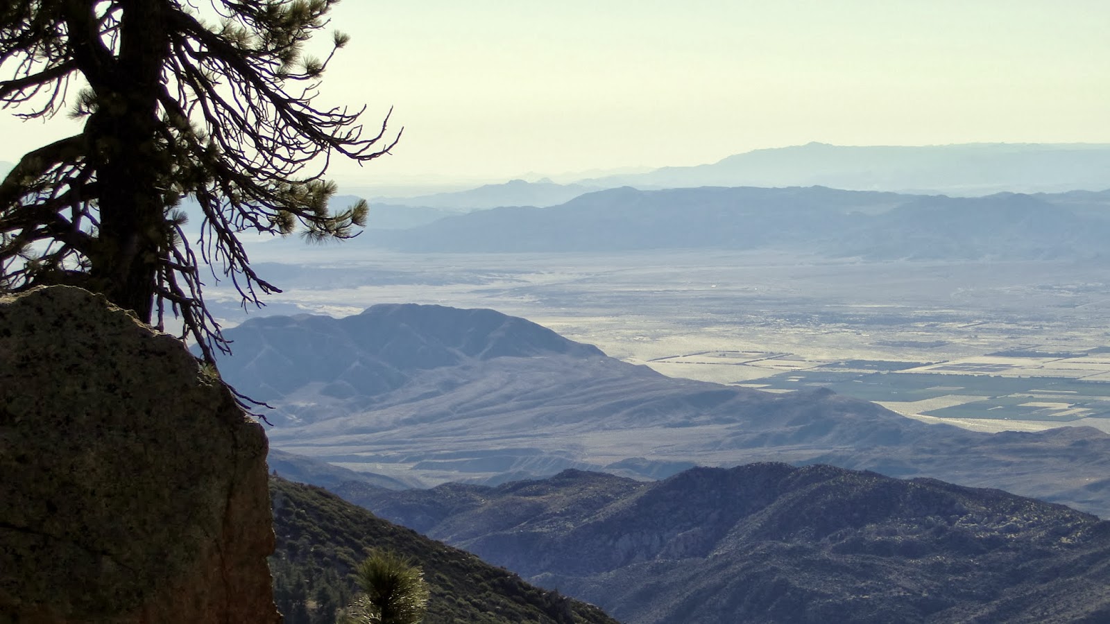
The views are nothing short of spectacular, as well. While they don’t rival nearby Mt. San Jacinto for scope and loftiness, the Santa Rosas feature expansive views south into San Diego and Anza-Borrego, north to the LA Basin and San Gabriel Mountains, east to the Colorado Desert, and west to Mt. San Jacinto and Mt. San Gorgonio. Add to this the presence of some dry campsites at the summit, and this is one of the few places where one can enjoy camping with views that seem to stretch on forever.
 |
| Looking south to Anza-Borrego Desert, Whale Peak, and the Laguna Mountains |
The trail itself is a little peculiar in that there really isn’t a trail to the top. Instead, there’s a well-used, well-graded fire road that leaves from Highway 74. The road is smooth enough for most cars to make it to the summit, which means that any hike on this road runs the risk of encountering automobiles, which is a definite minus. However, on an early, cold, windy December morning, you are less likely to encounter automobiles or mountain bikers, or anybody at all for that matter. Given the presence of the road, you can start this hike anywhere you like. Or, you can drive up to the top and skip the hike altogether (where’s the fun in that?).

I chose to start at 6800′, which is about where the mixed-conifer forest emerges in earnest. This afforded me the opportunity to walk in the shade, which I found more preferable than walking in open, sunny chaparral, even on this cold day. This is a pretty dry forest, which reflects the fact that the mountain is surrounded on three sides by some of the hottest and driest places in the United States. In addition to that, ranges like the Palomar Mountains and Santa Ana Mountains soak up a lot of moisture from Pacific storms before they can reach the higher desert peaks, leaving enough to support a forest but not enough for springs, streams, meadows, and waterfalls like one might find on the coastal facing ranges.
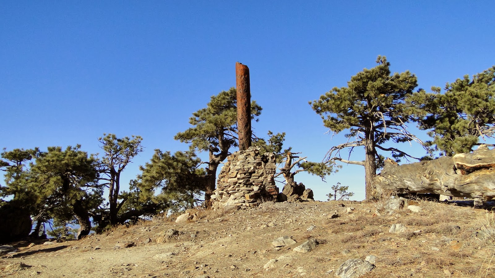
The actual summit is a bit anti-climactic as far as summits go. This summit is a wide, flat, sunny area rimmed by Jeffrey pines. The trees largely obscure panoramic views, and one must wander to soak in the full scope of the terrain thousands of feet below. There are also a cluster of campsites at the summit, which is highly unusual for a peak this size. One will find the ruins of an old log cabin, all of which that remains is a massive stone fireplace and rusted iron chimney. This would be a great place to camp due to the epic views in every direction.

This will be my last hike posted on the year, and my second to last hike in total. I’ll start back up again on the 2nd, which will represent the beginning of a long march toward some epic backpacking trips. So long, 2013. I hope next year is every bit as enjoyable (with a whole lot more precipitation).
