 |
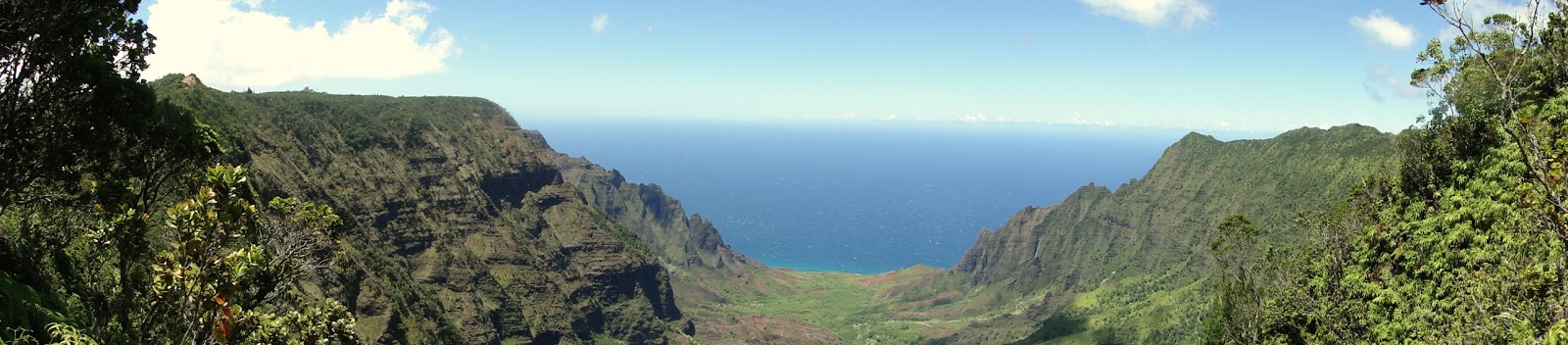
| Kalalau Valley from the Pihea Trail |
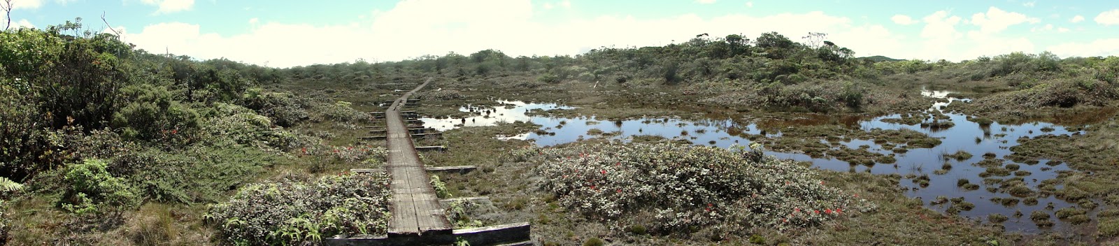 |
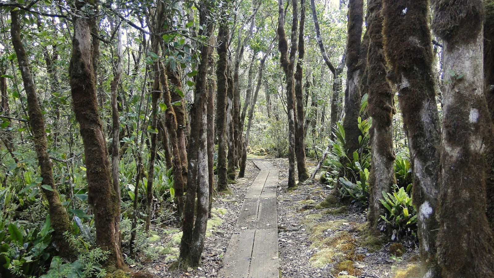
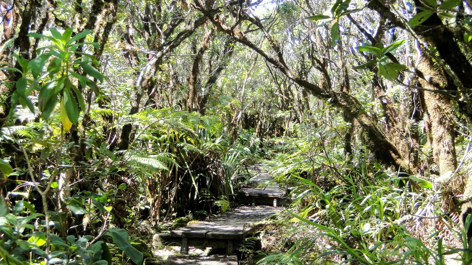
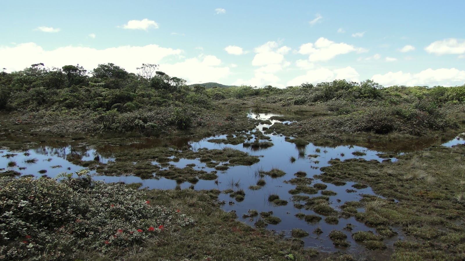
| Alaka’i Swamp |
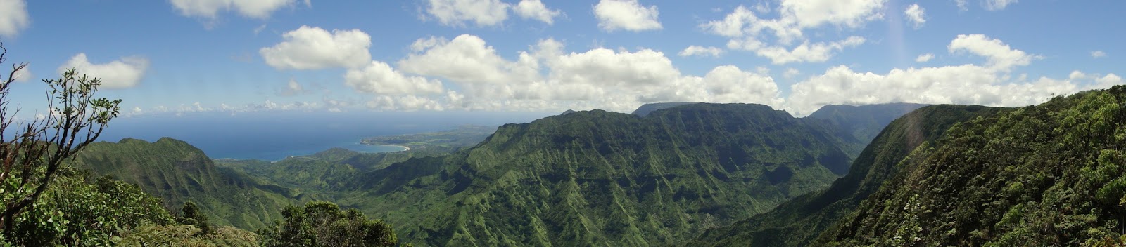 |
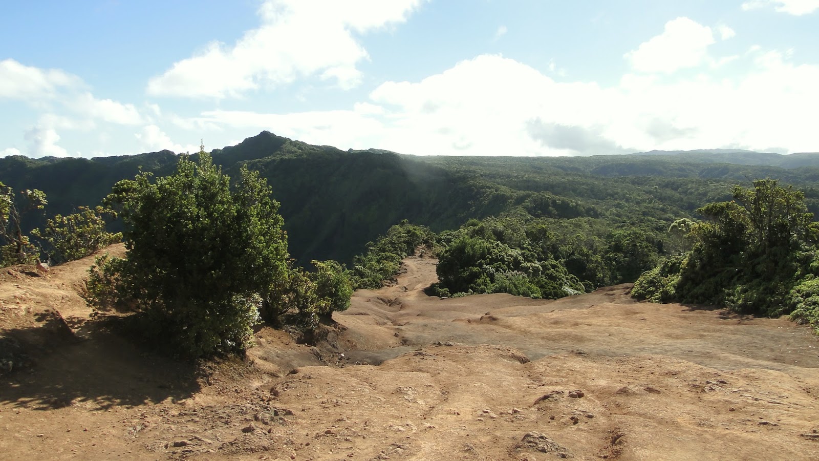
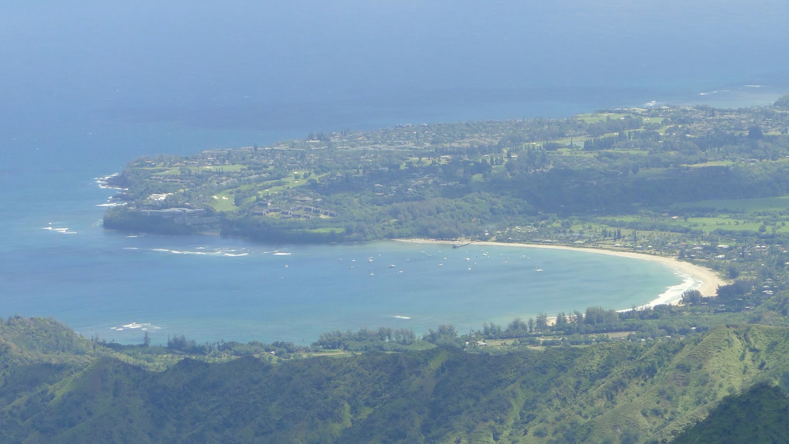
| Kilohana Lookout toward Hanalei |
The Pihea Trail crosses along the rim of Kalalau Valley, which is also the termination spot for the Kalalau Trail 4,000′ below. This trail passes through rain forest to reach Alaka’i Swamp, which is billed as the highest swamp in the world. After crossing the swamp on boardwalks, the swamp trail terminates at Kilohana lookout, where you earn a panoramic view of of the north shore of Kauai.
Distance: 8 miles
Elevation Gained: 1,600′
Difficulty: Moderately Strenuous
Time: 4:15
Critters: None
Details:
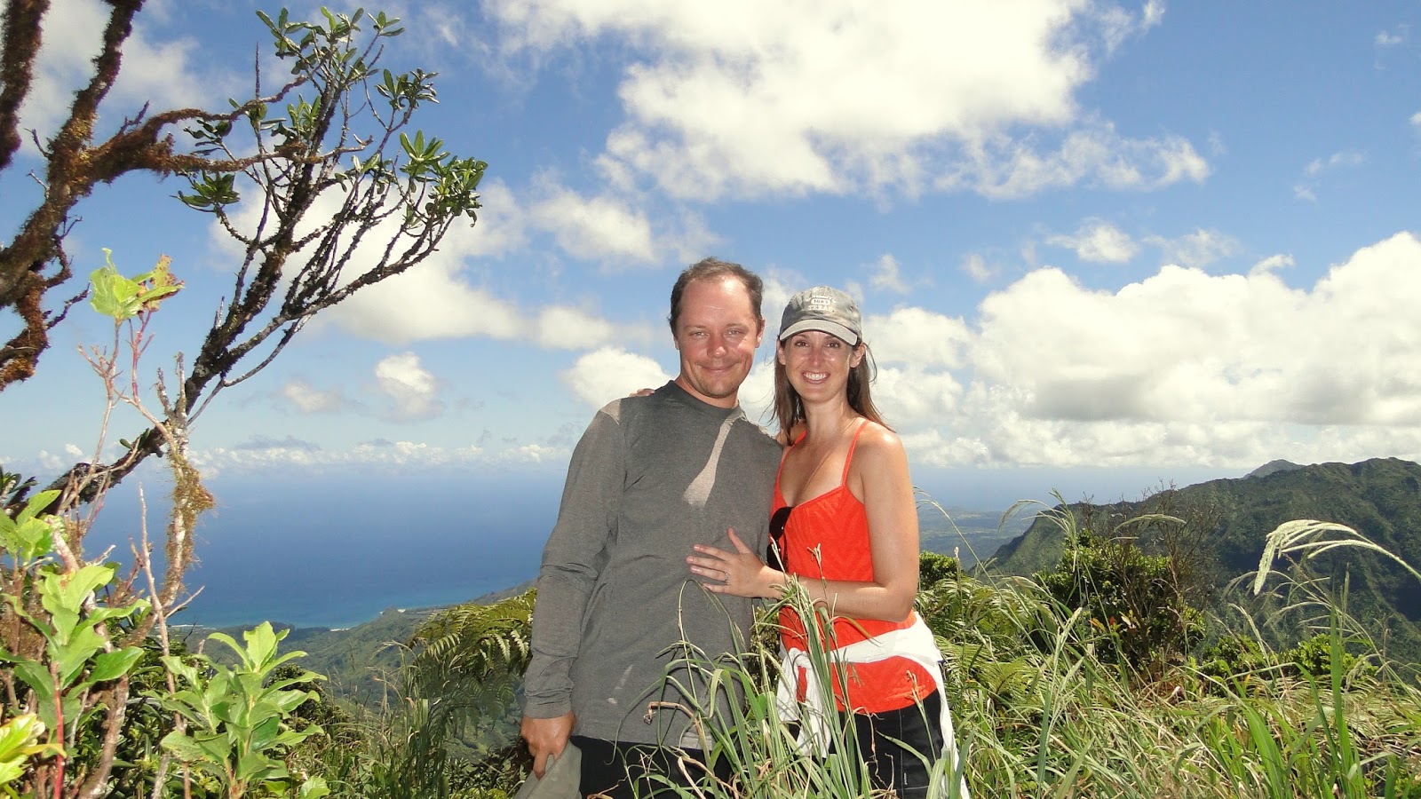
For our last hike in Hawaii, Kelly and I visited Koke’e State Park, which lies north of Waimea Canyon State Park and just south of the Na Pali Coast. Of course, the Na Pali Coast lies 4,000′ below Koke’e and is completely inaccessible from this point. However, there are plenty of views of Na Pali from a very “edge-of-the-world” perspective.
The Pihea portion of this trail runs up and down, roller-coaster style, along the edge of Kalalau before turning into the forest before the Alaka’i junction. This roller-coaster isn’t so bad going into the hike, but, with the heat of the day and a lot of climbing at the very end, becomes quite a nuisance at the very end. This is probably the only drag on this trail since after 7.5 miles, the last thing anybody wants to do is climb another 400′.

The trail then comes to a boardwalked segment through the rainforest, which is fantastic fun to walk upon. This boardwalk was likely constructed in the last 20 years or so, and as must be the norm where water is abundant, there are occasionally sections where the boards are broken. The boards exist because this area is exceptionally rainy. In fact, this entire trail from start to finish has a reputation as being a sloppy mess during rain. Kelly and I were lucky to come here during a dry time.
After the crossing, the trail turns north toward the massive cliffs overlooking the north shore of Kauai. To get there, one must cross Alaka’i Swamp, which sits on a plateau where the relative flatness allows abundant rainwater to collect into spongy, soggy ground. The ancient Hawaiians on the south side of the island used this swamp as a route to visit their families during winter time when surf on the north shore precluded their ability to visit by kayak. Imagine: 30 miles of walking up through Waimea Canyon, then across a swamp, then back down 4,000′ cliffs. All just to see Grandma.

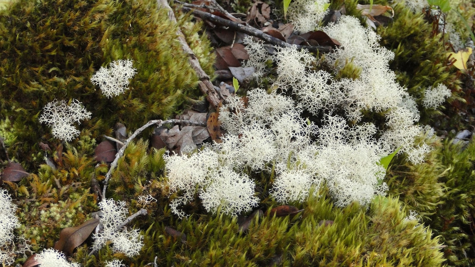
The swamp itself is an otherworldy place of stunted trees, ferns, shrubs, puddles, and mud. The boardwalk is almost entirely protective against this mess, although there is one section that requires a lot balance and focus where the boards have busted and you have to tight-rope along a narrow board. Aside from that, there is little risk of falling in unless your drunk or 4 years old. Big props to the family who managed to get this far, even though Kelly and I were both a little nervous about their 4 years old walking along the boardwalk on her own. Girl was on a mission, though.
After 4 eventful and unique miles, the boardwalk terminates at the Kilohana Lookout, which overlooks a good chunk of the north shore, including Hanalei Bay. The view here also includes fluted ridges awash in greenery for which Kauai is so renowned. Of all the “bird’s eye” views I saw in Kauai, this one may have been the best. It’s an expansive view, and it comes with a nice bench from which Kelly and I enjoyed PB sandwiches and pineapple.
And thus ended the hiking portion of this trip. We did much else here, including boogie boarding in a cove full of sea turtles, kayaking down a stretch of the Hanalei River, sunset at Haleakala, roaming around Lahaina, reading on the Lanai, catching a glimpse of Waimea Canyon, and having a great time goofing around about Sandy Buttholes and the incomprehsiveness of Hawaiian music. It was a great honeymoon, and we look forward to coming back.