
Big Rock Trail – Barker Way – Pyles Peak Trail
Distance: 8 miles
Elevation Gained: 1,500′
Difficulty: Moderately Strenuous
Time: 3:00:00
Critters: Quail, Dog of the Day Winner, Dylan to Malty
Pros:
– Good views of downtown San Diego, Mission Bay, and the surrounding mountain ranges
Cons:
– Overcast weather diminishes the pros
– Very crowded on Cowles Peak
Details:

Kelly is in the midst of a 31 day challenge at her yoga studio. The studio is challenging its students and instructors to complete 31 classes during the month of May. You don’t have to take a class per day. Rather, you can take 3 classes in one day and skip a few days and still come out on pace. Kelly has been doing a lot of that, and she is currently a couple of classes ahead of the day by day pace. In other words, she is kicking some ass. So, in honor of Kelly’s quest, I took three different hikes today, summing up at 12.6 miles and 2,000 feet gained. This is the first of three.
The old standbys were starting to get a little stale for me. Originally, I had slated Penasquitos Canyon and Daley Ranch for this weekends excursions. Both offer good mileage, and both are fairly accessible. However, hiking the same trails over and over can ruin the experience in the same way that eating the same thing for dinner tonight can ruin your jones for food. In that spirit, I decided to check out Mission Trails Regional Park

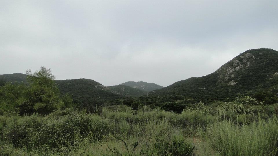
Mission Trails is a massive urban park that preserves a huge swath of open space in very close proximity to San Diego. The San Diego River and its accompanying gorge, as well as a number of small peaks, lie within the park. It’s a hugely popular place for hikers due in part to its proximity to San Diego and views that are very easy to come by. Many of the individual hikes can also be taken in more palatable 4-5 mile chunks, which is appealing to the more casual hikers.
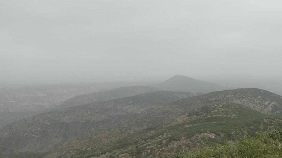
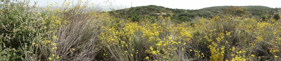
The trail from Big Rock Road, which is not to be confused with the Big Rock Park trailhead described in Afoot and Afield in San Diego County, sets off through classic Southern California coastal sage scrub mixed with a thriving chaparral community. Today, the chaparral is in the midst of its peak bloom, and all of the plants, including manzanita, sage, chamise, buckweat, and monkey flower displayed a vibrant mixture of blooms and pungent scents. The marine layer, however, obscured most of the expected views, leaving the overall sights of this trail somewhat disappointing. However, I’m sure the views are great when the air is clear.

After a hearty haul up the Barker Fire Road, I reached Cowles Peak, which, according to some sources is the most visited peak/trail in San Diego. It’s easy to see why since, from the south side of the peak, you can climb to the top, check out the view, snap a picture with your friends, pet somebody’s dog, and get back down within two hours. It’s definitely a Disneyland hike, and I don’t mean that disrespectfully. It serves its purpose beautifully.

More interesting and less congested is Pyles Peak, which lies a mile and a half north of Cowles. The elevation is about 300 feet lower, but the views are basically the same, and there are probably 80% fewer people on this trail. By the time I got here, the marine layer had burnt off somewhat, but the views toward the coast and the mountains were still obscured. I had more hiking in mind, so I abandoned patience and headed back.

This is not a bad trail if you live in the La Mesa/Santee/El Cajon or even downtown areas. Mission Trails is hugely popular. However, if you have to drive more than 20 minutes to get here, it’s probably not worth it since there are more exciting and interesting trails elsewhere, depending on where you come from.
May: 52.1 Miles
Year-to-Date: 559.4 Miles

Great tip about the Pyles Peak option for those looking to avoid the big crowds!