
Wildcat Creek Road – Havey Canyon Trail – Nimitz Way – Conlon Trail

Distance: 6.0 Miles (+1 Mile)
Elevation Gained: 1,040 Feet
Difficulty: Moderate
Time: 2:35
Critters: Bovines!, a garter snake, wild turkeys, and a very smelly dog.
Pros:
– Wide open views of Berkeley, San Francisco Bay, San Francisco, San Pablo Resevoir, and Marin County
– Rolling, green hills
– Lovely riparian vegetation
– Good company
Cons:
– Cow pies everywhere
– The hill you come down on is not very fun to climb at the end of the hike
Wildcat canyon
http://www.everytrail.com/swf/widget.swf
EveryTrail – Find the best Hiking in Marin, Californiahttp://www.everytrail.com/trip/widgetimpression?trip_id=1519877
Details:
Saturday morning rolled around after a Friday in which I packed out of Big Basin, picked up Kelly at the airport, met Andy and Ali, had a merciful shower, tasted sake, drank some beer, and ate a great dinner. We got up that morning to walk Charlie, enjoy a fine spring day, and walk off some of the excess at Wildcat Canyon Regional Park, which sits in the hills just east of Berkeley.
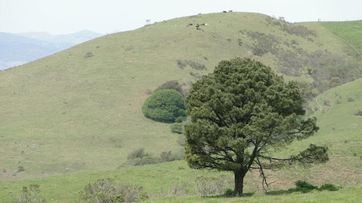
Wildcat Canyon is a regional park perched in the hills that allows the citizens of the East Bay a chance to breathe and get some peace and quiet. It features 22 miles of trails, and covers terrain that includes rolling, grass-covered hillsides, chaparral, and riparian forest comprising alder, bay laurel, madrone, maple, and live oak. It differs from the Southern California rolling hill scene in that there is more grass, more water-loving trees, and less chaparral. Aside from that, Wildcat Canyon offers a slice of the classic California scene.
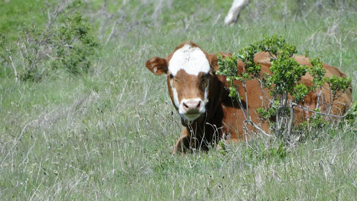
One of those scenes includes the “happy cows come from California” scene, in which cattle roam a verdant, idyllic hillside and talk to each other about how glad they are that they don’t live in Wisconsin. Cows are abundant here, and, apparently, there is a stipulation that allows cattle to graze within the otherwise protected land. This stipulation is probably a holdover from the nearly 170 years of cattle grazing that has gone on in these hills since the Spanish took over the land from the native Americans.
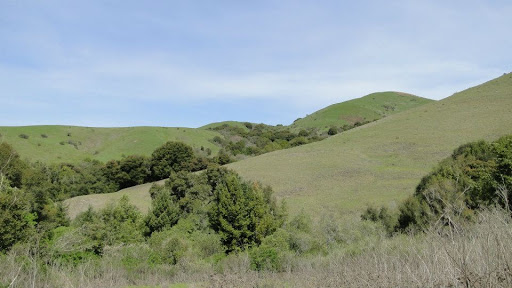
All five of us, Kelly, Ali, Andy, myself, and Charlie, set off down the hill into the cool shade of the riparian woods. As the trail bottoms out at the junction with Havey Canyon Trail, the views open up, and we could see rolling green hillsides dotted with bovines. We continued along the Havey Canyon Trail, which climbs gently for a mile or so, until we passed out of the woodland and onto the grassland.

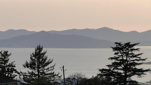
Views gradually opened up as we gained elevation. The ridge that separates Berkeley from the park gradually receded, revealing ever-widening views of the mountains to the west, along with bits of San Francisco Bay. The trail joins Nimitz Way at this point and swings south along a paved road that was heavy with mountain bike and runner traffic.

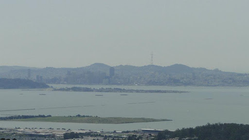
After another couple of miles, the trail makes another u-turn to head north. At this point, the trail emerges onto a relatively flat, grassy area that features a spectacular view of San Francisco. I’ve enjoyed views of San Francisco from the north end of the bay and from within the city, but I’ve never seen it in the same way that I’ve seen Los Angeles and San Diego so many times before, which is from the top of the hill and from miles away. San Francisco is a beautiful city from any angle, and that holds true when seen from great heights.
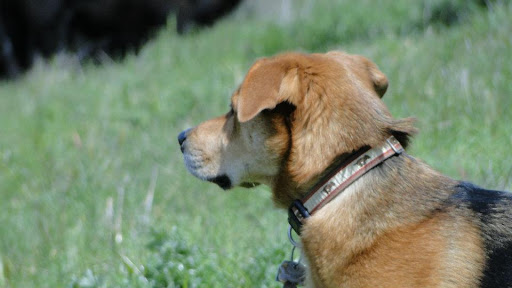
Somewhere along the way, though, Charlie, who is a dog, got it into his canine cabeza to roll around in cow crap. Andy tried valiantly to keep him from the crap, but when a dog wants dookie, there’s really no stopping him. Unfortunately, Charlie didn’t think it through very carefully, and wound up having to run home while the rest of us – sans Andy – drove back.
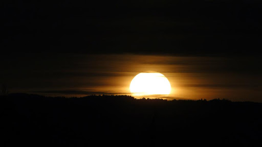
And although this wasn’t really a part of the hike, I’m tacking on an extra mile since we walked to another park to watch the sunset, throw the ball for Charlie, and drink a little wine. It was a nice extra diversion, although, through some criterion I don’t really understand or can’t explain, I can’t include it into the actual distance hiked for the year. Great way to end a day, though.
I don’t often get to hike with other people. Occasionally, I’ll get to hike with Kelly. However, of the 420 some miles I’ve hiked so far, maybe 30-40 of them have been with her. It was good to get out with the group, slow the pace, have some good conversations, and make it a social affair instead of a solitary trek. Thanks to everyone involved for a great hike.
April: 64.4 Miles
Year-to-Date: 420.7 Miles
